Big Island Surf Forecast: Large Northwest Swell Brings High Surf Warnings
A large northwest swell arrived Jan. 18, pushing north and west shores into high surf warnings and creating hazardous conditions for beachgoers and mariners.

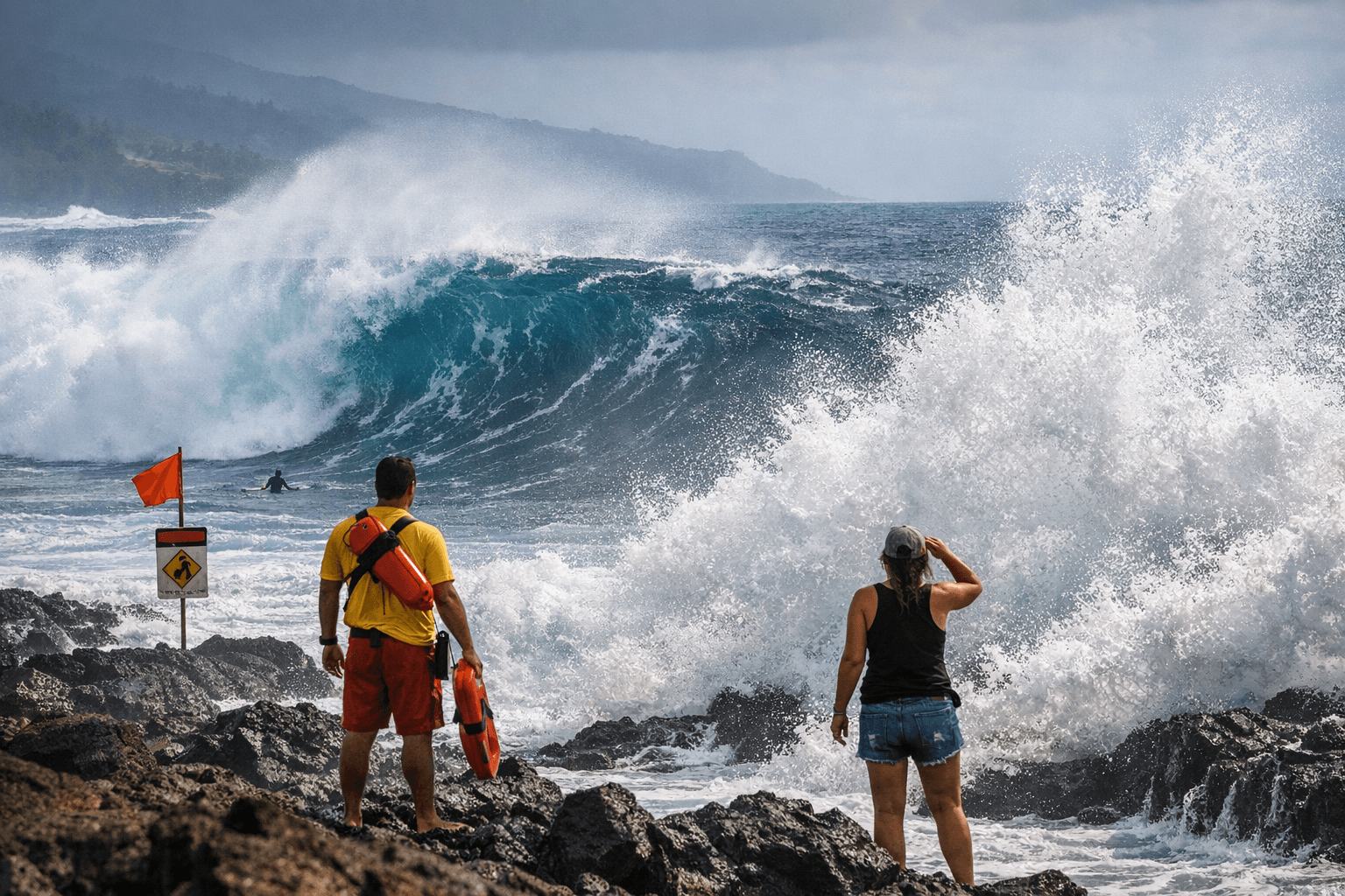
A moderate-to-large long-period northwest swell entered Big Island coastal waters late on Jan. 17 and peaked during the afternoon of Jan. 18, driving surf heights above High Surf Advisory and Warning thresholds along north and west-facing shores. The surge in wave energy produced powerful shorebreak and elevated currents that made nearshore zones hazardous for swimmers, surfers, and small boats.
Forecasters noted rough, choppy conditions continued along east-facing shores even as the northwest swell dominated the north and west exposures. Weather for the period was described as partly sunny with scattered showers in places, a pattern that can complicate visibility and rescue operations when surf is elevated. NOAA and SwellInfo data were cited in the forecast material used to assess swell timing and intensity.
The immediate impacts were practical and localized. High surf warnings typically prompt beach closures, lifeguard stand-by postures, and restrictions on small-craft operations in exposed harbors; similar conditions on prior swell events have forced harbor authorities to limit recreational launches and require mariners to use extreme caution. For coastal businesses that depend on nearshore access—charter operators, dive shops, and shoreline vendors—the swell also increases the risk of canceled trips and reduced foot traffic during peak periods. Recreational users in areas such as Hilo Bay and Kona/Kawaihae were urged to heed established safety guidance, given the forecast included shore-specific surf-height tables and tide information for those harbors.
The swell’s long-period character matters because it can generate powerful, unpredictable sets that propagate into reef zones and shorebreak areas where water depths change abruptly. That raises the potential for strong lateral currents and sudden wave surges that can sweep people off rocks or piers and make vessel handling difficult near breakwaters and harbor entrances.
For residents and visitors, the most immediate considerations were safety and timing. Forecast materials included tide times for Hilo Bay and Kona/Kawaihae as well as sunrise and sunset information to help plan safe beach access outside peak danger windows. Mariners and beachgoers were advised to exercise caution during elevated surf and to check current local advisories before heading out.
As the swell energy decays, conditions should gradually moderate, but lingering north-wash and choppy east-side seas may persist for a day or more. Residents should monitor local advisories for updates and plan coastal activity with the expectation that elevated surf and strong currents can return with subsequent northwest swell pulses.
Sources:
Know something we missed? Have a correction or additional information?
Submit a Tip