Coldwater River at Marks Gauge Updated With Flood Stage Forecasts
The Coldwater River at Marks gauge was updated Feb. 9-11 to add stage forecasts and a 'Flood Impacts' guide, improving local flood information that matters for homes, roads, and planning.
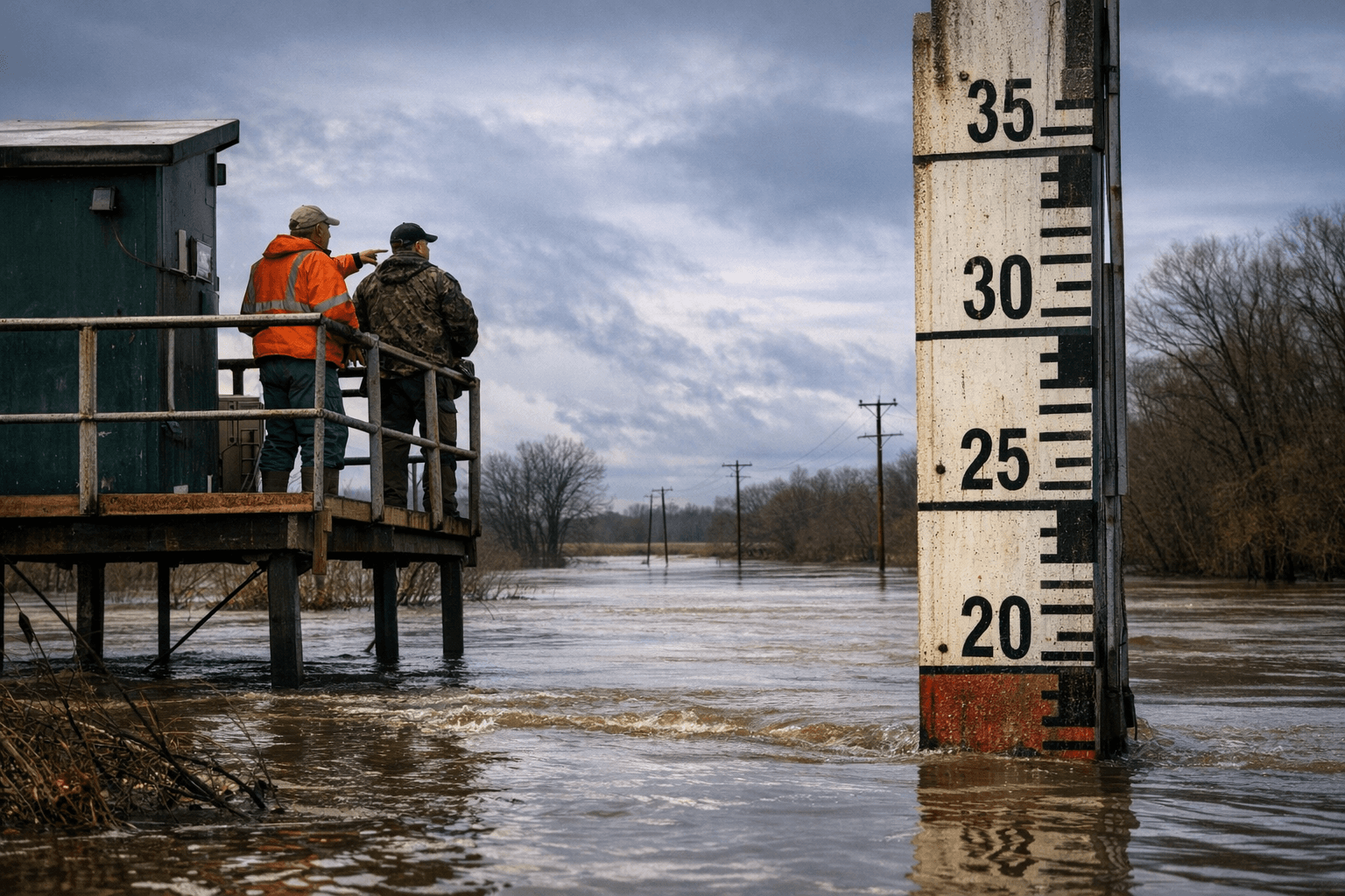
The National Oceanic and Atmospheric Administration updated the Coldwater River at Marks real-time gauge during the week of Feb. 9-11, 2026, adding stage forecasts and a brief "Flood Impacts" description tied to gauge levels near Marks, Mississippi. The change gives residents and local officials clearer, site-specific guidance on what to expect as river stages rise and fall.
The update improves situational awareness in Quitman County by pairing forecasted river stages with descriptions of likely impacts at progressively higher levels. That contextual information converts raw numbers into actionable expectations for low-lying neighborhoods, riverfront properties, and access routes that have routinely been vulnerable to seasonal rises. Emergency managers use gauge data to prioritize road closures, sandbag operations, and evacuation advisories; having flood-impact text directly associated with the Marks gauge narrows the gap between measurement and local action.
Institutional implications extend beyond immediate response. Accurate, up-to-date gauge forecasts feed county emergency plans and can shape budgeting and policy decisions by the Quitman County Board of Supervisors and local emergency management. Data that clarifies which areas are at risk at specific stages makes grant applications for mitigation work more credible and supports arguments for targeted investments in drainage, road elevation, and riverbank stabilization. It also factors into insurance risk assessments and discussions about participation in federal programs such as the National Flood Insurance Program and mitigation grant opportunities.
For residents, the update changes how information is used. Instead of interpreting a stage number alone, homeowners and businesses near West Third Street, the riverfront, and low-lying farmland can compare forecasted stages with the gauge's impact descriptions to anticipate access disruptions, property inundation risk, and livestock or crop exposure. Local schools, health providers, and transit operators also gain a clearer basis for operational decisions when river levels are forecast to rise.
The new gauge language enhances civic accountability. Elected officials can no longer point to an absence of precise local data when debating emergency preparedness or infrastructure priorities. Voters and civic groups in Quitman County can use the gauge's forecasts to press for specific actions: prioritized roadwork where flooding severs emergency access, targeted elevation projects for repeatedly impacted structures, and long-range planning that accounts for changing hydrology.
What this means for readers is straightforward: the Coldwater River at Marks now presents forecasted stages alongside plain-language impacts, making it easier to convert river measurements into preparedness steps. Residents should register for county alerts, follow updates from Quitman County emergency management, and raise the new gauge information at local meetings when discussing flood mitigation and budget priorities. The improved gauge does not prevent floods, but it strengthens the factual basis for response, planning, and accountability in a community that has repeatedly faced rising waters.
Sources:
Know something we missed? Have a correction or additional information?
Submit a Tip