Flash flood watches from Virginia to Alabama as storm brings more snow to Northeast
Flash flood watches cover multiple Southern states with 1-3 inches likely and isolated higher totals; the Northeast faces additional rounds of snow that could disrupt travel and commerce.
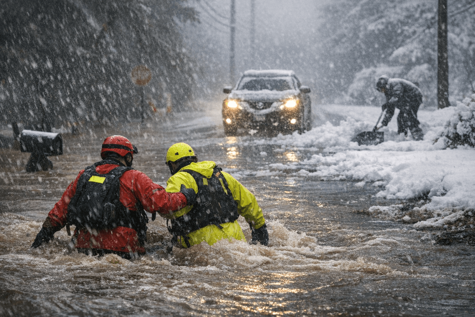
Flash flood watches issued by the National Weather Service span parts of Virginia, North Carolina, South Carolina, Georgia and Alabama as a new coastal storm pushes heavy rain inland, with meteorological guidance showing 1 to 3 inches of accumulation likely and isolated amounts up to 5 inches in the wettest corridors. The precipitation is falling across major population and transportation corridors, raising the immediate risk of flooded roadways, stalled commuter traffic and localized business interruptions this afternoon and into the evening rush.
The axis of heaviest rain is moving from Virginia southwest through the Carolinas into Georgia and Alabama, with NWS products signaling the greatest potential for short-duration heavy downpours and urban flash flooding where soils are saturated from recent precipitation. State departments of transportation in the region have been treating critical routes and advising motorists to expect slower highway speeds and standing water on low-lying exits and frontage roads. Storm-driven flooding commonly forces lane closures and raises the cost of last-mile deliveries for retailers and grocers in affected metro areas.
At the same time, additional rounds of snow are forecast for the Northeast. The inland stretch of New York state, northern New Jersey and interior New England can expect the heavier bursts, where model guidance points to a general 3 to 8 inches of new snow, with localized higher totals possible over higher terrain. Coastal corridors from Boston to New York will see lighter accumulation but persistent hollows of wet snow that can reduce visibility and slow morning commutes. Rail and air operations in the Northeast already on tight winter schedules face the prospect of further delays at hubs including Boston Logan and the New York metropolitan airports as snow bands pass through.
An ABC News meteorologist provided the latest forecast trends today, indicating the Southern precipitation will be most intense through tonight before tapering, while the Northeast will see intermittent snow bands into Friday. That timing means two separate operational peaks: an immediate hit for Southern road and municipal services during the evening commute, and a series of snow impacts on Northeast transit and freight operations through the end of the week.
Beyond immediate travel disruptions, the storm carries short-term economic implications. Flooded local streets and delayed trucking can interrupt retail deliveries and grocery restocking in affected metro areas, and extended service outages for utilities or transit can impose hourly costs on businesses and commuters. Utilities have mobilized response crews preemptively in flood-prone zones, and pavement treatment and plow fleets have been staged across the Northeast.
Residents and businesses are advised to monitor National Weather Service updates and local Department of Transportation advisories, avoid driving through standing water, and expect travel delays. With storm timing split between the South and Northeast, companies that rely on just-in-time supply chains should plan for localized slowdowns and check carrier notifications before scheduling pickups or deliveries.
This article was produced by Prism’s automated news system from verified source data, official records, and press releases, then run through automated quality and moderation checks before publishing. The system is built and supervised by the people who set the standards it runs under. Read our full AI policy.
Did this article answer your question?