Hail pounds Twin Cities as severe storms threaten multiple states
Hail over 2 inches pounded northern St. Paul as storms cut across the Twin Cities, while tornado threats spread into the South.
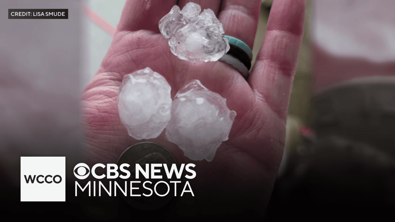
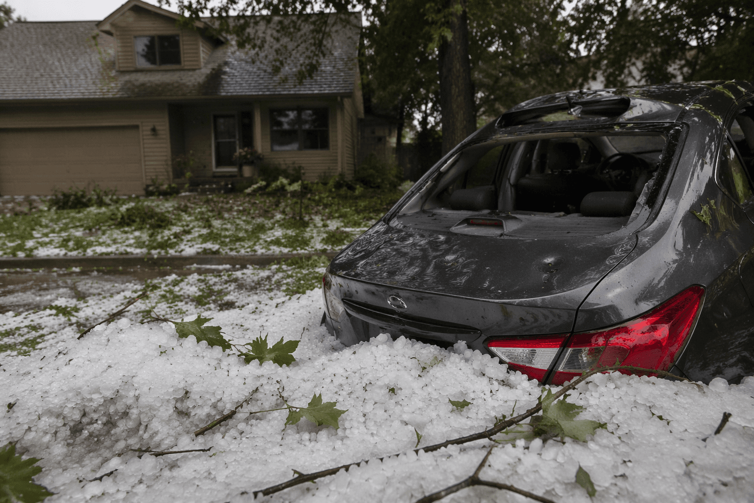
Hail larger than 2 inches slammed northern St. Paul and streaked across the Twin Cities metro as a storm line moved through east-central Minnesota and western Wisconsin, leaving hail on the ground in some places and knocking down trees and power lines. In some neighborhoods, hail fell for more than 10 minutes, and motorists even sought shelter under highway overpasses as the storms crossed the I-94 to I-694 loop.
The National Weather Service’s Twin Cities office had warned Friday that scattered showers and storms were likely late in the afternoon and evening, with the focus along and north of the I-94 corridor. The strongest storms were expected to bring hail and strong winds, and the forecast played out with multiple rounds of severe weather moving through the region.
The weather service said the first round produced large hail across east-central Minnesota and western Wisconsin, with the biggest stones reported at over 2 inches in northern St. Paul. A second round followed about 30 to 60 minutes later and caused scattered wind damage to trees and a few power lines. The office also said a funnel cloud near Osseo, Wisconsin, may have touched down and damaged parts of west Osseo. By Saturday night, the Twin Cities forecast page had been updated at 8:54:22 p.m. CDT.
The danger was not confined to Minnesota and Wisconsin. On Saturday, thunderstorms and potential tornadoes threatened parts of the South, while the broader setup continued to generate severe-weather hazards across the Plains and Midwest. The Weather Prediction Center said impactful flash floods and severe storms were expected across those regions on June 20 and June 21, a sign that the same early-summer heat and moisture driving hail in the Upper Midwest was also fueling a wider multi-state risk.
That combination made the system unusually disruptive. Hail and wind already caused some power outages in the Twin Cities area, and the reports of downed trees, damaged power lines and blocked sheltering under overpasses pointed to travel delays and added strain on emergency response if the storms repeated or shifted east. With severe-weather risk still active over the weekend, residents across the central and eastern U.S. faced a fast-moving threat that could turn quickly from heavy rain to hail, damaging winds or tornado warnings.
This article was produced by Prism’s automated news system from verified source data, official records, and press releases, then run through automated quality and moderation checks before publishing. The system is built and supervised by the people who set the standards it runs under. Read our full AI policy.
Know something we missed? Have a correction or additional information?
Submit a Tip