How to visit Roxborough and Castlewood Canyon State Parks, Douglas County
Park manager Larry Butterfield led a Creek Bottom hike that highlights Castlewood Canyon’s waterfalls and dam ruins, while Roxborough’s sandstone fins draw heavy use and require groups to contact the park.

Park manager Larry Butterfield, on a Denver7 hike through Creek Bottom Trail, described Castlewood Canyon as a place where “you get to see all the rock formations up on the cliffs and tons of boulders um along the trail,” and that immediacy captures why visitors make the drive to Douglas County’s two signature state parks. Roxborough State Park west of Highlands Ranch and Castlewood Canyon State Park near Franktown protect distinct geology and foothills ecosystems and offer linked trail systems, interpretive history, and persistent management questions about parking, access, and visitor services.
Quick facts and county context Douglas County covers 843 square miles and, according to the county’s 2030 Parks, Trails, and Open Space Master Plan (pages 2-5; 2-6; A-1), more than one-quarter of the county’s landmass lies within the Pike National Forest. Elevations range from about 5,380 feet at the Platte River in Chatfield State Park to roughly 9,836 feet at the top of Thunder Butte in the Pike National Forest. The county is home to three Colorado state parks: Chatfield, Roxborough, and Castlewood Canyon. The Master Plan highlights regional geology including hogbacks, canyons such as Castlewood Canyon, buttes, unique caprock and rhyolite formations, and typical rocky-area fauna such as fence lizards, chipmunks, and rock squirrels.
Roxborough State Park: location, rules, and trails Roxborough State Park sits southwest of Denver and is tightly woven into the regional trail network, connecting to Douglas County open space trails, Pike National Forest trails, Waterton Canyon, and the Colorado Trail. The Colorado Mountain Club trail listings show multiple popular routes with specific distances and elevation gains that hikers should plan for precisely. Notable trails include Carpenter Peak, 6.3 miles with 1,059 feet of gain; Carpenter Peak to Powerline, 7.9 miles with 1,407 feet of gain; and longer connector routes such as Waterton Canyon to Roxborough State Park, 13 miles with 2,100 feet of gain. Shorter options include the South Rim & Willow Creek Loop at 3 miles with 465 feet of gain and the South Rim Trail, about 1.8 miles and roughly 500 feet of gain, which begins approximately 0.5 miles from the Visitor Center on the Carpenter Peak Trail. The Indian Creek to Roxborough Park route is 14 miles with 2,288 feet of gain and requires a one-way car exchange or shuttle.
Because Roxborough is heavily visited, the Colorado Mountain Club notes a park policy that affects group access: “Due to popularity & limited parking all groups must contact the park prior to their visit.” Plan ahead for limited parking during spring through fall, and confirm trail status and shuttle logistics if you intend to use one-way routes such as Indian Creek to Roxborough.
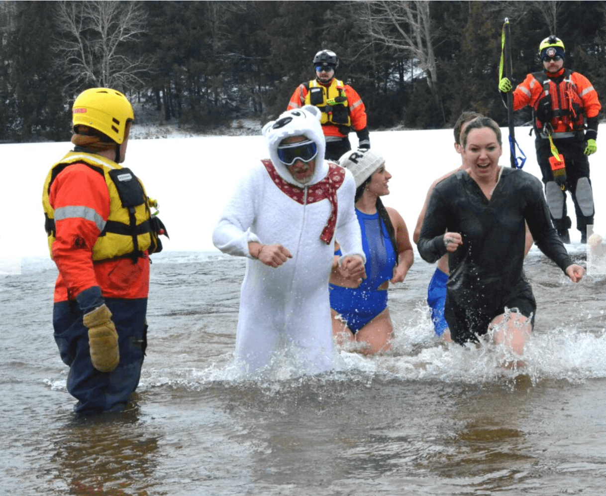
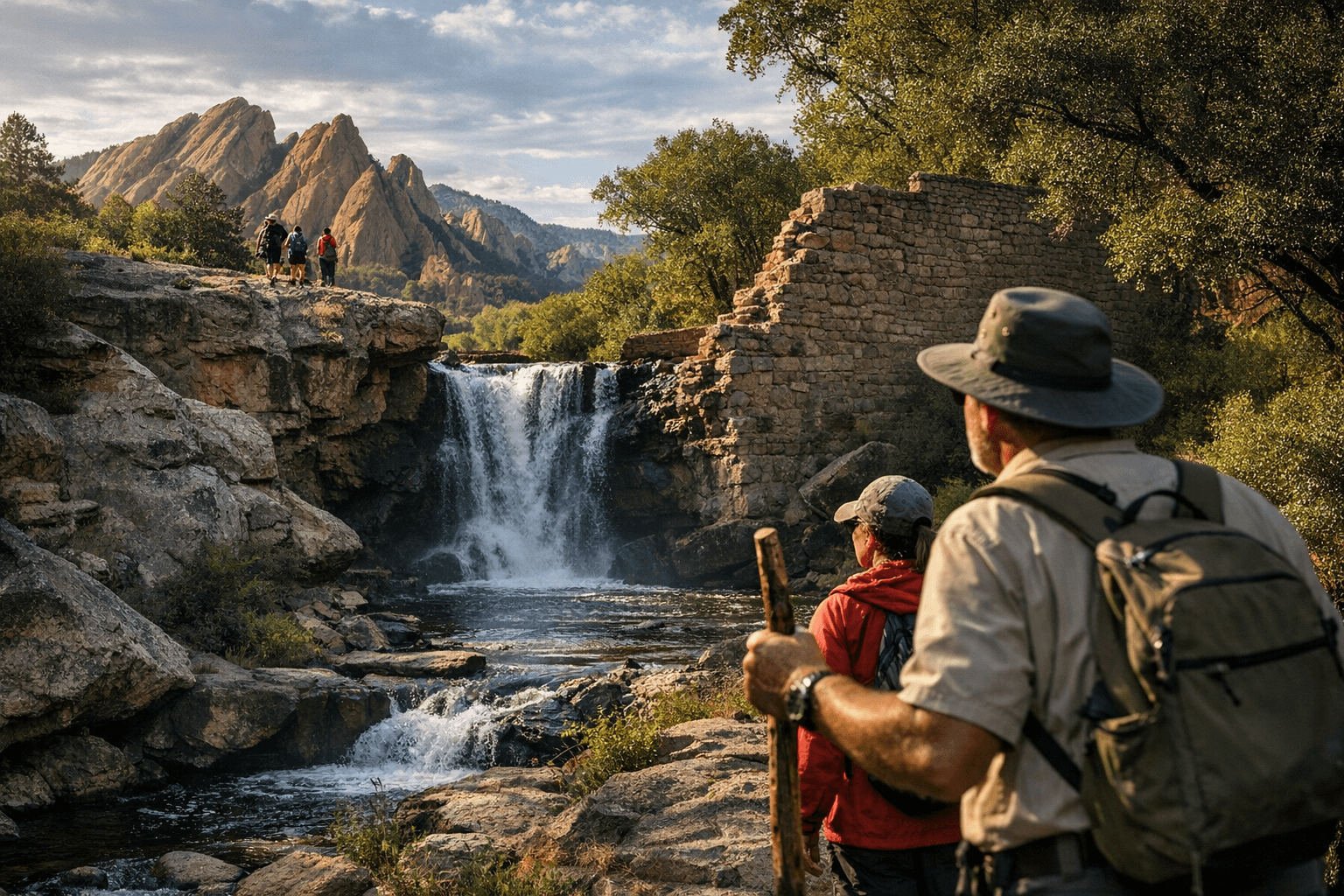
Castlewood Canyon State Park: what you’ll see and the park story Castlewood Canyon, near Franktown, offers a different cast of attractions: steep canyon walls, rock sculptures and boulder fields, a creek that forms small waterfall features, and the ruins of an old dam. The Denver7 video segment titled “Explore the hidden beauty of Castlewood Canyon State Park,” posted June 13, 2025, captures this ground-level experience. The segment’s narration describes “the canyons and the rock sculptures and just how it's dips down and up in the path. It's a hiker's paradise in Douglas County. The primary thing folks come out to do is just get out and hike and have that connection to nature.” In the same piece, a visitor observed, “So this was the payoff of our admittedly short hike. It's a lovely little waterfall system we have here. And believe it or not, it's the Cherry Creek.”
The Denver7 transcript also references historical interpretive material on site: “A lot of people love to come look at the damn ruins, hike around it, just get different views of it. There's a lot of history to this park. Visitors can learn all about the dam, which burst back in 1933, flooding Denver in the process and leading to the construction of a new dam and the Cherry Creek Reservoir that we know today.” That passage comes from the Denver7 segment and should be treated as attributable to that reporting; the transcript includes the phrase “damn ruins,” which appears to be a transcription artifact and should be verified against park signage or the original video file if accuracy on wording is essential. Castlewood’s visitor activities are summarized in Denver7’s description as “great for hiking, rock climbing, birding, picnicking or just spending time outside.”
Trail connectivity and a practical route example For hikers seeking longer, interconnected outings, the Waterton Canyon to Roxborough corridor is a clear example of regional linkage. The route begins at the Waterton Canyon trailhead, follows the canyon uphill, then uses the Roxborough connector trail at Stevens Gulch just past Strontia Springs Dam to reach the Powerline trail inside Roxborough. From the Powerline trail hikers can access Carpenter Peak or the Elk Valley trail. This Waterton-to-Roxborough corridor is listed at about 13 miles and 2,100 feet of elevation gain and provides a continuous wilderness experience that ties county open space, state park land, and national forest trails.
Wildlife, vegetation, and geology to watch for Douglas County’s Master Plan describes the geology you’ll encounter: sandstone red fins in Roxborough, hogbacks along the foothills interface, canyons like Castlewood Canyon, and caprock and rhyolite formations in other parts of the county. Riparian corridors in the county are associated with Plum Creek, Cherry Creek, and the South Platte River, where willow, cottonwood, rushes, sedges, and cattails dominate and support species such as the Preble’s meadow jumping mouse and the northern leopard frog. Within Roxborough, the Willow Creek Trail is known for an abundance of wildflowers and a variety of birds; elsewhere, expect fence lizards, chipmunks, and rock squirrels in rocky habitats.
Visitor logistics, safety and information needs The county Master Plan explicitly lists items that could be made more readily available to park users: “Information that could be made readily available include: trail conditions, facility booking, natural history resource information for a specific trail or open space area, enhanced mapping, and safety and emergency information.” That list is a useful checklist for planning any visit: check current trail conditions, reserve facilities when possible, carry detailed maps, and know emergency procedures for the park you are entering.
Practical visitor and relocation tips If you live in or are moving to Douglas County, a relocation guide put together by Dstreetbrokers captures why people value the area: “Thinking about a move to Douglas County, Colorado? You are not alone. Professionals and families choose this area for its open space, trail networks, and access to Denver job centers. If you want a clear picture of neighborhoods, commutes, costs, and what to expect, this guide is for you. Let’s dive in.” The guide notes that master-planned communities in the northern county include parks, pools, golf and playgrounds, while the southern county retains ranching, agriculture, large-lot residential and protected open space.
- Drive your likely routes at your normal commute times to check traffic patterns.
- Consider shifting your schedule to avoid peak hours when possible.
- Ask your agent for drive-time samples to work, schools, the airport, and daily needs.
Dstreetbrokers also lists practical steps and risks for prospective buyers and visitors:
Risk items to review before buying include wildfire risk and defensible-space standards, flood and drainage and FEMA maps for canyon or low-lying areas, water source verification for rural wells, and use restrictions in CCRs.
Final note and next steps for planning a trip Both Roxborough and Castlewood Canyon reward preparation: Roxborough’s sandstone fins and panoramic trails list exact distances and elevation gains that should be matched to your fitness and logistics, and Castlewood’s creek and historical interpretation are best experienced with a park manager’s on-site perspective such as that captured in the Denver7 piece. Before you go, confirm current policies and daily trail conditions with park staff, especially Roxborough’s group-contact requirement; verify any historical claims or transcription artifacts from media sources against park signage or archives. These parks are durable public assets: plan carefully, respect sensitive riparian habitats, and your visit will reveal two very different corners of Douglas County’s foothills.
Know something we missed? Have a correction or additional information?
Submit a Tip