Humboldt Outdoors traces Jolly Giant Creek from headwaters to bay
Humboldt Outdoors released a video tracing Jolly Giant Creek from the Arcata Community Forest to Humboldt Bay, highlighting hidden stretches and urging residents to notice local waterways.

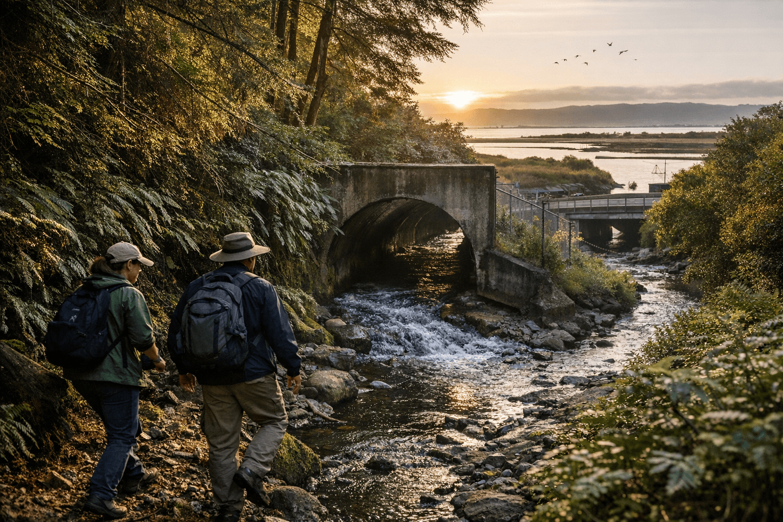
Humboldt Outdoors on Jan. 14 released a compact visual tour that follows Jolly Giant Creek from its headwaters east of Arcata downhill through roughly a four-mile route to Humboldt Bay. The video stitches together on-the-ground walking, map references and aerial footage to show how a small, mostly unnoticed stream threads forest, campus and town.
The route begins in the Arcata Community Forest, where maintained trails lead hikers downhill as small tributaries join and the creek becomes more defined. Viewers see sections of open channel, brief disappearances where the water runs under roads and through culverts, and stretches where the creek is easy to miss unless you are intentionally looking for it. As the stream leaves the forest it skirts the edges of Cal Poly Humboldt before dropping underground for a long stretch and then re-emerging downstream toward the bay.
That pattern matters to Arcata residents for several practical reasons. First, the creek’s alternation between visible channel and buried conduit highlights how urban and campus development have shaped local hydrology; culverted sections concentrate runoff and can complicate access for recreation or stewardship. Second, the four-mile route is short enough to be a single outing for many locals, and the mix of trails, campus edge and cityscape makes the creek a natural micro-classroom for students and neighborhood groups interested in ecology and civic infrastructure.
Humboldt Outdoors’ use of maps and aerial shots places the watercourse in the context of the built environment, making it easier for residents to connect what they see on trails with where the creek flows beneath streets and buildings. That clarity can help community volunteers, campus planners and local conservation groups locate access points, monitor problem spots and prioritize stretches that could benefit from cleanups or habitat work.
There are also modest local economic implications. Increased attention to a walkable, four-mile stream route can translate into more foot traffic for nearby businesses and more use of campus trails by visitors, students and residents, particularly in a place where outdoor recreation is a staple of daily life. At the same time, visible culverts and buried stretches underscore the maintenance responsibilities borne by city and campus agencies, from stormwater management to trail upkeep.
The feature invites Arcata residents to see a familiar landscape with fresh eyes and consider a simple experiment: follow the water from forest to bay. Our two cents? Pack a map, stick to maintained trails, be mindful of culverts and private property, and treat the creek like a neighborhood asset worth noticing and protecting.
Sources:
Know something we missed? Have a correction or additional information?
Submit a Tip

