Magnitude 7.3 Earthquake Strikes Vanuatu, Triggering Urgent Damage Assessments
A 7.3 earthquake shook an estimated 128,000 people along Vanuatu's Espiritu Santo island Monday night, with no tsunami warning issued and emergency damage assessments underway.
An estimated 128,000 people felt strong ground shaking when a magnitude 7.3 earthquake struck 35 kilometres northeast of Luganville at 7:44 p.m. local time on March 30, rattling homes and businesses across Espiritu Santo and setting off an emergency assessment that disaster officials in Sanma Province were still coordinating as of Tuesday morning.
The United States Geological Survey placed the quake at a depth of approximately 115 kilometres beneath the seafloor. That intermediate depth shaped the immediate risk calculus: the U.S. Tsunami Warning Center confirmed there was no tsunami threat. Local coastal monitoring remained in place regardless. The trade-off, however, was shaking felt across a wide arc of the archipelago. Beyond the 128,000 who experienced strong motion, an additional 55,000 felt moderate shaking and 89,000 felt lighter tremors, spreading the quake's effects across Sanma, Penama, Malampa and Torba provinces.
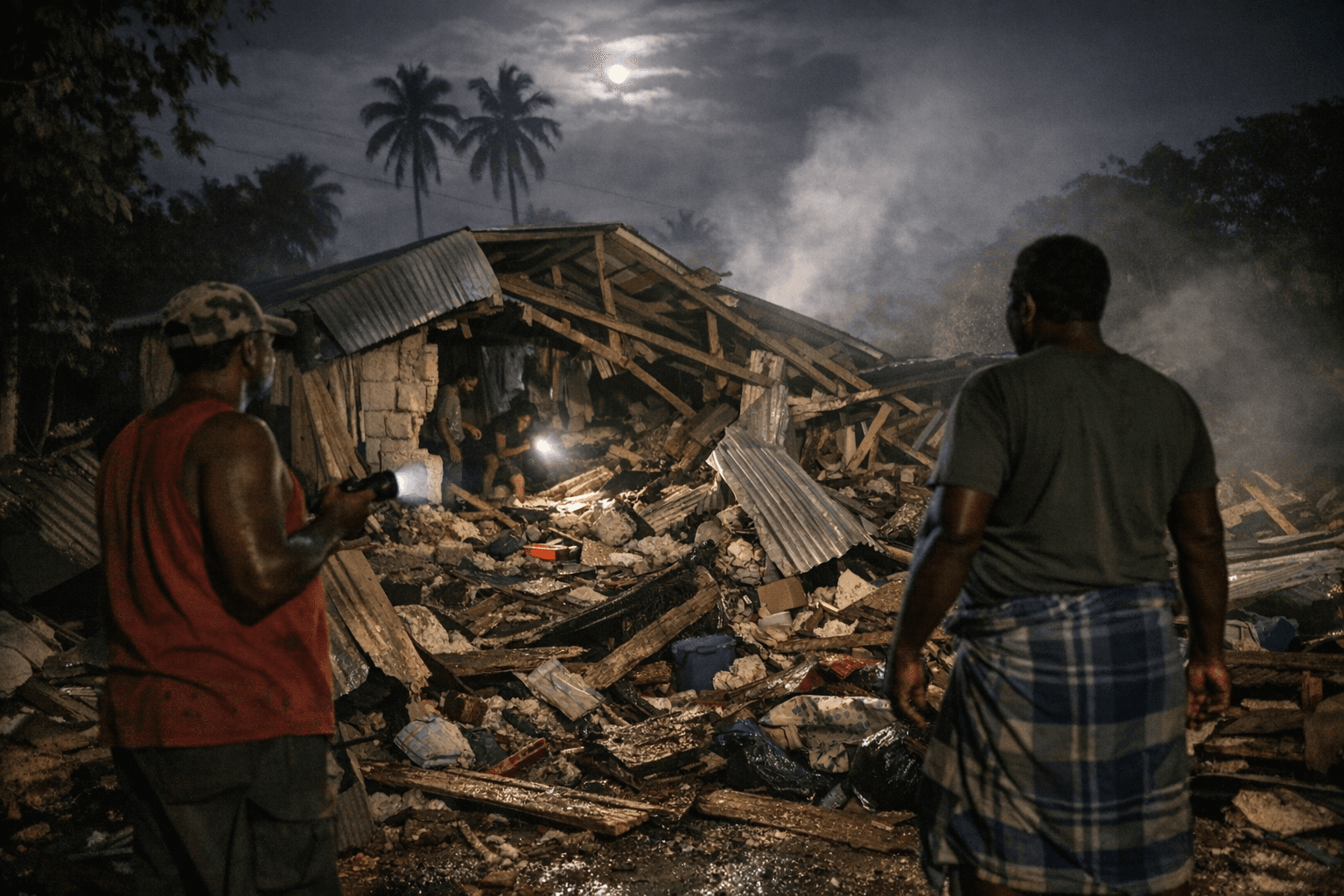
Johnathan Iavere, head of the Sanma Provincial Disaster and Climate Change Committee, said the committee would convene to quickly assess the damage in the province and prepare a rapid report to be submitted to the government. Early accounts gathered before that meeting described items thrown from store shelves, localized power outages and landslide activity on feeder roads through hilly terrain. No widespread fatalities had been confirmed by the end of March 31. USGS aftershock monitoring recorded a magnitude 5.0 event at 09:02 UTC, shortly after the main shock.
Reports from Malampa Province noted a one-hour power outage with no immediate injuries, while residents on Ambae island described the quake as one of the strongest they could recall. Those accounts reflect what a 7.3 at intermediate depth can do across a broad area: dramatic in sensory impact and often less catastrophic in structural terms than a shallower event, but still capable of severing road access, cutting utilities, disrupting communications and overwhelming the limited medical facilities that serve dispersed island communities. Luganville, as the country's second-largest municipality, sat closest to the epicenter, with provincial officials racing to determine whether ports, water supply infrastructure and inter-island shipping links had sustained lasting damage.
Vanuatu's vulnerability runs deeper than any single event. The 2021 World Risk Index ranked it as the country with the highest disaster risk globally, a designation that reflects not just seismic exposure but the compounding effect of cyclone seasons, volcanic activity and the logistical realities of an island state stretched across thousands of square kilometres of open ocean. Sanma's disaster committee planned to submit its findings to the national government to guide formal aid requests, with immediate priorities covering housing assessments, road clearance and restoration of communications links that island communities depend on for everything from medical evacuations to food resupply.
International partners including Australia, New Zealand and the United States have historically mobilized logistical support and humanitarian assistance when major Vanuatu earthquakes exceed domestic response capacity. Humanitarian monitoring agencies were tracking the situation closely in the hours following the quake, waiting on provincial damage tallies before determining whether external mobilization would be required. For an archipelago ranked first in the world for disaster risk, the speed of that determination matters as much as the scale of the response it eventually triggers.
This article was produced by Prism’s automated news system from verified source data, official records, and press releases, then run through automated quality and moderation checks before publishing. The system is built and supervised by the people who set the standards it runs under. Read our full AI policy.
Did this article answer your question?


