Marks Boat Ramp Serves Quitman County, Access Varies with River Levels
Marks boat ramp provides Quitman County's main small-boat access to the Coldwater River, but usability changes with river levels and U.S. Army Corps of Engineers operations.

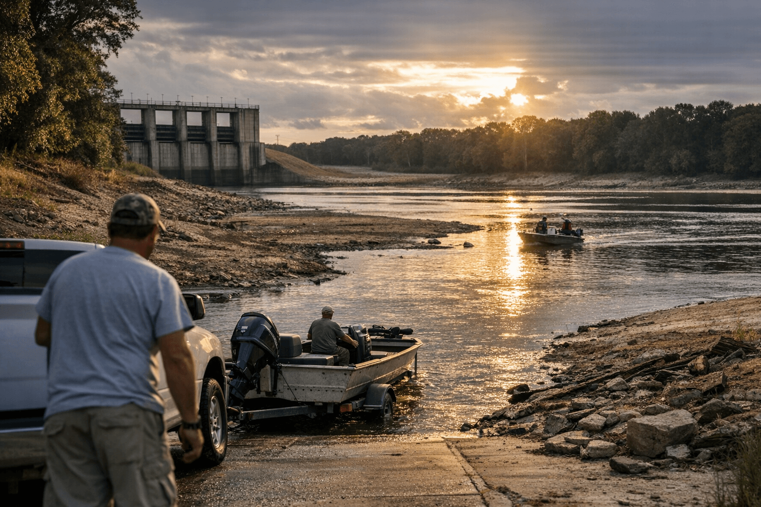
Marks boat ramp is Quitman County's primary municipal river access point on the Coldwater River, located near Highway 6 in Marks. Anglers, kayakers and owners of small boats rely on the ramp for recreational fishing, weekend outings and weekday launches, but water levels and project operations by the U.S. Army Corps of Engineers determine when and how the site can be used.
Local residents know the ramp as a simple, central launch for short trips on the Coldwater, but availability is often inconsistent. Low river stages make launching difficult for trailers and outboard motors; high water can submerge the ramp and shore parking, creating safety hazards and periods of temporary closure. Corps project operations that adjust flow to meet downstream needs can cause rapid changes in depth and current, affecting small-boat handling and shoreline conditions.
The practical impact touches household schedules and the local economy. Recreational anglers and kayak users adjust trip timing around river levels, which can compress demand into narrow windows and concentrate traffic on clear days. Businesses that depend on river visitors, bait and tackle retailers, convenience stores and food vendors in Marks and surrounding communities, feel the variability through fluctuations in customer traffic. While the ramp itself is municipal, decisions about water management come from regional Corps operations, which prioritize broader flood control, navigation and environmental goals and can override local expectations for steady access.
Safety and logistics are immediate concerns. Small-boat operators face changing currents and submerged obstacles after heavy releases, while low flow can expose sandbars and make traditional launch angles unusable. For regular users, the best practice is to check current river stage information and Corps notices before planning a trip and to have a contingency plan if the ramp is unusable. This practical approach preserves time and reduces wear on equipment.
Longer-term, variability at Marks boat ramp reflects broader hydrologic patterns that affect recreation and local budgets. If seasonal swings or operational adjustments increase in frequency, Quitman County may need to consider investments in ramp elevation, improved signage or formal coordination channels with the Corps to reduce surprise closures. For now, residents should expect that river access at Marks will vary and plan outings accordingly.
What this means for Quitman County is straightforward: Marks boat ramp remains the community's go-to launch on the Coldwater River, but river levels and Corps operations will continue to dictate when that access is smooth, limited or temporarily unsafe. Check current conditions before heading out so trips are safe and local businesses can better anticipate demand.
Sources:
Know something we missed? Have a correction or additional information?
Submit a Tip