NOAA says El Niño likely to emerge, historic impacts raise stakes
NOAA said El Niño was likely to emerge, with an 82% chance this summer and a 96% chance through winter, reviving fears of crop shocks, floods and higher insurance costs.

El Niño was moving back toward the center of the global economic story, and NOAA’s latest forecast gave it strong odds of reshaping weather risks across the United States and beyond. The National Oceanic and Atmospheric Administration’s Climate Prediction Center said on May 14 that El Niño had an 82% chance of emerging in May-July 2026 and a 96% chance of lasting through Northern Hemisphere winter 2026-27. What remains unsettled is strength: NOAA said the most powerful events are marked by tight ocean-atmosphere coupling through the summer, but its current outlook gave no strength category better than a 37% chance.
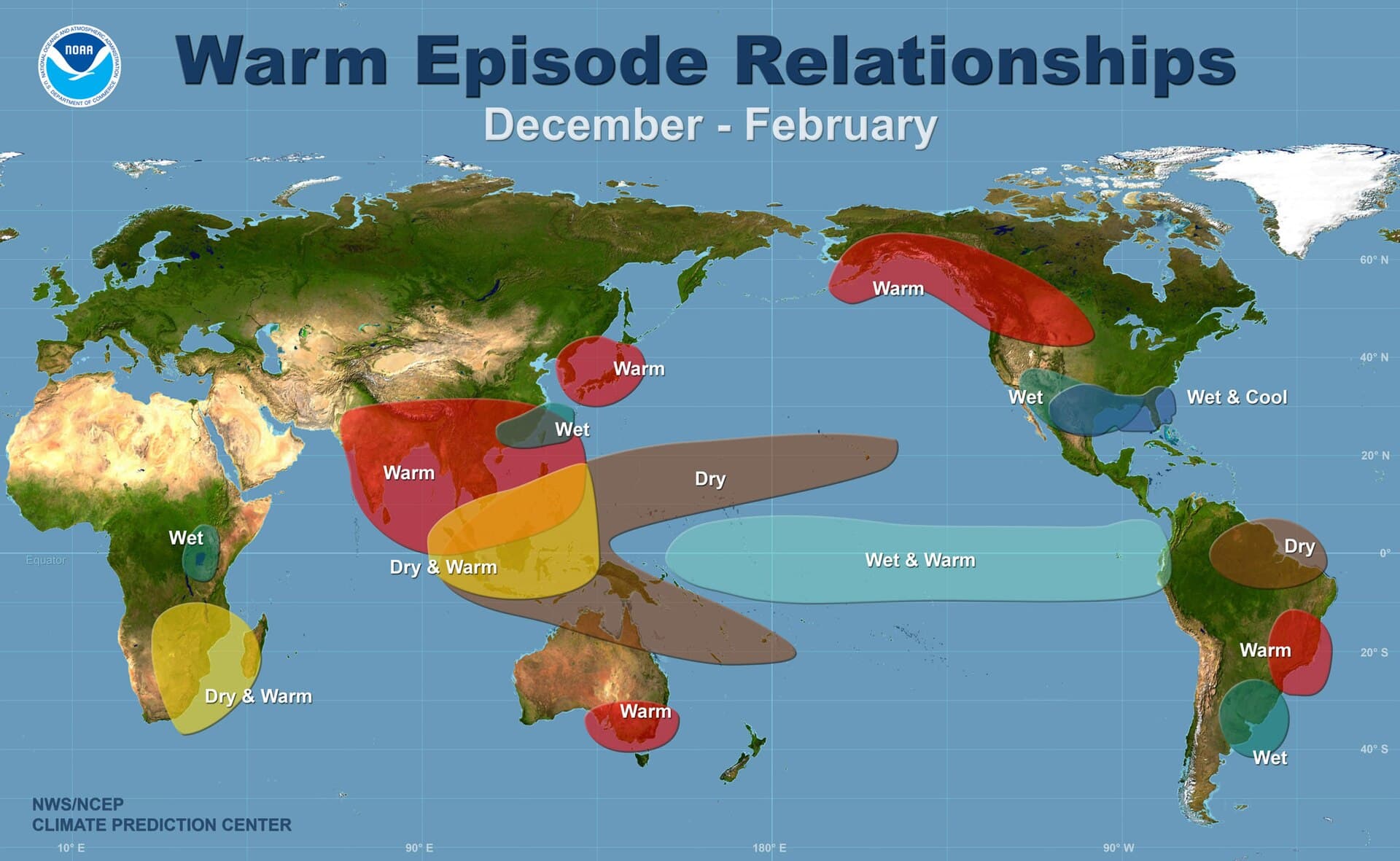
That uncertainty matters because El Niño is not just a meteorological label. NOAA says the pattern can affect weather, food supplies, prices, forest fires and broader economic and political conditions, while the World Meteorological Organization describes ENSO as a recurring shift in equatorial Pacific temperatures and atmospheric circulation with major effects on climate patterns worldwide. For the United States, that means the stakes run from water management in the West to storm losses in the Southeast, with insurers, farmers and state emergency planners all watching the same ocean signal.
History shows why the market is taking the prospect seriously. NOAA lists 1982-83, 1991-92, 1997-98, 2002-03, 2009-10, 2014-16 and 2023-24 among notable El Niño years. NASA says the 1997-98 episode was the strongest on record in satellite, ship and buoy observations. A NOAA review estimated that event caused more than 22,000 deaths and more than $36 billion in damage worldwide. In the United States, that winter was the second warmest and seventh wettest since 1895, bringing flooding in the Southeast and California, an ice storm in the Northeast and tornadoes in Florida.
The more recent 2023-24 event also underscored how a strong El Niño can amplify a year already under heat stress. The World Meteorological Organization said it peaked as one of the five strongest on record, and 2023 became the warmest year on record. That does not mean 2026 will replay the same script, but it does show how a strong Pacific warm phase can interact with a warming baseline and push extremes farther.

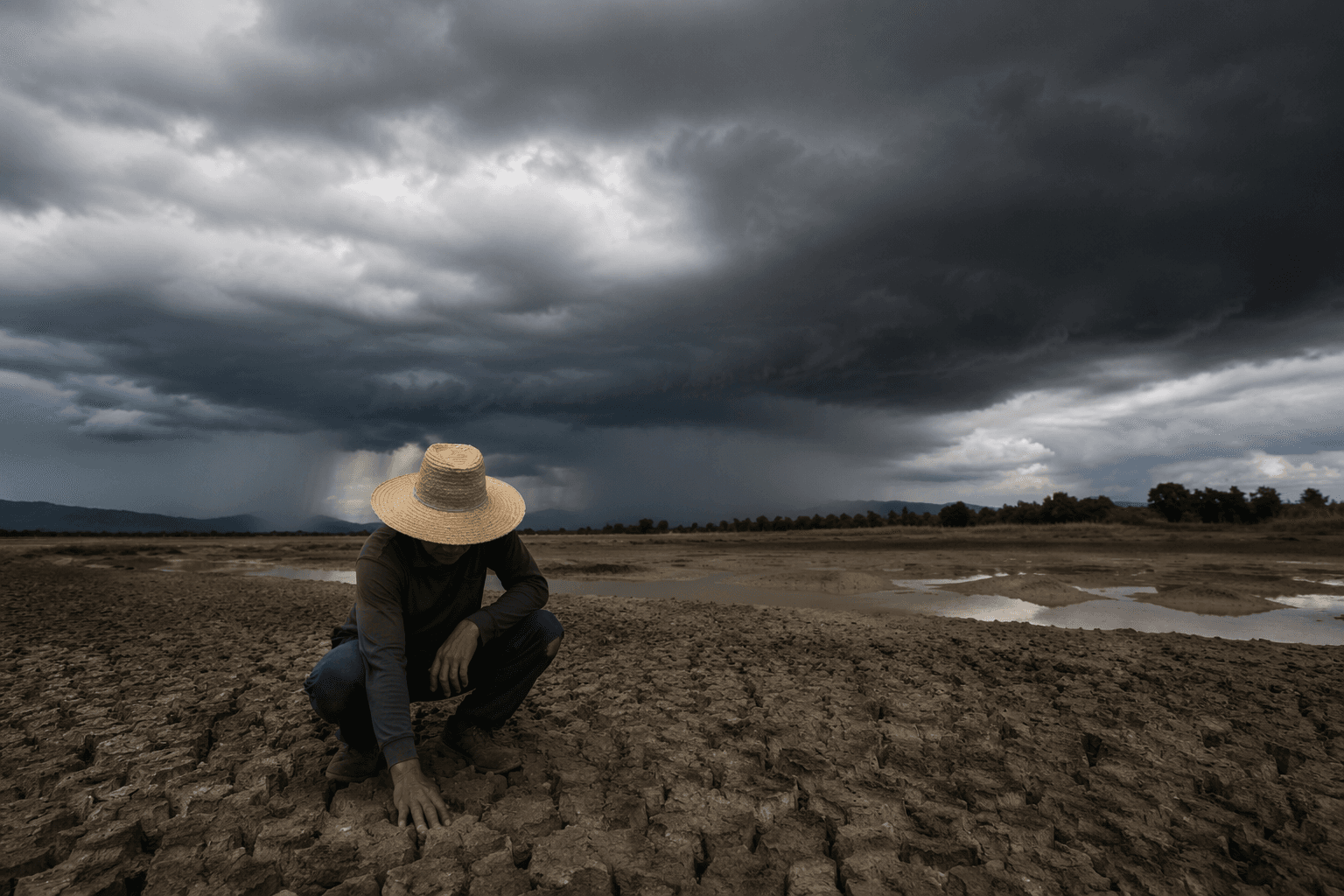
For the months ahead, the biggest national consequences are likely to show up in crop yields, water allocation, wildfire risk, public health and insured losses. A strong El Niño can tilt rainfall and temperature patterns in ways that strain reservoirs, disrupt planting and harvest timing, and raise the odds of floods or drought in different regions at once. NOAA’s own warning is clear: the event may emerge soon, but the size of the shock remains the unknown that will determine how costly it becomes.
This article was produced by Prism’s automated news system from verified source data, official records, and press releases, then run through automated quality and moderation checks before publishing. The system is built and supervised by the people who set the standards it runs under. Read our full AI policy.
Did this article answer your question?


