NWS Issues Upgraded Winter Storm Warnings for Central Nye County
NWS upgrades watches to warnings for areas above 5,000 feet in central Nye County, forecasting 5–10 inches there and gusts to 45 mph from 10 a.m. Monday to 10 p.m. Wednesday.
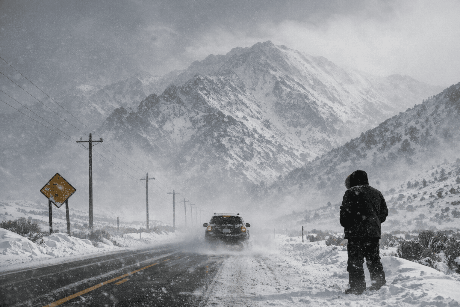
The National Weather Service in Las Vegas upgraded Winter Storm Watches to Winter Storm Warnings for high-elevation zones in central Nye County, Esmeralda County, the Spring Mountains and the Sheep Range, with the Nevada warning window reported as 10 a.m. Monday through 10 p.m. PST Wednesday. The agency warned that the storm will produce heavy mountain snow, strong gusts and whiteout conditions that could make travel "treacherous and potentially life-threatening."
Forecasts and contemporaneous reporting show a two-wave storm pattern. In the Spring Mountains and Sheep Range, accumulations could exceed 2 feet above 9,000 feet, with 1 to 2 feet above 7,000 feet and 6 to 12 inches down to 5,000 feet around Mount Charleston. For central Nye and Esmeralda counties at elevations above 5,000 feet, projected totals are roughly 5 to 10 inches, with the second wave expected to push snow levels down toward 4,000 to 5,000 feet.
Wind will compound the hazard. Local forecasts and NWS products indicate gusts up to 45 mph in Esmeralda and central Nye counties and up to 50 mph at higher elevations in the Spring Mountains and Sheep Range. NWS Las Vegas messaging characterizing conditions for adjacent Eastern Sierra and White Mountains notes "wind gusts up to 55 mph and visibility down to ¼ mile are possible. These conditions make travel difficult to impossible and outdoor activity should be reconsidered."
Roads and mountain passes named in warnings include Highway 266 at Lida Summit and stretches of Highway 95; both were flagged as likely to become particularly hazardous as blowing snow reduces visibility and surfaces become slick. Communities called out in the forecasts include Mount Charleston, Hayford Peak, Dyer, Silver Peak, Beatty and Goldfield, where officials and transportation crews are expected to monitor conditions as the storm unfolds. Travel could briefly ease late Monday night before intensifying again by midday Tuesday as the second wave arrives.
Officials urged preparedness for anyone who must travel. The NWS warning states, "Travel could be very difficult to impossible. Whiteout conditions are expected and will make travel treacherous and potentially life-threatening." Motorists are advised to carry emergency supplies; the NWS has advised people who must travel to "keep an extra flashlight, food, and water in your vehicle in case of an emergency," and to call 511 for local road updates. Tire chains may be necessary on mountain passes and motorists should expect possible restrictions on Highway 266 at Lida Summit and parts of Highway 95.
The Eastern Sierra and White Mountains remain under a related Winter Storm Warning from 4 a.m. Monday to 10 p.m. Wednesday, and regional maps used by forecasters were last updated Saturday, Feb. 14 at 5:44:23 p.m. PST. Nye County residents should monitor NWS Las Vegas products, call 511 for road conditions, and watch for updates from Nevada Department of Transportation and county emergency managers as crews respond to the storm.
Know something we missed? Have a correction or additional information?
Submit a Tip