Oregon snowpack hits record low as drought and wildfire risk rise
A record-low snowpack has left Oregon with a grim summer water outlook, while drought and wildfire danger are rising fast across the state.
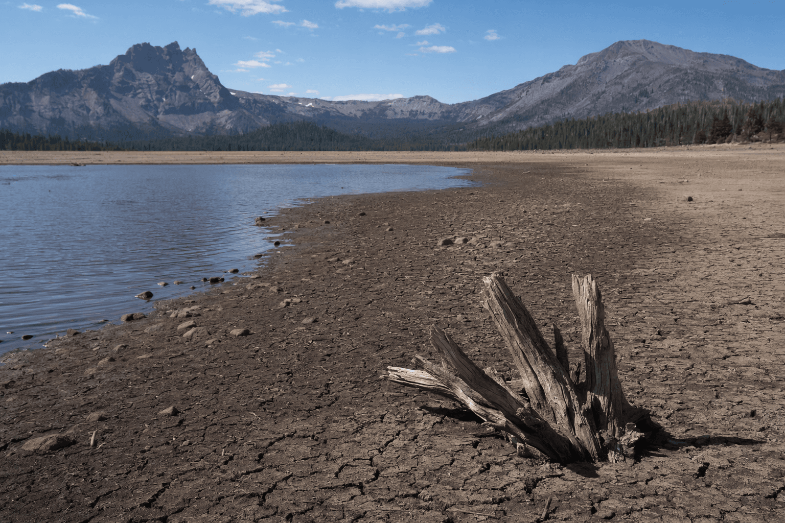
A record-low snowpack is already tightening Oregon’s summer water supply, putting farms, cities and fire crews on a collision course over scarce water as the state heads into a hotter, drier season. The state’s April 1 water supply outlook described historically low snowpack and a grim forecast for the months ahead, and conditions worsened further by May 1, when snow water equivalent in the Upper Deschutes Basin fell to 6% of normal, the lowest reading since SNOTEL records began in 1981.
The missing snow is only part of the problem. State officials said Oregon’s 2025-26 winter tied 1934 as the warmest on record, with unusually high temperatures helping erase snowpack before it could become summer runoff. That leaves less water stored in the mountains for later use, a problem that hits irrigation districts first, then municipal systems and streamflow-dependent habitats as the dry season deepens.
The governor’s office said nine of Oregon’s 36 counties were already under drought emergency status in early May. Baker, Deschutes and Umatilla counties were among the first declared, and Crook, Grant, Jackson, Jefferson, Morrow and Wallowa were later added as conditions spread. Officials warned that some irrigation districts may receive smaller allocations, water users could face earlier regulation, and ephemeral waterways may shrink or dry up altogether.
The fire outlook is turning just as ominous. Gov. Tina Kotek and state fire leaders warned on May 5 that Oregon was facing a potentially severe wildfire season, with above-normal risk east of the Cascades beginning in June and spreading to southwestern Oregon in July before moving deeper into forests later in the summer. The Riverview Fire in La Pine in March was the first major wildfire of the year, an early signal of a season that could arrive before many communities have fully adjusted to drought.
Last year brought more than 2,700 wildfires statewide, far above the 10-year average of about 2,000. Officials said more than 60% of those fires were human-caused, with debris burning the leading source of ignitions. That matters because even as the state braces for lightning and dry winds, one of the fastest ways fire starts in Oregon remains avoidable. A potentially strong El Niño could add another layer of risk by bringing warmer, drier weather and lightning with little rainfall.
The state is trying to push preparedness earlier. Oregon fire officials said about 700 residents had downloaded the new Before You Burn app since its April launch. But the bigger warning is regional: winter snowpack across the Northwest was about one-third of normal, and Oregon is becoming an early warning for a hotter, less predictable West.
This article was produced by Prism’s automated news system from verified source data, official records, and press releases, then run through automated quality and moderation checks before publishing. The system is built and supervised by the people who set the standards it runs under. Read our full AI policy.
Did this article answer your question?