Rancher captures rare cold-air funnel cloud near Sterling during storm
A rancher near Sterling photographed a rare cold-air funnel around 3 p.m. during an early-March rainstorm as temperatures plunged across the Front Range.
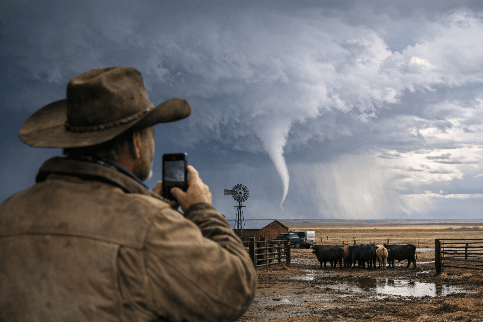
A local rancher captured a rare cold-air funnel near Sterling around 3 p.m. on Tuesday, March 3, 2026, as a rainstorm and cooler air mass pushed through Colorado’s Front Range and northeastern plains. The image and short video clip accompanying local coverage document a narrow, rotating column beneath low clouds just outside the City of Sterling.
Much-needed rain moved into northeastern Colorado that day, producing a sharp temperature swing statewide; Denver temperatures fell from a high of 70°F on Monday, March 2 to about 46°F on Tuesday, March 3. That rapid cooling aloft and beneath showers helped create the turbulent, unstable conditions that favor weak cold-air funnels rather than classic tornadic storms.
Meteorologically, cold-air funnels form beneath weak thunderstorms or showers when the air above is unusually cold. The National Weather Service states that “cold air funnels are usually harmless but can possibly touch down as an EF-0,” a caveat officials repeat when such features appear early in the season. Cold-air funnels differ from tornadoes because tornadoes are violently rotating columns of air that extend from cloud base to the ground and produce much greater damage when they touch down.
On-scene chase and observer accounts expand the picture beyond the single Sterling sighting. A storm-chasing blog following the cells tracked storms north out of Sterling toward the Nebraska border, reporting downdrafts and a second, small funnel on the same complex. The blogger wrote, “These funnel clouds did not quite reach the ground, but were still really cool to see,” and noted the chase ended on a dirt road less than half a mile from the Nebraska border after a run of IMG_0448 through IMG_0458 photos.
Multimedia tied to the Sterling sighting includes a rancher’s photograph and a short video clip; internal file references for local coverage list tandi-keen-funnel-cloud-near-sterling.jpg and an accompanying funnel‑cloud‑vs‑tornado graphic, and a featured video with a duration listed as (01:54). Additional chase images from the northeastward run provide visual context but derive from a separate personal chase log rather than an official spotter report.
No official storm report confirms that the Sterling funnel touched down or caused damage. Multiple accounts emphasize the rarity of seeing cold-air funnels this early in March in Colorado; climatological context from the region shows the principal tornado threat increases rapidly in May and continues through August, with roughly 90% of Colorado tornadoes occurring during that four-month period. Local emergency management and National Weather Service storm logs would be the next step to confirm any touchdown or to record a local storm report for March 3.
Visually striking but, by available reports, not damaging, the Sterling sighting underscores how a brief March cooldown and rain can produce uncommon funnel activity on the northeastern plains even before the traditional May–August severe-weather window.
Know something we missed? Have a correction or additional information?
Submit a Tip

