Residents Raise Concerns Over Wind Farm Visual Impacts at St. Johns Meeting
Apache County commissioners agreed to measure wind-farm setbacks from the project boundary, a decision that drew a full room in St. Johns and sparked complaints about visual impacts and road damage.

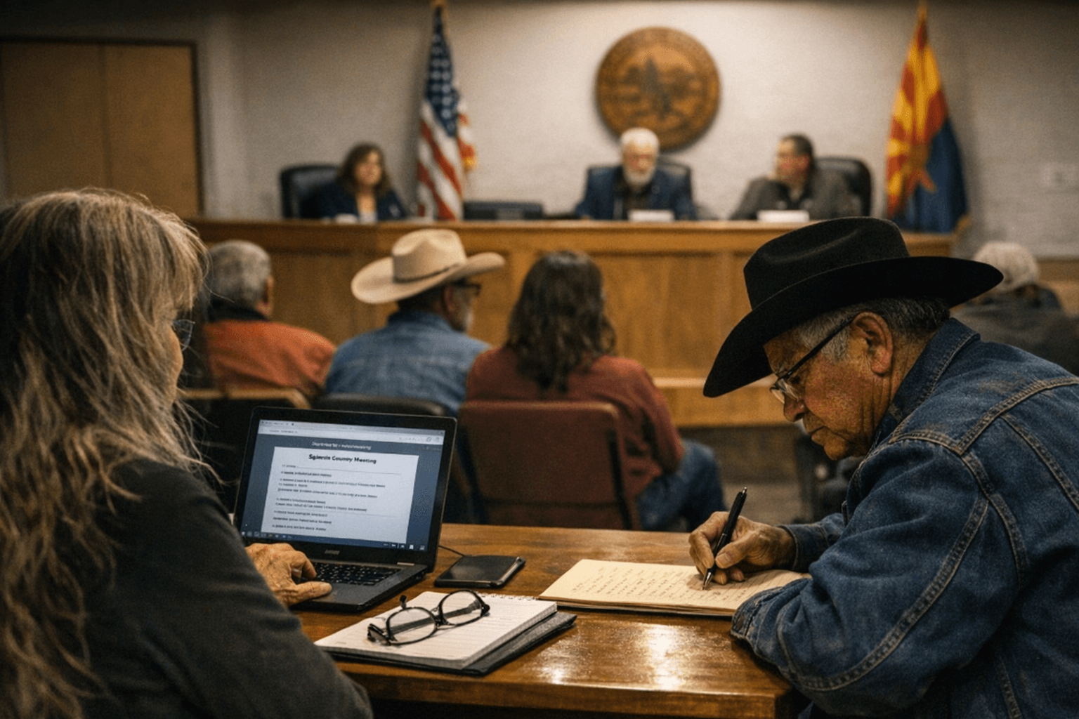
Apache County Planning and Zoning commissioners agreed that setbacks for proposed wind projects should be measured from the project boundary, a technical decision that played out before a full house of residents at the Feb. 4 working session in St. Johns. The vote followed visual-impact simulations, terrain visibility maps, and extensive public testimony that filled the meeting room.
The meeting, held Feb. 4, 2026, featured staff recommendations and draft ordinance review for Sections 436 through 442. Staff presented a formal finding that “Staff find the request consistent with the Comprehensive Plan and Article 11 criteria and recommend approval subject to conditions.” Commissioners reviewed the proposed addition to Section 436.3 Purpose Statement: “Further the County’s goals of protecting public health, safety, convenience, welfare, and its natural, cultural, and scenic resources through clear and enforceable siting standards.”
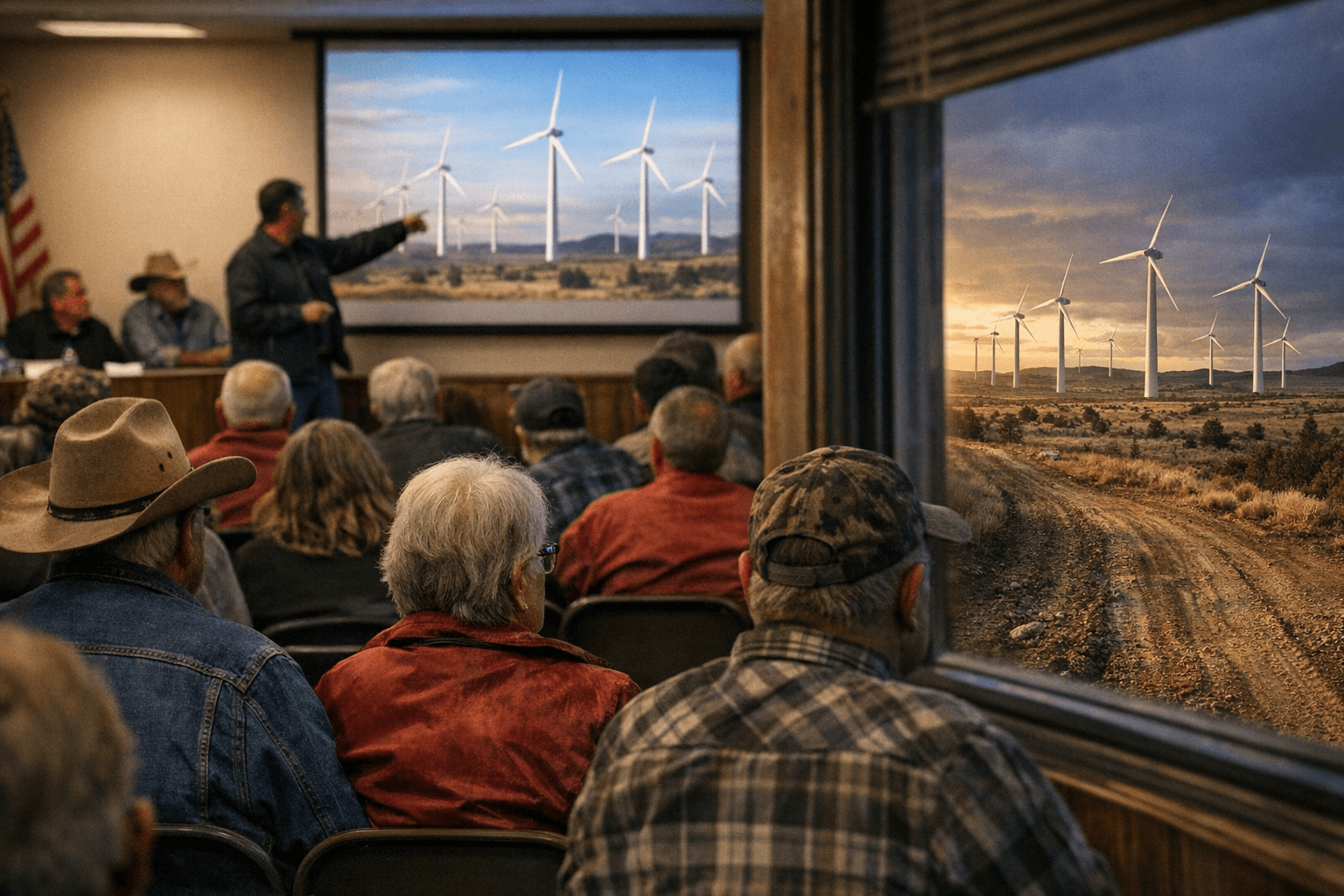
Community Development Director Matt Fish led much of the presentation, displaying “large wind-turbine visual simulations and landscape photos” and offering distance and visibility examples using field photographs. Mr. Fish raised concerns voiced by others that visual impact criteria may conflict with private property rights, and he introduced a definition of Project Boundary alongside a definition for Visual Resource. Mr. Fish noted that ridgelines, “where wind resources are ideal, might be impacted by the definition.”
Monica Boehning and Linda Weiland provided a handout described as terrain visibility maps and turbine distance zones used to evaluate how wind turbines may be seen from surrounding areas and scenic roadways in Apache County. Demonstrative evidence shown included nighttime imagery cited in two forms in materials: the tag “synchronized wind turbine ligts seen at night from East of mile 373 on SR 61” and the alternate phrasing “Synchronized red aviation lights from distant wind turbines are visible at night east of mile 373 on SR 61, an example of long-range visual impacts.”
Public testimony included statements from Alpine resident Stan Zumbrunnen, who said he was not opposed to the project but expressed concerns regarding visual impact and proximity to neighboring properties. Zumbrunnen cited Article 11, Section 1107 of the Zoning Ordinance on compatibility and mitigation and requested a performance or maintenance bond for road use because of heavy construction equipment. Meeting materials record that he asked the applicant be required to mitigate construction impacts, maintain the road during construction, and comply with submitted design specifications, and Mr. Fish confirmed road maintenance concerns are valid.
Procedural items remained unresolved in the packet. Commissioners agreed setbacks should be measured from the project boundary “as the CUP authorizes development within that defined area.” Chair Muth framed the limits of the commission when he said “property rights claims would fall under state constitutional processes, not this commission,” and suggested using the phrase “County-approved advisors” rather than naming specific reviewers such as NRCD, Engineering, Game and Fish, and Planning & Zoning. Draft language on transmission lines includes a utilities comment recorded as “utilities advised this is not [...] access or roadway use rights,” and one staff condition is truncated in the packet as “Applicant shall obtain a valid [...]” Pending clarification, those ellipses remain in the record along with an unexplained line that reads “Approval December 4, 2025.”
Know something we missed? Have a correction or additional information?
Submit a Tip