Tropical disturbance threatens South with flooding, possible storm development
A 60% chance of Gulf development put Texas, Louisiana and Mississippi under flood watches, with Houston and Southeast Texas facing the heaviest rain.

Waterlogged parts of the South faced another round of danger Tuesday as Invest 90-L drifted near the Texas coast with a 60% chance of tropical development in the next 48 hours and seven days. Forecasters said the disturbance could briefly become the season’s first named storm, Arthur, but the greater threat remained the rain, not the wind.
The National Hurricane Center warned that southern and eastern Texas, along with portions of Louisiana and Mississippi, should prepare for several days of intense rainfall that could produce widespread, life-threatening flash, urban and river flooding. The Weather Prediction Center placed portions of the Texas Gulf Coast and the lower Mississippi Valley under a moderate risk of excessive rainfall, while the New Orleans and Baton Rouge forecast office said 4 to 6 inches of additional rain could fall through Friday evening, with some places topping 10 inches. It also warned of rainfall rates as high as 3 to 5 inches per hour in the most efficient bands.
The heaviest impacts were centered first along South Texas, the Houston metro area and the coast from Galveston Bay toward Beaumont and Port Arthur, where the National Weather Service said a Flood Watch had been issued through Thursday morning for much of Southeast Texas. The Corpus Christi forecast office said widespread moderate to heavy rain was already underway, with a medium 60% chance of tropical development along the Texas coast and rainfall rates of 2 to 4 inches an hour still possible. Forecasters said repeated rounds of tropical moisture, combined with a stalled front, could overwhelm creeks, bayous, rivers and drainage systems before the disturbance pulled east toward Louisiana.

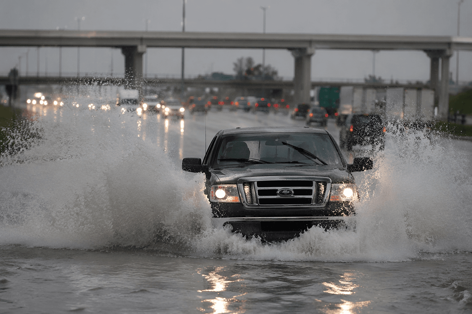
The threat arrived just after central Texas had already been hammered by flooding that forced rescue crews into the water. In McLennan County, emergency crews rescued people trapped by floodwater overnight into Monday, with Waco police handling 114 weather-related calls between 7 p.m. and midnight and Waco Fire carrying out at least 21 water rescues. On Interstate 35 southbound, multiple vehicles were stranded in rising water, a reminder of how quickly even short-lived downpours can shut down roads and expose weak points in local stormwater systems.
This article was produced by Prism’s automated news system from verified source data, official records, and press releases, then run through automated quality and moderation checks before publishing. The system is built and supervised by the people who set the standards it runs under. Read our full AI policy.
Know something we missed? Have a correction or additional information?
Submit a Tip