US scientists say El Niño has started, raising extreme weather fears
El Niño has developed in the tropical Pacific, and NOAA sees an 82% chance it will last into winter 2026-27. The southern U.S. faces wetter odds first.
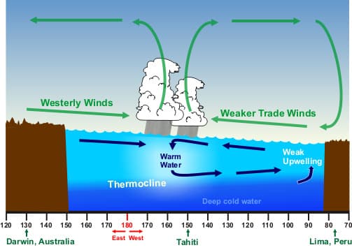
US scientists said El Niño has developed in the tropical Pacific, putting the country on alert for a weather pattern that can reshape rainfall, heat and storm risk across the United States. NOAA’s Climate Prediction Center said the event is likely to emerge soon, with an 82% chance in May-July 2026, and a 96% chance it will continue through December 2026-February 2027.
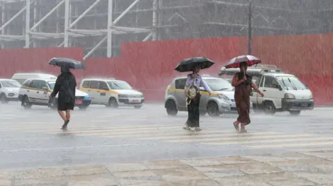
The practical effects usually show up most clearly in winter. NOAA says El Niño typically brings milder weather to the northern United States and wetter conditions across the southern United States, a shift that can matter for flooding, winter heating demand, reservoir levels and crop planning. NOAA also says ENSO, the broader climate cycle that includes El Niño and La Niña, can influence severe storms or mild weather, drought or flooding, food supplies, prices, forest fires and wider economic and political conditions.

That makes timing as important as the signal itself. NOAA’s earlier March 2026 outlook said El Niño was likely to emerge in June-August 2026, so the forecast has moved earlier as Pacific conditions changed. Forecasters say the key question now is whether the ocean and atmosphere stay tightly coupled through summer, since NOAA notes that the strongest El Niño events in the historical record are the ones that keep that coupling going.

For farmers, the immediate issue is not just whether rain increases, but where and when. A wetter southern U.S. can ease dryness in some areas while raising flood and planting risks in others, while a milder northern winter can change the odds for snowpack, freeze protection and energy demand. Utilities, insurers and local governments will be watching the same maps for clues about winter demand, coastal flooding, wildfire exposure and emergency planning.
The broader backdrop adds to the stakes. A multiyear La Niña lasted from late 2020 to early 2023, then came the strong El Niño of 2023-2024. NOAA and the World Meteorological Organization say ENSO-neutral conditions held for much of 2024 and 2025 before this turn toward El Niño, with the WMO warning on June 2, 2026 that developing conditions were likely to raise the risk of extreme weather in the months ahead. NOAA researchers also say high tide flooding has increased in many coastal communities over recent decades, even compared with the strong El Niños of 1982-1983 and 1997-1998, a reminder that rising seas can magnify the damage when the next winter pattern arrives.
This article was produced by Prism’s automated news system from verified source data, official records, and press releases, then run through automated quality and moderation checks before publishing. The system is built and supervised by the people who set the standards it runs under. Read our full AI policy.
Did this article answer your question?