Wenden Sinking More Than 2 Inches Annually Due to Groundwater Depletion
Wenden is sinking more than 2 inches a year as groundwater pumping dries wells and threatens buildings and infrastructure.
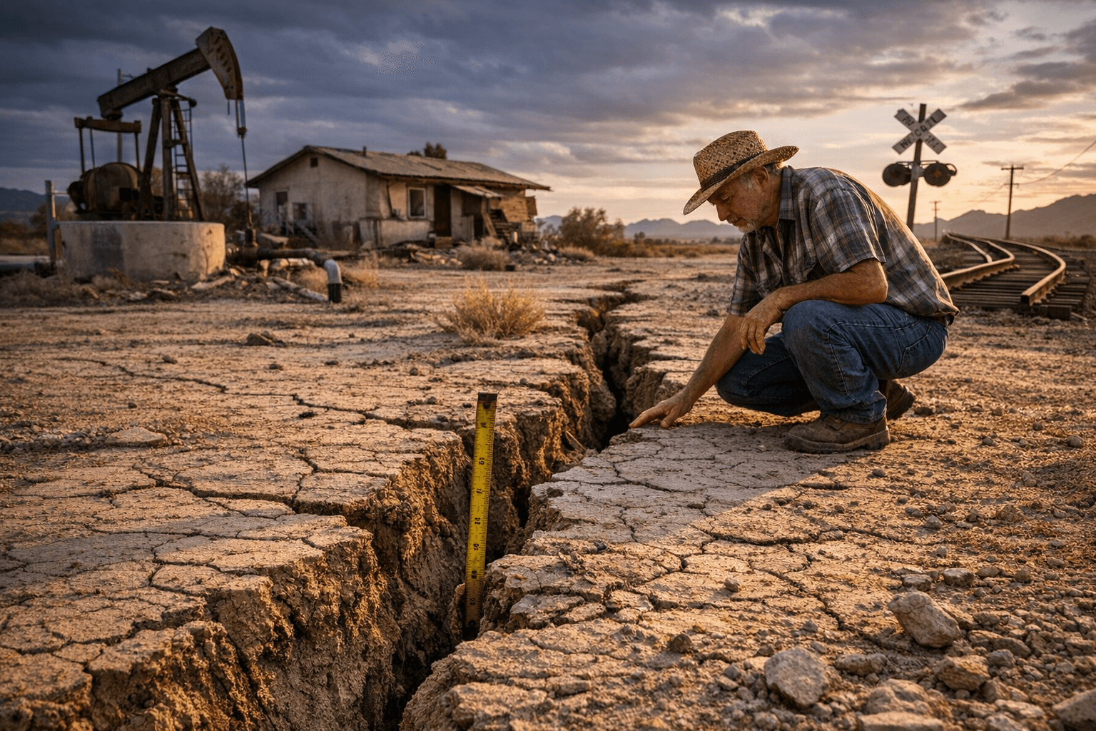
Ground levels in Wenden are dropping at rates that local residents say are already changing life and livelihoods in La Paz County. Resident and shop owner Devona Saiter told Governor Katie Hobbs that “over the last 15 years, we have dropped over 3.2 feet, and then at an average of like 2.2 inches per year,” and that her shop “has sunk several inches in different locations.” Saiter added, “There's gaps, there's cracks,” and local reporting says residents are paying up to $130,000 for new wells as older wells go dry.
Researchers from Arizona State University and other institutions have linked those local observations to broader groundwater depletion trends across the Colorado River Basin and Arizona. ASU professor Jay Famiglietti warned that “Much of that groundwater is irreplaceable.” The subsidence in Wenden is part of a patchwork of land-surface declines that scientists are mapping from satellites and field data, and the practical consequences are already visible in broken foundations, cracked pavement, and failing wells.
State and national studies show widely varying rates depending on geographic scale and measurement method. A satellite-based study led by Leonard Ohenhen at Columbia University's Lamont-Doherty Earth Observatory and published in Nature Cities reports that Phoenix is sinking by about 0.8 millimeters per year on average, with localized hotspots dropping as much as 2 centimeters per year. Ohenhen said, “In some places we have rates reaching up-to and more than 1 centimeter per year. In some parts of the city,” and warned that “It means that there is a cost to groundwater, or water usage, or resource extraction in most cities, including Phoenix, and that should be a warning concern.” That work estimates 1.4 million people in Phoenix are already impacted, with 113,000 buildings labeled medium to high risk and another 172 buildings seen as high risk.
In southeast Arizona, InSAR satellite measurements by Danielle Smilovsky at the Conrad Blucher Institute show even sharper local decline. Using interferometric synthetic aperture radar to measure surface height between 2017 and 2021, Smilovsky found some areas in the Willcox Basin sinking more than 6 inches (15 centimeters) per year, with parts of the basin dropping nearly 3 feet during that four-year span and up to 12 feet since the 1950s. InSAR detects minute changes by averaging repeated satellite distance measurements to the ground.
Arizona Geological Survey geologist Joseph Cook placed recent findings in historical perspective, saying, “You know in the teens up to 20 feet of subsidence since you know we started pumping water out is what Arizona experienced.” Cook cautioned that subsidence “can cause cracks in the ground, and damage infrastructure,” and that it “can cause areas that weren't prone to flooding to be prone to flooding, or, you know, redirect floodwaters into areas that didn't have that issue before.” ASU professor Kip Hodges added that small surface movements matter: “I think the biggest one to worry about is that when the ground surface moves up or down a millimeter or two, it doesn’t sound like much, but it could have an impact on the stability of structures that are built in that particular area.”
For La Paz County residents, the immediate impacts are tangible: higher costs to replace or deepen wells, visible building damage, and growing uncertainty about infrastructure and flood patterns. The scientific picture is clear that rates vary by place and by how they are measured, but the trend of groundwater-driven subsidence is ongoing. County and state planners, water managers, and property owners will need maps, monitoring and funding decisions to manage repairs and future development. For Wenden, the coming months will test how state and local agencies translate the satellite and field data into assistance for homeowners, updated well permits, and long-term water planning.
Know something we missed? Have a correction or additional information?
Submit a Tip