TrailPrint3D turns GPS hikes into personalized 3D printed terrain models
TrailPrint3D turns a GPX track into a keepsake terrain model, with local Blender processing, no accounts, and no tracking.
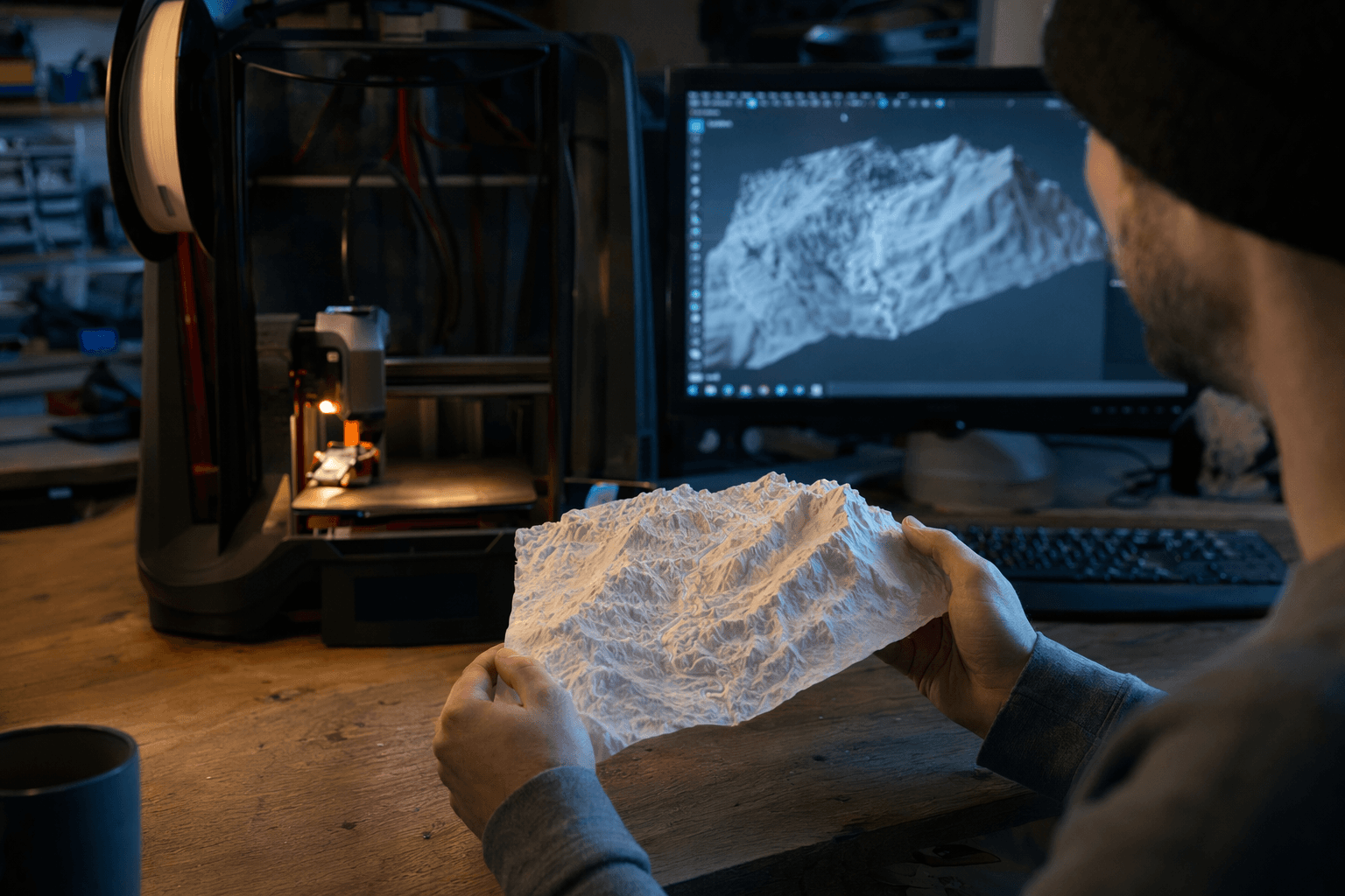
TrailPrint3D is built for the kind of print that gets kept, not tossed in a drawer. Instead of hunting for a generic topographic STL, it lets you feed in a hike, trail run, or bike ride and turn the actual route into a 3D printable terrain model. That makes the finished piece feel less like wall decor and more like a physical record of a specific day on the trail.
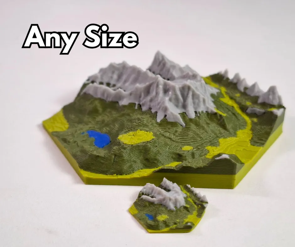
The workflow runs through Blender, where TrailPrint3D works as a free add-on. Users drop in a GPX file, the standard GPS exchange format for waypoints, routes, and tracks, then work inside Blender’s 3D Viewport sidebar. From there, the process is straightforward: set an export path, adjust the settings, and click Generate. The result is a mesh that can be shaped into square, circular, or hexagonal outlines, with frame options and single-color output for printers that are not set up for multicolor work.
The appeal is not just the route itself, but the privacy and control around it. TrailPrint3D says it has no accounts, no tracking, and does all processing locally on the user’s computer. That matters in a hobby where people are often handing over personal location data just to make a custom object. It also matters for ownership: TrailPrint3D’s FAQ says users can use it commercially and sell the prints they make, and Blender’s licensing model leaves creators free to use the work they produce with it.
There is a premium tier, and Fabbaloo noted the higher-end options included multi-GPX maps, specialty borders such as a jigsaw-style edge, and multi-tile terrain prints for larger or more detailed routes. Fabbaloo’s coverage on April 30, 2026 also pointed out that TrailPrint3D can generate meshes for arbitrary locations and automatically color features such as water, cities, and forests, which gives the model a finished look before it ever reaches the slicer.
TrailPrint3D is also arriving in a niche that has room to grow. It is already listed through its own site, MakerWorld, and Printables, and it fits neatly alongside other map-to-model tools aimed at people who want something more meaningful than a screenshot of a Strava activity. Strava itself supports GPX exports with GPS coordinates and timestamps, so the data is already sitting on a lot of phones and training accounts. TrailPrint3D turns that file into a souvenir that can sit on a desk, hang on a wall, or get handed to somebody who was there for the climb, the ride, or the race.
This article was produced by Prism’s automated news system from verified source data, official records, and press releases, then run through automated quality and moderation checks before publishing. The system is built and supervised by the people who set the standards it runs under. Read our full AI policy.
Did this article answer your question?