BLM seeks public input on San Rafael Swell OHV route changes
The BLM opened a June 8 comment window on San Rafael Swell and Desert routes that could shift hundreds of miles from closed to open or limited use.
The Bureau of Land Management opened a comment window that could move hundreds of miles of San Rafael Swell and San Rafael Desert routes out of the closed column, a change that could reshape how motorized trips thread through central Utah’s redrock country.
The review runs through June 8, 2026, at 11:59 p.m. Mountain Time and is tied to NEPA project DOI-BLM-UT-G020-2019-0019-EA. For the San Rafael Swell, the BLM said the travel management plan is meant to satisfy a 2017 Settlement Agreement that required a new plan, and any route decision has to line up with Federal Land Policy and Management Act rules and BLM OHV standards that require resource protection, safety, and fewer user conflicts.
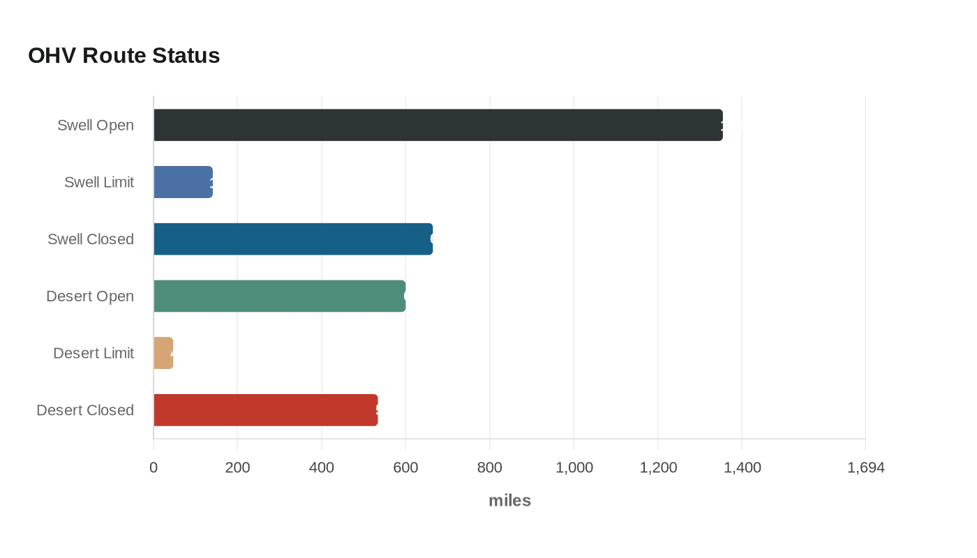
On the ground, the numbers matter. In the San Rafael Swell Travel Management Plan, the BLM says about 1,355 miles of routes are now open to OHV travel, about 141 miles are limited-use routes, and about 665 miles are closed. During the reassessment, the agency is considering opening or limiting about 226 miles. In the San Rafael Desert, the BLM says about 600 miles are open, 47 miles are limited, and 534 miles are closed, with roughly 20 miles under reconsideration. The Desert project page says the reconsideration covers specific routes totaling about 195 miles under a settlement agreement.
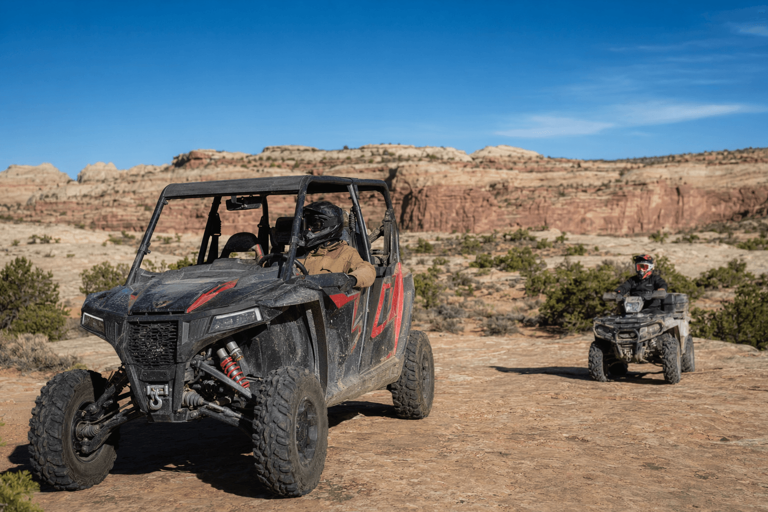
For riders who map trips around loop potential, connector roads, and access to trailheads, that is the part to watch. A route that stays open keeps a long loop viable; a route that flips from open to closed can force a bailout, shorten a day run, or push traffic onto a narrower set of legal roads. The BLM says current designations remain in effect while the process continues, so visitors do not need to assume on-the-ground access has changed yet.
The agency is directing comments through its online maps and project pages, preferably using the Participate Now option. Comments can also be delivered to the Price Field Office in Price, Utah. The BLM specifically asked commenters to include route numbers and Segment IDs when possible, which makes this look less like a general thumbs-up-or-down exercise and more like a line-by-line review of the network.
That focus fits the scale of the Swell plan. The BLM says the final 2024 plan covered more than 1.1 million acres in Emery County and about 44,000 acres in Sevier County, and it said it considered more than 6,000 public and stakeholder comments when it drew the motorized network. The broader BLM travel-management effort in Utah now spans 29 travel management areas and has been underway since at least 2008. Southern Utah Wilderness Alliance has already blasted the Swell and Desert plans as part of a court-supervised settlement, arguing the proposals would hit cultural sites, wildlife habitat, and non-motorized recreation. For anyone who rides the Swell, the real takeaway is simple: the map is still live, and the next version could change the shape of a weekend in the desert.
This article was produced by Prism’s automated news system from verified source data, official records, and press releases, then run through automated quality and moderation checks before publishing. The system is built and supervised by the people who set the standards it runs under. Read our full AI policy.
Did this article answer your question?

