Boggy Draw prescribed burn to close roads, send smoke over Four Corners communities
A 1,200-acre Boggy Draw burn closed part of the trail system through May 2 and may send smoke across Dolores, Cortez and Highway 491.
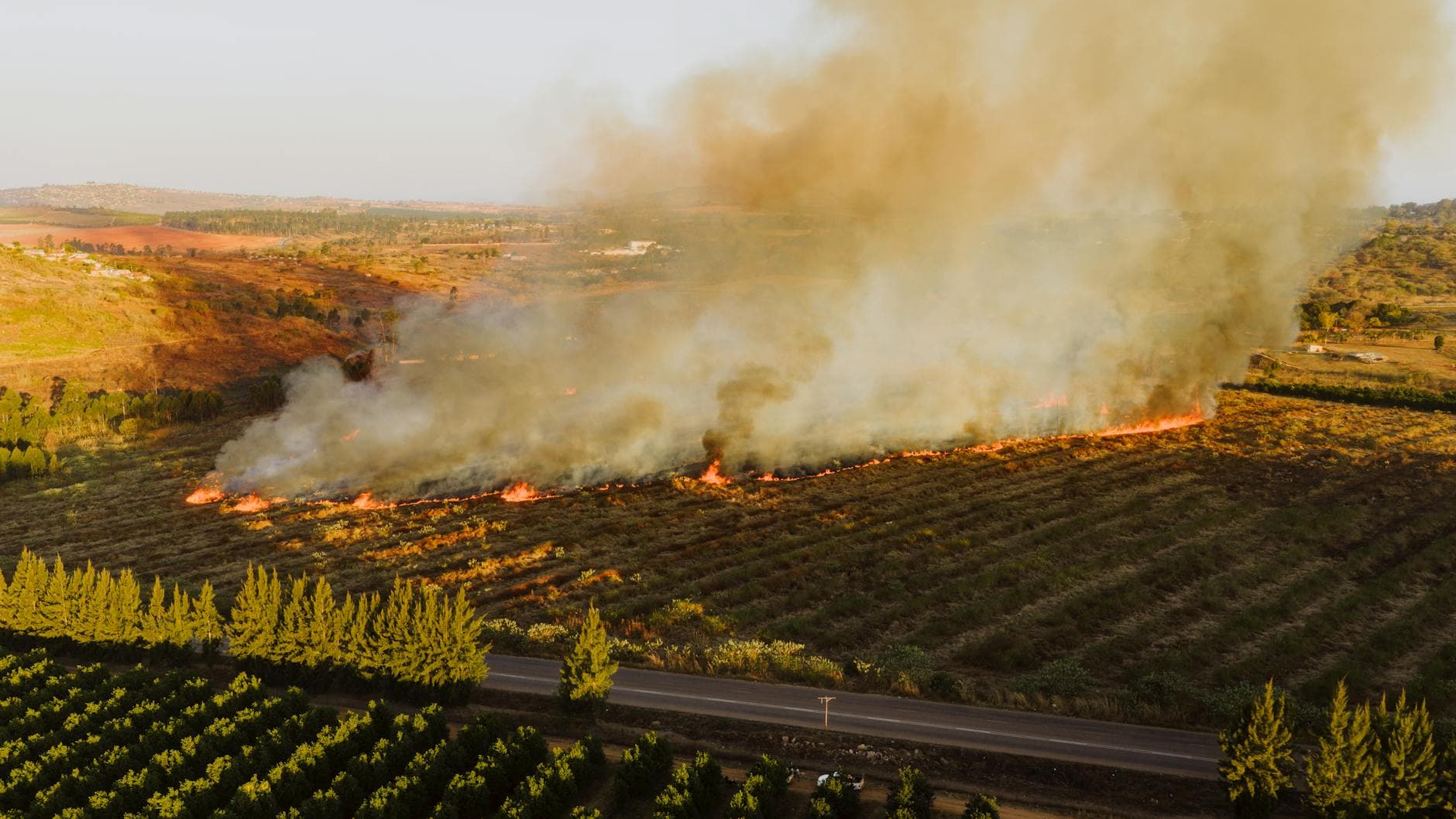
A prescribed burn in Boggy Draw pushed smoke over Four Corners communities and kept part of the trail system closed as crews worked a 1,200-acre patch northeast of Dolores.
The Boggy Draw fire area closure stayed in place through May 2, shutting a section of the Boggy Draw Trail System while the burn moved through the 4,107-acre project area along NFSR 526 and 527, about 4 to 8 miles northeast of Dolores in Montezuma County. For riders and hikers heading out from Dolores, the immediate effect was clear: access into the burn area was off-limits, and spring trip plans had to shift around a closure tied to one of the region’s most used trail networks.
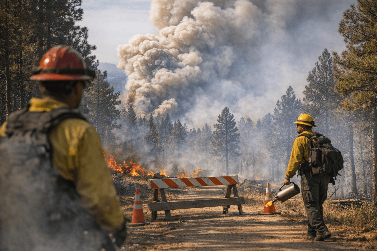
Smoke was visible in Mancos, Dolores, Dove Creek, Cortez and along Highway 491 between Dove Creek and Pleasant View, with the possibility that it could settle into the Dolores River Canyon or drift wherever winds carried it. The operation was not a small hand-lit burn. Crews used helicopter aerial ignition, and the Forest Service said smaller units were to be burned as weather and conditions allowed. In the Dolores Ranger District, prescribed burns can also use ground ignitions and, in some cases, drones.
The tradeoff is long-term risk reduction. The Forest Service says prescribed fire helps reduce overgrown vegetation and protect communities, infrastructure, natural resources and ponderosa pine ecosystems. In Boggy Draw, the work is intended to lower wildfire risk to adjacent private lands and the broader watershed, a goal tied to local partners including the Dolores Watershed Collaborative and the Mancos Conservation District. Lorena Williams, a Forest Service spokesperson, said crews size the burn around weather and the number of firefighters and contingency resources they can keep ready if another wildfire starts the same day.
Boggy Draw has been treated before, including a 518-acre prescribed fire in the past, and the broader planning area was described in 2021 as 4,331 planned acres. The current project shows how steadily the landscape has been managed, with crews balancing access, smoke and fire preparedness across a trail system that stretches more than 75 miles and draws beginner mountain bikers as well as hikers, hunters and other recreation users.
This article was produced by Prism’s automated news system from verified source data, official records, and press releases, then run through automated quality and moderation checks before publishing. The system is built and supervised by the people who set the standards it runs under. Read our full AI policy.
Did this article answer your question?

