Grand Canyon warns North Rim visitors of flash flood risk after fire
The North Rim is open again, but burned slopes now raise flash-flood and mudslide risks on summer monsoon days.
Visitors can still go to the North Rim, but the question this summer is no longer whether the rim is open. It is how quickly a storm on burned ground can turn a normal trip into a race for higher ground.
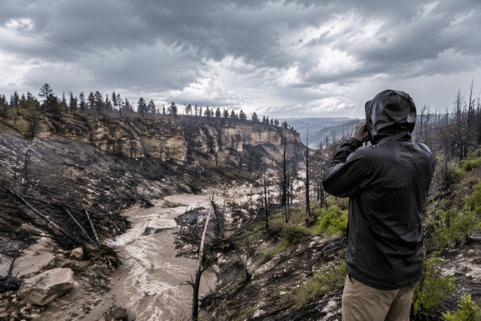
Grand Canyon National Park reopened the North Rim for the 2026 season on May 15, but officials are warning that last summer’s Dragon Bravo Fire changed the landscape in ways that matter once monsoon clouds build over the Kaibab Plateau. The fire, which ignited July 4, 2025, burned 149,399 acres total, including 71,129 acres of park-managed land, and left a mosaic of low- and moderate-severity burn scars across most of the affected area. In the developed North Rim, the Grand Canyon Lodge and numerous historic cabins were lost, and the park says those burned slopes can now shed water fast enough to trigger flash floods, debris flows, erosion, rock falls and falling trees.
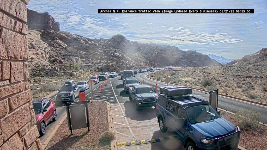
For trip planning, the biggest practical shift is that the North Rim is open, but it is not operating like a normal summer. The North Kaibab Trail reopened May 15 for foot traffic only, with stock use suspended for the season, and trail maintenance and rehabilitation will continue all summer. The park flagged a roughly two-mile stretch between Supai Tunnel and the North Kaibab trailhead as especially vulnerable. Cottonwood Campground reopened May 15, while the North Rim Campground is expected to reopen later in June if conditions allow. Overnight lodging inside the park will not be available in 2026.
Road access is better than the burned-out scenery might suggest. All paved North Rim roads reopened with the season, including Highway 67, Cape Royal Road and Point Imperial Road. Still, the vehicle limits matter: vehicles over 22 feet are not permitted on Cape Royal Road and Point Imperial Road, and parking at the North Kaibab Trailhead is restricted to vehicles under 22 feet. That makes backup plans worth building into any day-trip or hiking itinerary before you leave your hotel or campsite.
The park has also built a stronger warning system around the new hazard. The National Park Service and the U.S. Geological Survey expanded flash-flood monitoring in the Bright Angel Creek watershed with new stream and precipitation gauges, and the Grand Canyon River Alert system now sends critical weather and flash-flood messages directly to satellite texting devices such as Garmin and SPOT units. The system was developed with Coconino County Emergency Management and the National Weather Service, and the park says it is especially important in watersheds touched by the Dragon Bravo Fire, including Bright Angel Creek, Crystal Creek, Tuna Creek, House Rock Wash, Nankoweap Creek, Kwagunt Creek, Malgosa, Awatubi, 60-Mile and Clear Creek.

That timing lines up with northern Arizona’s monsoon season, which runs from June 15 through September 30 and can deliver 40% to 50% of the region’s annual precipitation. For North Rim visitors, that means the safe answer is still yes, you can go, but only if you treat every dark cloud, drainage and trail closure as part of the route plan. The North Rim is back, but the burned country beneath it now reacts to summer storms in a way that can change a trip in minutes.
This article was produced by Prism’s automated news system from verified source data, official records, and press releases, then run through automated quality and moderation checks before publishing. The system is built and supervised by the people who set the standards it runs under. Read our full AI policy.
Did this article answer your question?