Meshtastic range-test module turns field surveys into network maps
Stop guessing at Meshtastic coverage: the range-test module records what a fixed node and a moving node actually hear, then turns the walk into a map.
Measure before you buy the next radio
Meshtastic’s range-test module is the kind of tool that saves money before it spends it. Instead of arguing from anecdotes about whether a hill, a building, or a different antenna is killing your link, it lets you measure what two nodes actually do in the field. That matters in a project like Meshtastic, where inexpensive LoRa radios form a mesh that rebroadcasts packets so people at the edge of the network can still receive them.
The practical payoff is immediate: you can use real numbers to decide where a node belongs, whether a deployment needs a different role, and whether the problem is hardware or geography. For U.S. 915 MHz users, small hardware builders, and anyone trying to make a real off-grid setup behave predictably, range testing is the cleanest first step.
How the module works in the field
The module is built for a simple two-node test. One node stays fixed as the sender, while a second node moves through the area you want to survey as the receiver. The sender transmits sequential packets at a chosen interval, and the receiver records which packets arrive and where they were heard.
Meshtastic recommends 60 seconds for Long Slow and 30 seconds for Long Fast, which gives you a steady stream of samples without flooding the air. That is the real value of the tool: it turns a walk, drive, or site survey into a record of where packets are heard, not just whether a link exists at one lucky moment.
What the data turns into
The receiver can save the messages and GPS points into a CSV file named rangetest.csv. That file can then be imported into mapping tools such as Google Earth and Google Maps My Maps, which means the test is not just a log, it becomes a visual map of coverage.
On ESP32-based devices, the module can save results directly to flash, and the device stops writing if filesystem space falls below 50 KB. That makes it practical for longer field sessions, especially when you are collecting a lot of points and do not want to rely on a live connection the whole time. The result is a workflow that fits the way Meshtastic users actually work: out in the field, with a phone or handheld node, trying to understand terrain and placement in real time.
Do not let bad channel settings distort the map
Range testing only helps if the location data is trustworthy. Meshtastic’s channel configuration notes say that periodic broadcasts like position and telemetry ride over the primary, or default, channel, and if that channel is left unchanged, your location will be shared with all nodes in range that are also using it. The configuration tips also warn that Meshtastic now lets you control the precision of location data sent over a particular channel.
That detail matters more than it sounds like. If the default channel precision is too coarse, the points you collect will not reflect true accuracy, and the map will look cleaner than the network really is. When you are trying to determine whether a node belongs on one side of a ridge, a wall, or a tree line, precision is not a luxury. It is the difference between a useful field survey and a fuzzy guess.
Run it like an operator, not a tourist
The module is designed to help, but it also consumes on-air time, slows the mesh, and can spam the channel if you leave it running. Meshtastic warns users to turn it off when they are done, and the module also auto-disables after eight hours, which is a sensible backstop for anyone who forgets.
That caution fits the broader Meshtastic model. The network itself automatically creates a mesh to forward packets as needed, and it stores only a small amount of packets, around 30, in memory. If you are testing in a busy environment, discipline matters. A range survey should clarify your network, not become another source of congestion.
Where the module fits in the app ecosystem
Meshtastic says range-test support reaches across Android, Apple, CLI, and Web, so the workflow is not locked to one platform. The browser-based Web client makes it easy to work without a desktop install, while the Python CLI can show packets and serial debugging information straight from devices. That broad support is part of why the module feels like a baseline tool rather than a specialty add-on.
It also says something about the project’s maturity. Meshtastic currently supports over 100 devices, so a standardized range-test workflow gives people a common way to compare hardware, antennas, and deployment layouts across a large and varied ecosystem. When the same test can be run from a phone, a browser, or the command line, the numbers become easier to trust and compare.
Use the results to choose roles, not just hardware
Range data is most useful when it changes how you place nodes. Meshtastic’s configuration tips warn that using ROUTER or REPEATER unnecessarily can increase packet collisions and reduce effective range, so a good survey helps you decide whether a site really needs one of those roles or whether a lighter setup will work better. In practice, the map you build can tell you where a CLIENT, CLIENT_MUTE, CLIENT_BASE, ROUTER, or REPEATER belongs, instead of letting you guess.
That is the field-practice reminder hidden inside the module: test first, assign roles second, and only then buy the next piece of hardware. If the goal is to make a mesh behave in the real world, the range-test workflow is the simplest way to find out where the network actually lives.
The records show what is possible
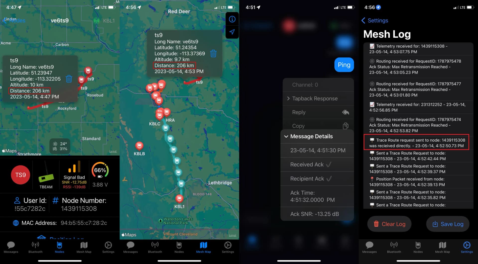
Meshtastic’s range-test records page includes a 331 km ground-to-ground record and a 206 km ground-to-air record. Those numbers are not the average outcome of an ordinary backyard network, but they show how seriously the project treats range as something measurable and repeatable.
That is why the module matters even when you are nowhere near a record attempt. It gives you a baseline before the terrain, the antenna, or the node role starts lying to you. In Meshtastic, the fastest way to stop guessing is still the oldest field move: put one node on the map, move the other one around, and let the packets tell the story.
This article was produced by Prism’s automated news system from verified source data, official records, and press releases, then run through automated quality and moderation checks before publishing. The system is built and supervised by the people who set the standards it runs under. Read our full AI policy.
Know something we missed? Have a correction or additional information?
Submit a Tip