Maine to Nova Scotia offers new sailors a first offshore passage
The Maine-to-Nova Scotia hop packs real offshore lessons into 225 miles of tide, fog and watchstanding, making it a smart first test before a longer crossing.

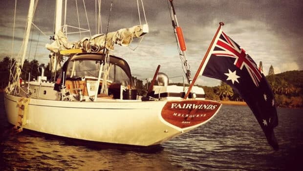
A first offshore run that still feels manageable
If you want a first offshore passage that teaches real seamanship without throwing you straight into blue-water sprawl, Maine to Nova Scotia is hard to beat. The route is only about 225 miles, but it forces you to live the offshore rhythm: watch changes, sleep scheduling, route planning, squall management, and the moment when the coast slips away and the trip stops feeling like a day sail.
Ben Eriksen Carey’s account centers that lesson on a practical run from Maine across the Gulf of Maine toward Cape Sable, then northeast along Nova Scotia toward Halifax. It is not “easy” in the casual sense. It is smart because it compresses the offshore syllabus into a distance that still fits a limited schedule, giving you enough repetition to see whether your crew actually functions as a passage-making team.
Why this water is such a good classroom
The Gulf of Maine spans about 36,000 square miles and is fed by 60 rivers, which tells you almost everything you need to know about its character: it is a big, busy, moving body of water, not a protected coastal pond. NOAA’s Gulf of Maine forecast systems and tide-current prediction tools are central here because the water itself is part of the navigation problem, not just the backdrop.
That matters when you are trying to judge readiness. A crew that has only done afternoon hops inside easy sight of land may think it is prepared, but offshore confidence only arrives when the boat, the weather picture, and the watch schedule all hold together at once. Carey’s route does that without demanding the scale of a full ocean crossing, which is exactly why it works as a proving ground.
The passage teaches the habits that keep offshore work calm
The specific scenes Carey describes are the kind that stick in your memory for a reason. A 0300 watch change is not romantic, but it is the moment when you learn whether your crew can hand off cleanly, whether people can sleep when they are off watch, and whether your plan still functions after fatigue starts to bite. He also writes about a reefed main and full jib in 15 knots of wind just forward of the beam, which is the kind of ordinary offshore setup that reveals whether the boat feels balanced or merely lucky.
That is the real value of the passage. By the time the land has receded and the crew realizes they can handle life beyond sight of shore, they have already practiced the small decisions that matter offshore: when to shorten sail, how to keep eyes on the horizon, how to keep the boat moving without turning the trip into a grind.
Cape Sable is where the lesson sharpens
Cape Sable is the extreme southwest corner of Nova Scotia and a turning point for vessels headed to the Bay of Fundy from the east. Cape Sable Island is also described locally as the most southerly point of Nova Scotia, and its Mi’kmaq name, Kespoogwitik, is commonly translated as “where the land ends.” That is not just a poetic label; it captures the psychological shift that makes this passage feel more offshore than its mileage suggests.
The hazard history there is serious, too. The first Cape Sable Light was completed in November 1861 after a 1860 wreck on the Cape Sable ledges that took more than 200 lives, and a steam-whistle fog alarm was added in 1876. The current lighthouse, built in 1923 and 1924, rises 101 feet and is the tallest lighthouse in Nova Scotia. When you are planning your own first passage, that history is a reminder that the route earns respect even when the shoreline appears friendly.
Tides, fog, and bailout thinking are the real planning test
The Bay of Fundy is the wildcard that turns this from a scenic cruise into a proper offshore exercise. Nova Scotia tourism calls it home to the world’s highest tides, and describes roughly 100 billion tonnes of water rushing in at high tide, while another tourism page says about 160 billion tonnes move in and out over one tide cycle. That scale changes how you think about departure times, current calculations, and whether your approach to Cape Sable or the Nova Scotia coast is actually going to work the way you imagined.
Fog can be just as demanding. Lunenburg fog is part of the local sailing reality, and the mix of open-ocean swell, tidal set, and low visibility is exactly why this route is so useful. You still have enough nearby land on parts of the passage to stay oriented and confident, but you cannot treat the coast as a crutch; the weather and swell originate from the Atlantic, and the sea state can remind you of that long before the skyline does.
What to have sorted before you cast off
If your goal is a first serious offshore hop, the preparation should be aimed at systems, not just shopping. Your reefing gear has to work smoothly, your sail plan should make sense in the 15-knot range Carey describes, and your crew needs a watch schedule that survives the overnight stretch. Just as important, you need to understand the current and tide picture well enough to see why NOAA’s Gulf of Maine tools matter so much here.
A useful way to think about readiness is this:
- Can your crew stand a clean 0300 watch change without confusion?
- Can people sleep, eat, and rejoin the rhythm without falling apart?
- Can you shorten sail and hold a balanced helm when the wind comes up?
- Can you use tide and current timing to help rather than fight the passage?
If those answers are shaky, the problem is not the route. The route is simply showing you the gaps before a longer passage does.
Why the run still feels like an adventure, not a homework assignment
The Maine-to-Nova Scotia corridor has cruising precedent, including a 2013 Cruising World account that used Cape Sable in a similar passage narrative. That history matters because it shows this is not a stunt or a fad route; it is a well-known proving ground with enough complexity to teach, but enough structure to finish without becoming a gamble. Carey notes that if you budget extra days, the return can become even more instructive by heading farther south into open water before turning back toward land on a better angle.
That flexibility is part of the appeal. You can make the trip as compact or as expansive as your crew, schedule, and confidence allow, which means the passage can scale with your ambitions instead of exceeding them. For a boat that is ready to leave the day-sailing comfort zone, Maine to Nova Scotia offers exactly the right kind of pressure: enough to expose weak habits, not so much that the lesson becomes a rescue problem. For a crew looking to know whether it is truly ready, that is the rare offshore test that pays off before you ever point at something bigger.
This article was produced by Prism’s automated news system from verified source data, official records, and press releases, then run through automated quality and moderation checks before publishing. The system is built and supervised by the people who set the standards it runs under. Read our full AI policy.
Did this article answer your question?