Norway and Sweden’s skerry coast rewards careful pilotage and route choice
Norway and Sweden’s skerry coast pays off when you sail it like a pilotage puzzle: read the wind, back up the chart with your eyes, and keep ferry lanes in view.
Norway’s official mapping agency counts 239,057 islands and 81,192 islets and skerries along the coast. Sailing Norway and Sweden’s skerry coast is not about finding the beauty. It is deciding, channel by channel, which line is safest when the water is crowded with rocks, ferries, islands, and anchorages that all look inviting until you are committed to them. The boat moves best when route choice, lookout discipline, and quick deck handling all work together.
Treat the coastline like a system, not a backdrop
Norway’s edge is famously fragmented. Norway has one of the longest coastlines in the world and more fjords than any other place on the planet, while Sweden’s coast includes several archipelagos and thousands of islands stretching from the far north to the west coast. Every leg is shaped by land, water, and the gaps between them.
The most useful cruising mindset here is to break the coast into small decisions. Where is the next protected stop, which side of the island chain gives the cleanest water, and where does the shore open enough that you are not boxed in by rock and traffic?
Plan the route around wind and geography
The route framing that works best here is clockwise, starting in the Oslofjord area and working west along Norway before turning south along the Swedish coast. Prevailing south-westerly winds make that shape logical, because the boat can use weather and geography together instead of fighting both at once. On a coast built for island hopping, a good day is often not about miles sailed but about arriving in the next sheltered pocket with energy left to keep going.
In practice, that means treating weather windows as route windows. A narrow fair-weather spell may be enough for a short skerry hop, but a longer run across exposed water is a different proposition, especially when your options for shelter are close together and tempting. The right habit is to map the next two or three exits before leaving each anchorage so you are never relying on the current leg alone.
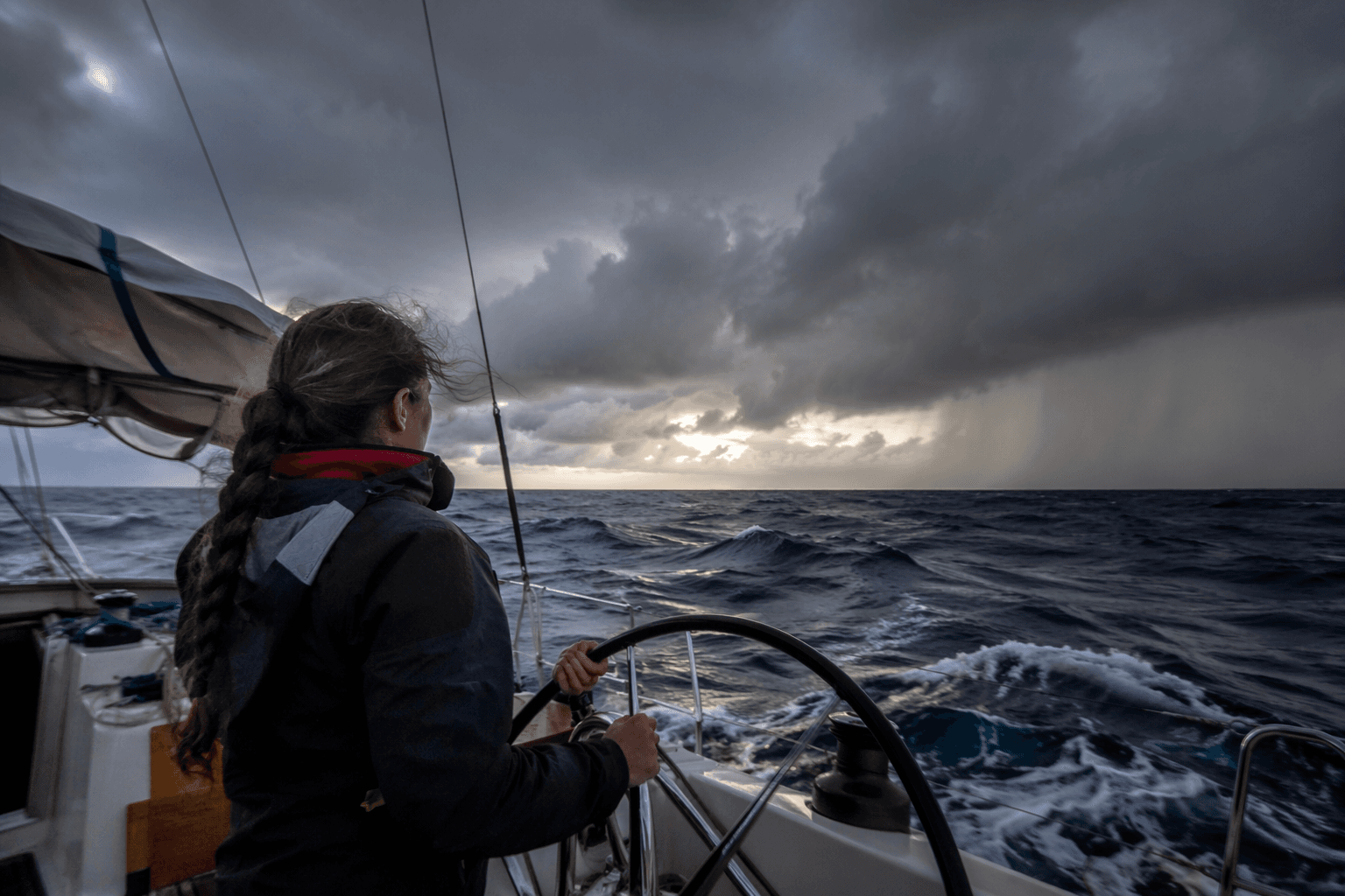
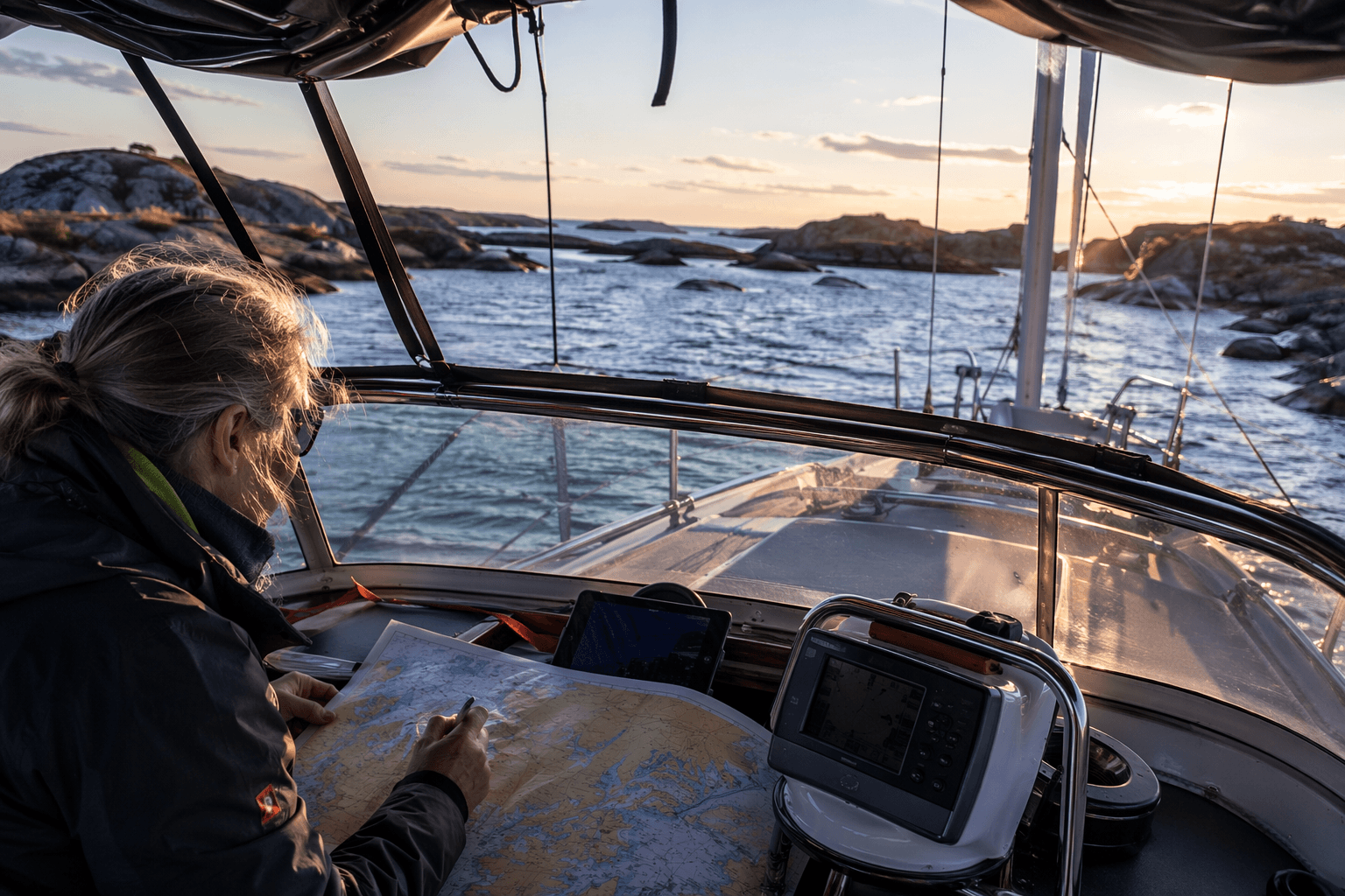
Use charts, but keep your eyes outside
Dense skerry sailing punishes lazy chartwork. Large-scale charts matter because the coastline is full of small cuts, rocks, and landforms that can collapse into clutter on a small-scale overview, and because the final approach to an anchorage often depends on details that only show up when you zoom in.
That is where eyeball navigation becomes more than a backup. In skerry country, the visible line between safe water and trouble can be surprisingly thin, so the crew needs to cross-check chart symbols with what the hull, bow, and shoreline are actually doing. If the land starts closing in faster than expected, or the water changes color in a way that suggests shallows or rock, the wise move is to slow down before the chart says you have to.
Set the boat up for frequent transitions
This coast rewards crews who are ready to change modes quickly, from anchoring to mooring to moving on again. A boat set up for bluewater monotony can feel awkward here, because the work is in repeated short hops and quick stops, not long hours on the same course. Keep the anchor ready, the lines easy to reach, the fenders accessible, and the cockpit clear enough that you can shift from passage mode to stop mode without a deck full of loose gear.
Anchor choice matters because the stops are part of the route, not just a place to sleep. In close-quarters cruising, the best anchorage is often the one that gives you room to settle without drifting into rock, plus a clear exit if the weather shifts or the next day’s leg needs an early start. That is especially true when the coast offers so many sheltered pockets that the temptation is to stop anywhere pretty, instead of stopping where the geometry actually works.
Respect ferry traffic and local authority systems
The inner Oslofjord makes the traffic picture especially vivid. Island-hopping links connect Aker Brygge with Hovedøya, Lindøya, Nakholmen, Bleikøya, Gressholmen, and Langøyene, which shows how active and accessible these waters are even close to Oslo. In a place like that, ferry wakes and working traffic are not background noise. They shape your timing, your crossing decisions, and the places where a quiet anchorage stays quiet.
Official navigation systems matter too. The Norwegian Coastal Administration’s pilot service is meant to safeguard traffic at sea and protect the environment by ensuring navigators in Norwegian waters are adequately qualified. In Sweden, the Swedish Maritime Administration provides modern and safe shipping routes, with 24-hour service and coordination on reporting and safety. For DIY cruisers, local traffic patterns and official route systems are part of the seamanship.
The Oslofjord shows why this coast demands restraint
The Oslofjord is about 120 kilometers long, or roughly 60 miles, and is one of Norway’s most densely populated coastal areas. Scenic water, towns, seaports, and working traffic all share the same cruising ground.
In January 2025, Norway’s Environment Directorate said a government action plan launched in 2021 aims to make Oslofjorden “clean, rich and accessible for all” by 2026, and a 2025 summary report describes a severe ecological crisis driven by eutrophication, overfishing, and pollution from land-based activities.
This article was produced by Prism’s automated news system from verified source data, official records, and press releases, then run through automated quality and moderation checks before publishing. The system is built and supervised by the people who set the standards it runs under. Read our full AI policy.
Did this article answer your question?