Orca adds live weather, tides and currents to its navigation charts
Orca now layers animated weather, tides and currents onto charts, letting skippers scrub forward through changing conditions while planning Solent departures and Channel crossings.

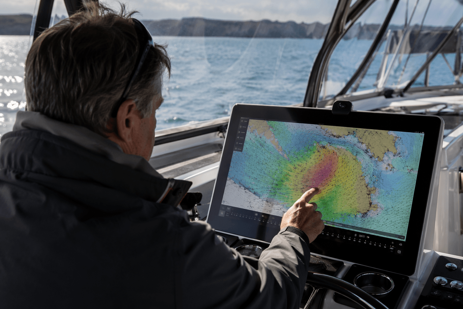
Orca has pushed its charts closer to the cockpit decision-maker sailors have long wanted. The latest update overlays animated weather, tides and currents directly on the navigation screen, so a skipper can see rain, wind, waves, tidal height and flow in the same place instead of hopping between tools before casting off.
The practical change is not just visual polish. Orca’s weather view lets users scrub horizontally through forecast graphs and watch conditions change over time along a route, which makes timing a departure feel less like guesswork and more like a tide-and-weather exercise. Orca says those forecasts are deeply built into the product, with real-time alerts if conditions change while underway.
Behind the scenes, the app draws from hand-picked regional sources. For U.K. waters, Orca uses MetOffice data, and its routing and weather visualization rely on models including ECMWF global forecasts, UKV 2km from UKMO for the North Sea and English Channel, and the AMM15 operational model from UKMO for the North Sea, English Channel, German Bight, Skagerak and Kattegat. The Tides tab shows forecast tide height for the selected location and time, using nearby tide stations on the map and a tide-height chart rather than the animated heatmap used for rain, wind, waves and currents.
That matters when the margin for error is thin. A Solent departure, a run through the Needles on the ebb, or a crossing to the Channel ports all get harder when wind, current and tide are planned in separate places. Orca’s animated layers make it easier to see whether a harbour approach will be made with water under the keel or against a foul stream, but they do not replace paper planning, local knowledge or the kind of conservative seamanship that still keeps small-crew cruising honest.
The rollout also sits inside Orca’s tiered subscription model. Free and Plus plans include five-day weather forecasts, while Smart Navigation extends that to 10 days and adds manual weather model selection. Orca says the wider navigation system works across phone, tablet, watch and laptop, with Orca Core and Orca Display extending the setup onboard.

Orca’s own origin story explains why the company keeps leaning this way. The three co-founders, Amir, Jorge and Kristian, started the company in 2020 after noticing that more than 70% of boaters with dedicated marine navigation systems still felt they needed mobile apps while planning and navigating at sea. Orca’s March 21, 2025 update added a brand-new weather forecast experience for route planning, and its April 10, 2026 spring update brought in an aim line, Doppler radar support and a smoother routing flow. This latest weather layer is the next step in that same direction, bringing the tide, the wind and the route onto one chart, where a sailor can make the call before the harbour wall or the Needles make it for them.
This article was produced by Prism’s automated news system from verified source data, official records, and press releases, then run through automated quality and moderation checks before publishing. The system is built and supervised by the people who set the standards it runs under. Read our full AI policy.
Did this article answer your question?