Historic snow drought slashes Colorado River flows, threatening Southwest adventure travel
Eight states hit record-low snowpack, and Lake Powell is only 24% full. That means earlier boating cutbacks, hotter trips, and tighter access from Bullfrog to Lees Ferry.
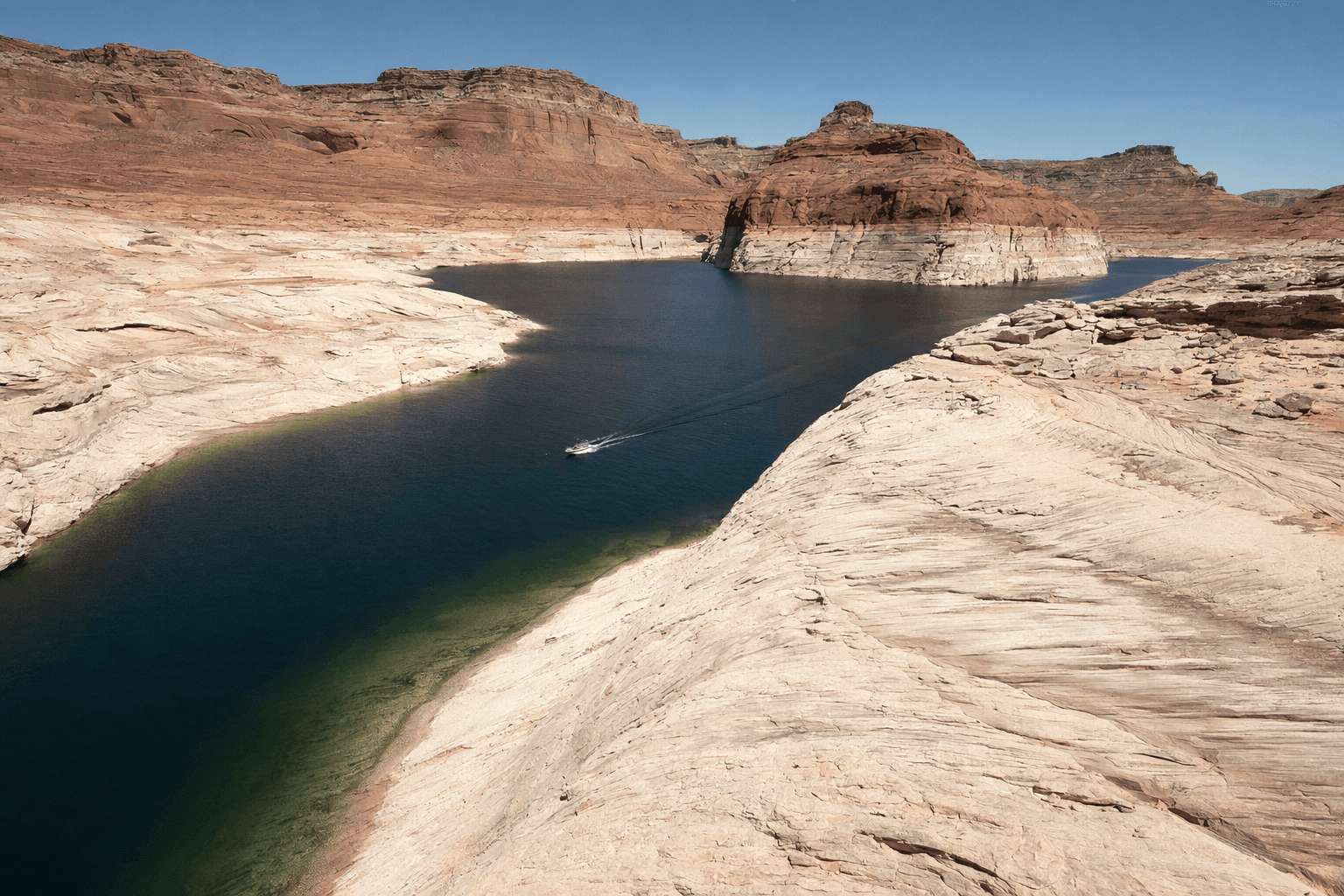
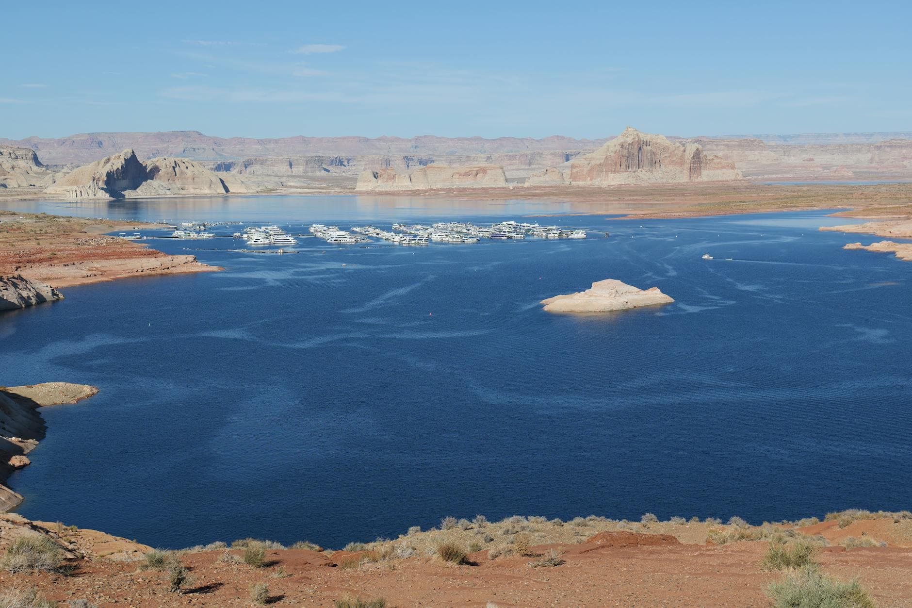
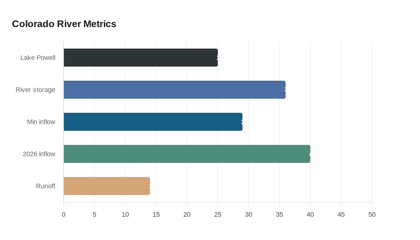
The snow drought that left 155 million Americans in drought areas is already changing the way people will travel through the Southwest this season. Lake Powell sat at roughly one-quarter full in mid-April, Colorado River system storage was down to about 36% of capacity, and the U.S. Bureau of Reclamation warned that low inflows could push Glen Canyon Dam below its 3,490-foot minimum power pool by August without major intervention.
For boaters and rafters, the sharpest impact is access. Reclamation said Lake Powell’s water-year minimum probable inflow was just 2.78 million acre-feet, or 29% of the historical average, and its most probable April forecast still only put 2026 inflow at 3.87 million acre-feet, or 40% of average. April-to-July runoff was projected at just 900,000 acre-feet, 14% of normal. Glen Canyon National Recreation Area told visitors on April 17 to plan ahead because low water was creating rapidly changing conditions, and separate park notices this year showed temporary marina adjustments around Bullfrog and Halls Crossing to keep uplake access open as long as possible.
That matters across the whole Lake Powell corridor, from Lees Ferry in Arizona to the Orange Cliffs of southern Utah. A drop below 3,490 feet would force releases through outlet works only, which would complicate downstream operations and add another layer of uncertainty for river trips, reservoir boating, and the businesses that depend on both. Reclamation’s emergency drought plan now calls for sending 660,000 to 1 million acre-feet from Flaming Gorge Reservoir into Lake Powell from April 2026 through April 2027, while also cutting annual releases from Lake Powell to Lake Mead by 1.48 million acre-feet through September.
The weather story behind all this is brutal. The National Integrated Drought Information System said Arizona, Colorado, Idaho, Nevada, New Mexico, Oregon, Utah, and Wyoming all set new record-low April 1 snow-water-equivalent values, while California logged its second-lowest April 1 value on record. The Colorado River Basin also had its warmest March on record, at 13.7 degrees Fahrenheit above normal, and peak snowpack across the West arrived 21 to 34 days earlier than usual. The Natural Resources Conservation Service said 65% of 1,575 April 1 measurements set or tied record lows, with 80% below the 20th percentile.
For desert parks, the practical advice is simple: build trips around heat, not hope. Shoulder seasons are getting hotter earlier, fire restrictions can tighten fast, and low-water conditions can alter launch timing, beach camping, and route planning at the exact moment visitor demand ramps up. Reclamation said the changes could also deepen the strain on Hoover Dam, with up to an additional 40% reduction in hydropower capacity possible as early as fall 2026. In the Southwest, that is no longer a background drought story. It is a trip-planning problem.
This article was produced by Prism’s automated news system from verified source data, official records, and press releases, then run through automated quality and moderation checks before publishing. The system is built and supervised by the people who set the standards it runs under. Read our full AI policy.
Did this article answer your question?


