New Mauna Loa research could improve lava flow forecasts on Big Island
New satellite and machine-learning tools could give Big Island officials earlier warning when Mauna Loa lava turns toward highways, observatory roads and freight corridors.
A new set of tools built from the 2022 Mauna Loa eruption could help county officials decide sooner when to close roads, protect observatory access and warn communities before lava starts cutting across Big Island routes.
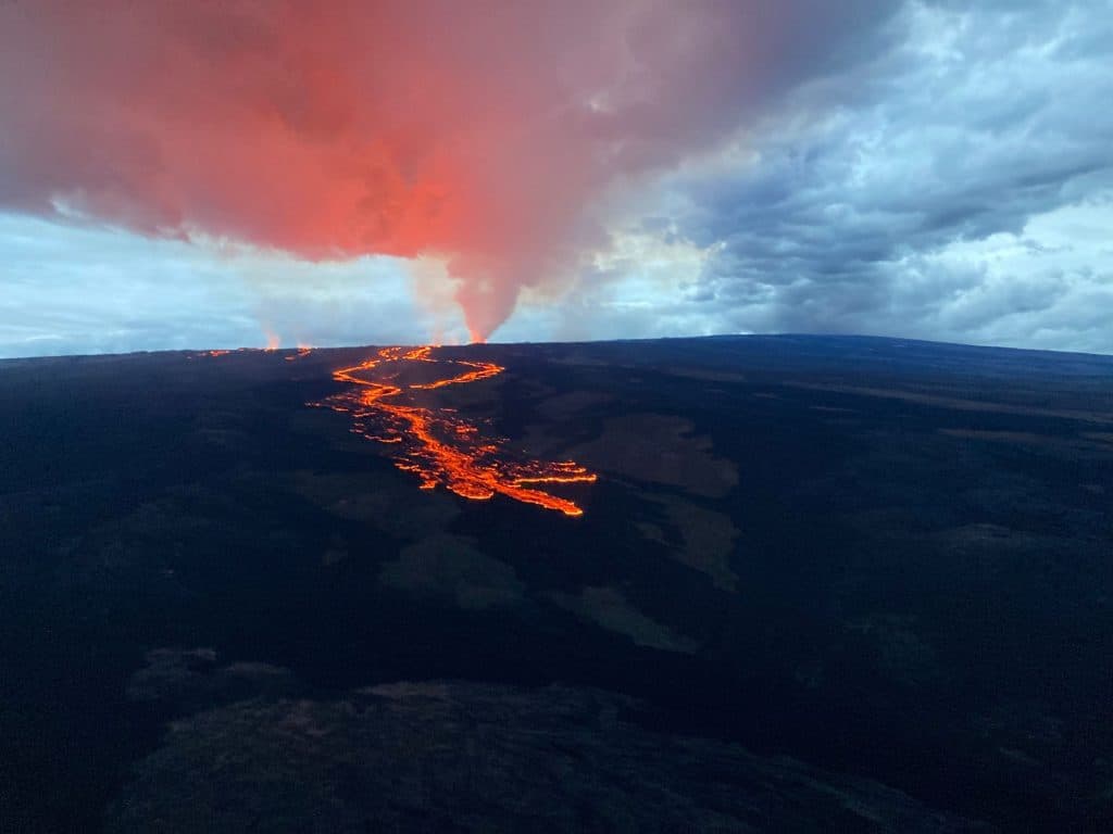
The payoff is practical. During the 2022 eruption, lava crossed the Mauna Loa Weather Observatory Road at about 8 p.m. on November 28 and came within 1.7 miles of Daniel K. Inouye Highway, the island’s key east-west link. The flow ran about 12 miles before the eruption ended on December 10, turning what should have been a routine hazard watch into a 13-day crisis for drivers, workers and emergency managers.
That eruption mattered because Mauna Loa had not erupted since 1984, its longest quiet period in recorded history. Unrest began in mid-September 2022, when earthquakes below the summit climbed from roughly 10 to 20 a day to 40 to 50 a day, while GPS and tilt instruments showed the volcano inflating. When lava finally broke out around 11:30 p.m. HST on November 27 in Mokuāweoweo, Hawaiian Volcano Observatory staff, Hawaii County Civil Defense Agency, Hawaii Emergency Management Agency and Hawaii Volcanoes National Park all had to move quickly as roads and access points came under threat.
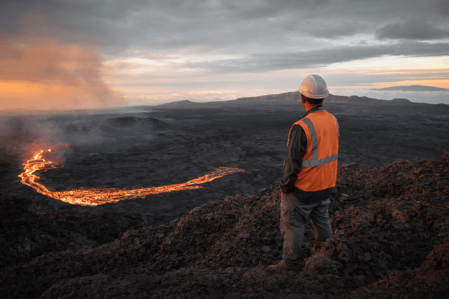
The new research focuses on how to do that better next time. Research assistant professor Ian Flynn used public satellite imagery together with private commercial satellite data to track the flow and measure how its thickness and direction changed over time. His team also used machine-learning methods that picked up a thermal increase about a month before the eruption, a possible early signal that could strengthen future forecasts.
For Big Island officials, that is where the real change lies. Better modeling could translate into earlier warnings, smarter road-closure decisions and stronger protection for the Mauna Loa Observatory Road, Mauna Loa Road and Daniel K. Inouye Highway. During the eruption, Hawaii County later said its response cost nearly $400,000, much of it tied to overtime, security and traffic hazard mitigation along the highway and Old Saddle Road, while Hilo also received support from a Hawaii Emergency Management Agency team.
The eruption showed how quickly lava can turn into an economic and public-safety problem on an island with only a few critical routes. The new work does not solve eruption prediction, but it gives scientists a better way to model lava flow thickness and movement before access routes, freight traffic and nearby communities are cut off.
This article was produced by Prism’s automated news system from verified source data, official records, and press releases, then run through automated quality and moderation checks before publishing. The system is built and supervised by the people who set the standards it runs under. Read our full AI policy.
Did this article answer your question?