NPS Seeks Public Input on 95-Acre South Kona Shoreline Management Plan
Canoe sheds, salt ponds, and a fishing village untouched for decades: NPS is now planning what happens to 95 acres of South Kona coastline, with a public meeting set for April 18.
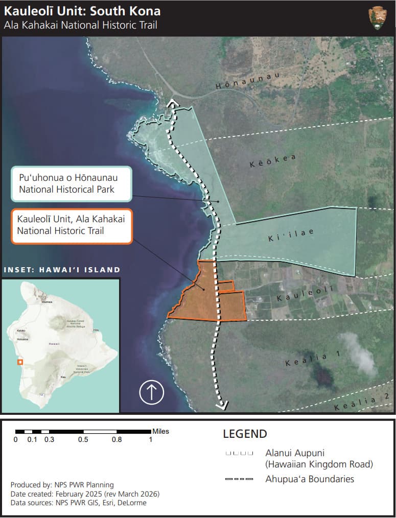
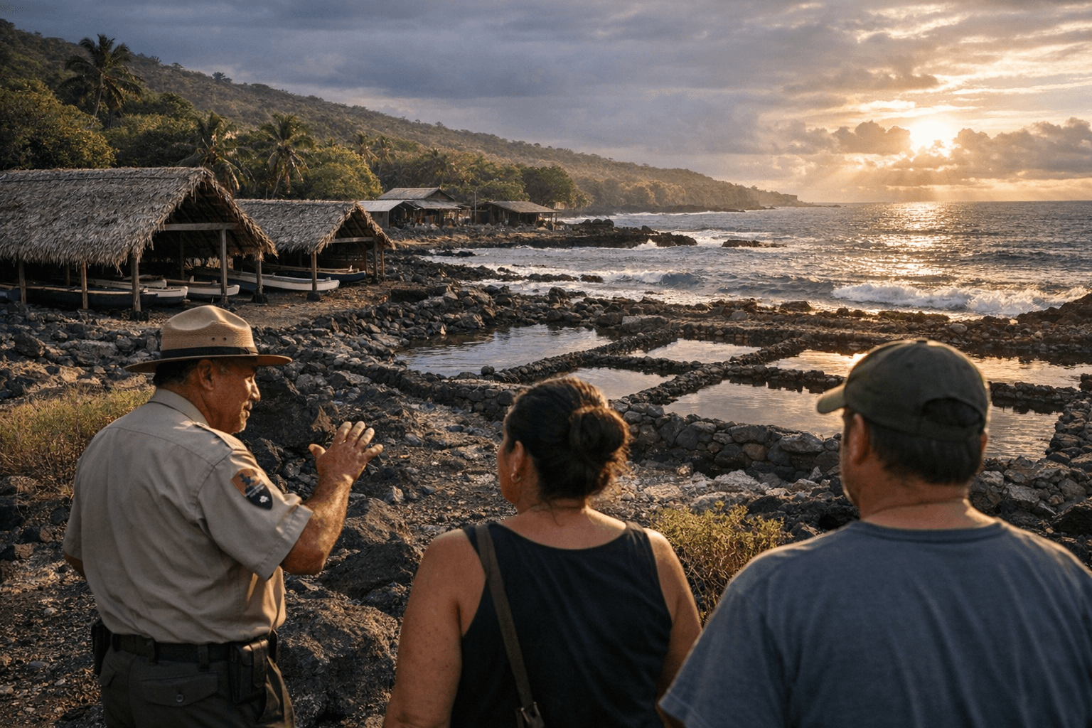
For the first time in living memory, a formally marked public walking path could wind through the remains of Kauleolī, a South Kona fishing village where ancient canoe sheds, salt-making ponds, and drystack stone house foundations still mark 95 acres of coastline just south of Puʻuhonua o Hōnaunau. The National Park Service is drafting a long-term management plan for the parcel and is asking residents, fishermen, Native Hawaiian cultural practitioners, and community groups to help write it before a binding framework is set.
The Ala Kahakai National Historic Trail program acquired Kauleolī in two rounds: 63 acres in 2016 and an additional 32 acres in 2021. Federal requirements now obligate NPS to develop a formal management plan before establishing uses, and the agency circulated preliminary ideas in a late-March newsletter. The most consequential option on the table is a designated interior coastal trail following an ancient path through the village, with ATV access limited strictly to emergency evacuations, maintenance, and transporting elders to community events. Supporting that trail, the agency is considering minimal infrastructure: drinking water, a small traditional-thatched shelter, and a restroom near the alanui aupuni. A day-use halau positioned close to the coast, designed for community gatherings and cultural interpretation, is also listed among early concepts.
What is not on the list is large-scale tourism infrastructure. The NPS framing throughout its planning materials emphasizes day use, cultural practice, and ecological restoration, an approach that diverges sharply from how much of Hawaii Island's more commercially accessible coastline has developed over the past two decades. Native plant restoration and hands-on stewardship projects with community groups round out the preliminary vision.
"Kauleolī is a place with deep history and meaning for many families in South Kona," Superintendent Aric Arakaki said in a news release. "We hope this planning process will bring people together to share their knowledge, perspectives, and ideas for how this special place should be cared for into the future."
The management plan will ultimately govern entry points, trail routing through the ancient village, any parking or access roads, and how the site's archaeological features are protected from foot traffic and coastal erosion. For fishermen who have long worked that stretch of shore and for Native Hawaiian practitioners whose ties to the land predate NPS ownership by centuries, the early planning stages are the critical window to shape those decisions before alternatives are locked in.
NPS will hold a public meeting on April 18, 2026, from 2 p.m. to 5 p.m. at the Amy B.H. Greenwell Ethnobotanical Garden in Captain Cook. The open-house format allows attendees to review preliminary materials, ask questions of Ala Kahakai trail staff, and leave written feedback directly. The agency is seeking specific input on where public access should be concentrated, how the coastal trail should be routed, what parking and facility scale is appropriate, and how cultural and natural resources should be shielded from both visitor impact and erosion.
Those who cannot attend in person can send written comments to the Ala Kahakai National Historic Trail office at 73-4786 Kanalani Street, Suite 14, in Kailua-Kona. Submission instructions and planning documents are also being posted to the Ala Kahakai National Historic Trail website as the process advances. Responses gathered now will determine the full range of management alternatives the NPS puts before the public before any final decision is made.
This article was produced by Prism’s automated news system from verified source data, official records, and press releases, then run through automated quality and moderation checks before publishing. The system is built and supervised by the people who set the standards it runs under. Read our full AI policy.
Did this article answer your question?