Ferris Fire nears Dolores River Canyon, triggers Zone 8 SET status
Zone 8 in Dolores County went to SET as the Ferris Fire pushed toward the Dolores River Canyon and climbed to 25,814 acres with no containment.
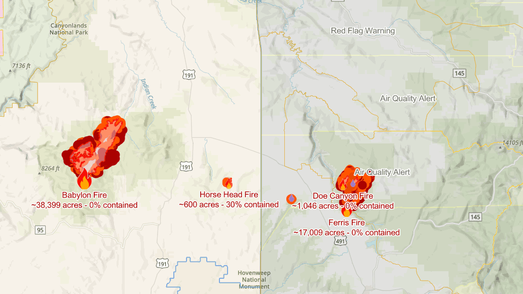
Zone 8 in Dolores County was placed under SET status as the Ferris Fire moved toward the Dolores River Canyon and grew to 25,814 acres, forcing residents from Road 15 south to Road P and north to Road H.6 to get ready to leave if conditions worsened. The county’s warning step meant go-kits needed to be loaded, vehicles parked facing out, pets and livestock prepared, evacuation routes reviewed, and official alerts watched closely.
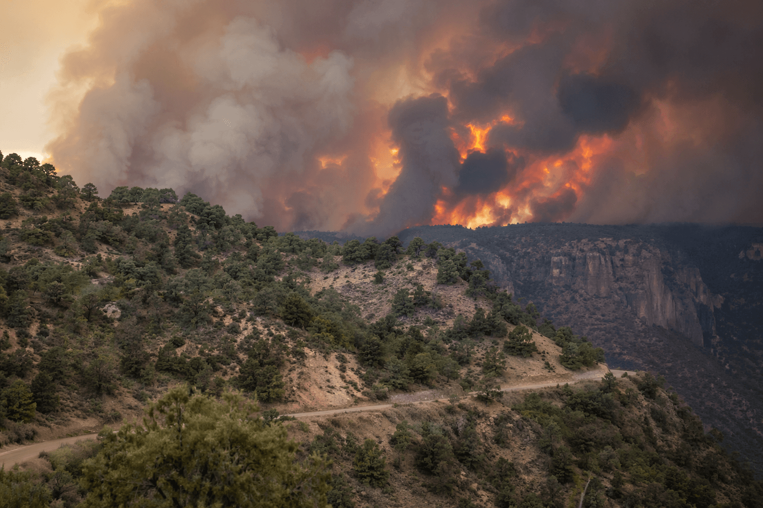
By June 30, the fire was at 19,613 acres with 0% containment. By July 1, the blaze had gained more than 6,000 acres in a single day’s update and was still burning without containment as it backed down Doe Canyon and moved toward the Dolores River Canyon. Crews were building containment line on the northeast edge near private lands and improving lines on the southwest corner, while managers kept firefighters out of the steep canyon itself because of dangerous terrain and the need to protect structures and the Benchmark Lookout area.
The fire began with lightning on June 27 on the Dolores Ranger District of the San Juan National Forest and was being managed by San Juan Team 8, a local Type 3 incident management team. More than 280 people were assigned to the fire by July 1, up from 251 the day before. Helicopters dropped 50,000 gallons of water over the fire area, but increasing winds threatened air operations as Red Flag conditions brought ridge-top gusts of 45 to 50 mph and dry fuels kept the fire active at night.
Dolores County evacuated Glade Ranch residents and later expanded notices to nearby private landholdings, while Montezuma County ordered evacuations for private lands along the lower Dolores River corridor from McPhee Dam to Bradfield Bridge. The closure order, which placed the fire about 30 miles northwest of Dolores and 10 miles east of Cahone, shut access to lands, roads, and trails in the fire area, including Bradfield Bridge campground and upriver campgrounds to the base of McPhee Dam. Violations could be prosecuted as a Class B misdemeanor.
This article was produced by Prism’s automated news system from verified source data, official records, and press releases, then run through automated quality and moderation checks before publishing. The system is built and supervised by the people who set the standards it runs under. Read our full AI policy.
Did this article answer your question?


