Public meetings in Rico, Dolores will shape wildfire readiness plan
Rico and Dolores residents will weigh in on wildfire readiness before next fire season, with meetings May 27 and 28 setting priorities for roads, homes and mitigation funding.
Residents in Rico and Dolores will have a direct hand in shaping where the Upper Dolores watershed’s wildfire readiness plan puts its next dollar and its next shovel, from evacuation routes to fuels reduction near homes and access to mitigation funding before the next fire season.
The Dolores Watersheds Collaborative is leading the Upper Dolores Watershed Wildfire Ready Action Plan with partnering agencies through the Colorado Water Conservation Board’s Wildfire Ready Watersheds program. The effort, underway for more than a year, is designed to map where post-fire flooding, erosion and sedimentation are most likely to hit before a wildfire starts, so local officials can move faster when the smoke clears.
The first public meetings are set for 5:30 to 7:30 p.m. May 27 at Rico Town Hall and 5:30 to 7:30 p.m. May 28 at the Dolores Community Center. DWC says both meetings will cover the same information, so residents only need to attend one. A half-day workshop is scheduled for Aug. 1 at the Dolores Community Center, a final review session is planned for Sept. 9 in Dolores, and a Towaoc meeting is being discussed for August.
For Rico and Dolores residents, the questions that matter are practical: which roads must stay open in a fire, which drainages are most likely to wash out after a burn, and which neighborhoods, mesas and creek corridors should get the earliest mitigation work. State mapping cited in the planning effort points to the most at-risk areas in northeastern Montezuma County, especially along Colorado Highway 145, including Stoner Mesa and Haycamp Mesa.
The collaborative says the plan is meant to improve community disaster readiness and ecological resilience in the upper Dolores River watershed. The group has operated since 2015 and was formerly known as the Dolores Watershed Resilient Forest Collaborative. Its broader coalition includes the Dolores Water Conservancy District, Montezuma County, Dolores County and the City of Cortez, with earlier LOR Foundation support helping pay for experts to run stakeholder meetings and develop pre-wildfire planning. A separate $30,000 local water project funded in 2024 was also tied to the collaborative’s wildfire planning work.
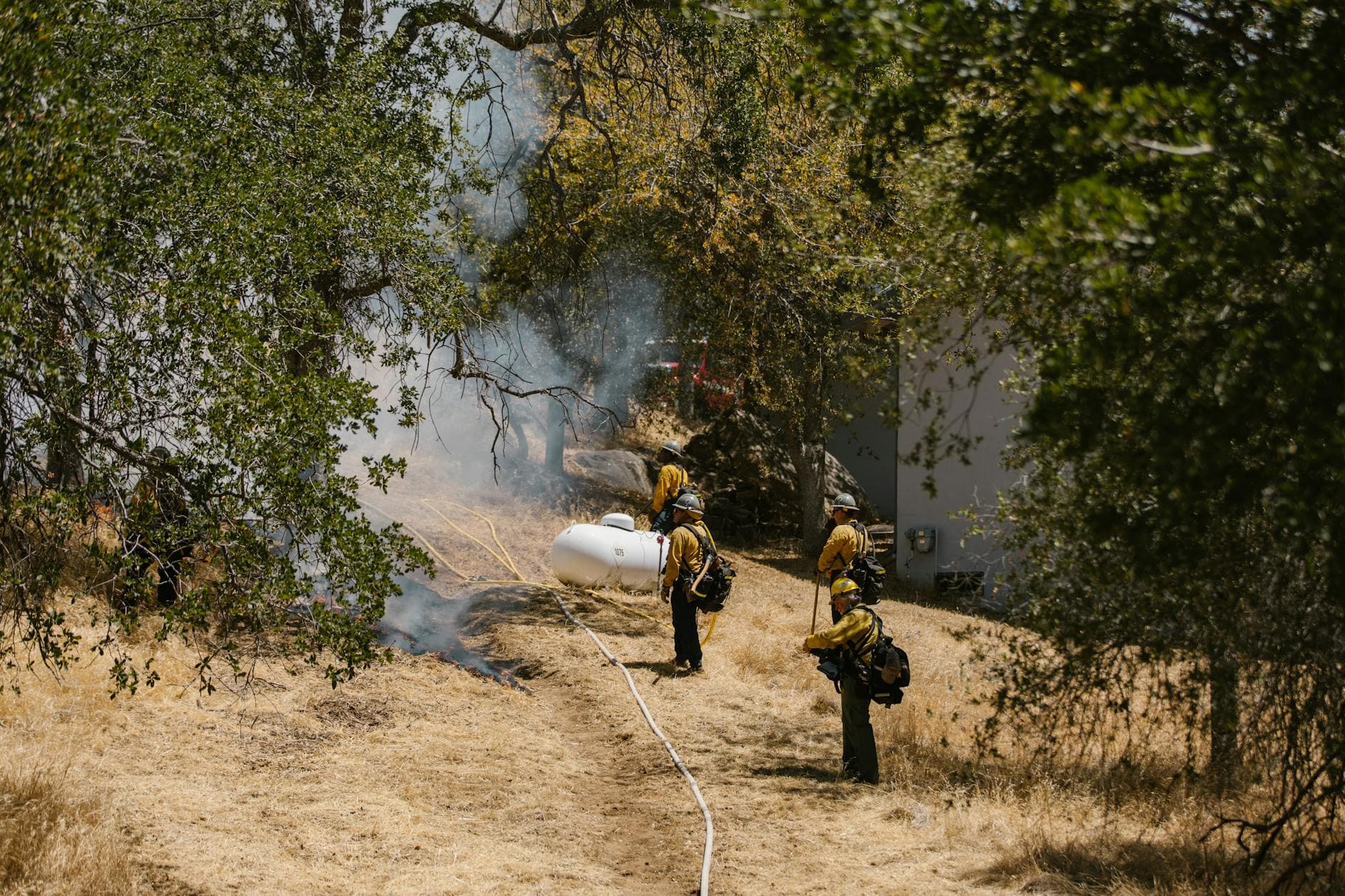
The state program behind the effort was launched under Senate Bill 21-240 and is being used across Colorado to get communities ready for post-fire impacts before the first ignition. Cameron Peak remains the cautionary example, showing how fast flooding after a fire can damage roads, homes and other infrastructure. For Dolores County, the timeline now runs through September, and the decisions made in Rico, Dolores and possibly Towaoc will shape what preparedness looks like when fire season returns.
Know something we missed? Have a correction or additional information?
Submit a Tip