Douglas County's Santa Fe Trail heritage offers year-round driving tour
Baldwin City, Vinland and Palmyra make Douglas County's Santa Fe Trail a low-cost driving route with trail ruts, marker #8 and places to eat and shop.
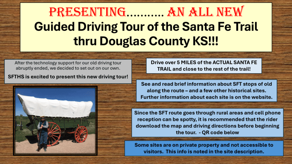
Santa Fe Trail Marker #8 stands in Baldwin City’s Trail Park, and prairie ruts still show east of town along U.S. Highway 56. A self-guided loop here can be low-cost, flexible and open all year, with enough local stops to keep you in town for lunch, shopping and a second look.
Why this stretch of the trail still reads clearly
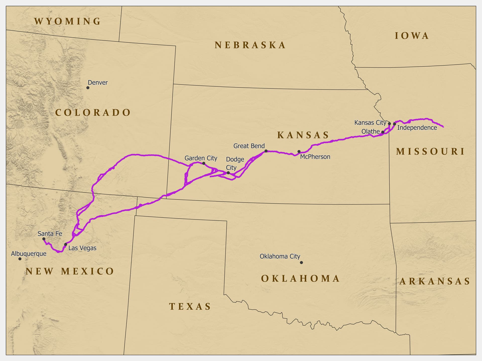
The Santa Fe Trail opened in the early 1820s and stayed in regular operation until the 1870s. GeoSpectra traces U.S. Highway 56 along much of the original route from Kansas City, Missouri, to Santa Fe, New Mexico, a distance of more than 750 miles. In Douglas County, that broad national corridor narrows into specific places you can still visit without a guide.
The Santa Fe Trail Historical Society of Douglas County Kansas has been promoting, protecting and preserving history in the Baldwin and Vinland areas and along the trail since 1967. The Douglas County Community Foundation lists the organization as a tax-exempt group created that year, focused on southern Douglas County, primarily Baldwin and Vinland, with preservation work extending into Palmyra, Willow Springs and Marion townships. Its site is already set up like a route planner, with pages for places to visit, places open by event or appointment, Baldwin and local-area history, people and groups, buildings, and current projects.
Start in Baldwin City, where the trail meets downtown
The most recognizable stop in town is Santa Fe Trail Marker #8 in Trail Park, a small park created in 1907 to showcase the eighth of 96 markers placed by Kansas chapters of the Daughters of the American Revolution. Clio dates the marker’s installation to Oct. 11, 1907, on land donated to the city.
Give this first stop at least 30 to 45 minutes so you can read the marker, orient yourself and walk the area before heading deeper into the county. Then use downtown Baldwin City for the part of the trip that turns heritage tourism into local spending. The Santa Fe Trail Historical Society’s building history pages identify 711 High Street, now Baldwin City Creative Arts, as a building that has also housed Hobbs Mercantile Company, Morgan-Gardner Mercantile Company, M-M Mercantile Company, The Baldwin Department Store, Downs’ Hardware, C.E. Francis Salvage Store, Robinson Hardware, Brecheisen’s Hardware and Baldwin Academy of Dance and Voice.
For food and quick shopping, Baldwin City gives you several practical stops within a short drive of the trail sites:
- Wooden Spoke Rest & Sports Saloon, 309 Ames St.
- Homestead Kitchen & Bakery, with online ordering for Baldwin City pickup.
- Hickory Creek Bbque, 711 High St.
- Vintage Flea, 721 8th St., for antiques and small purchases.
- Baldwin City Market, for groceries, picnic supplies or a road-trip stock-up.
If you want one place to organize those errands, the Baldwin City Chamber directory is built around local businesses and services.
Drive east to the trail ruts
From Baldwin City, head about three miles east of town on U.S. Highway 56 to the Ivan Boyd Prairie Preserve. GeoSpectra places the historical trail site there, next to the highway; the ruts appear as swales with distinctive vegetation and wet spots.
The preserve lets you connect the historical marker in town to the actual corridor travelers used, and the highway alignment helps explain how old movement patterns still frame present-day driving in Douglas County. Leave time to look slowly, because the visual cues here are subtle and easy to miss from a fast pass.
Vinland and Palmyra add the settlement story
Vinland is the other place name the historical society keeps returning to. Its preservation work centers on Baldwin and Vinland, and its site includes material on local-area history and buildings that keep the trail story tied to the people who lived along it. The society also highlights a walking-trail project in progress.
One Vinland site worth folding into a loop is the Vinland Grange Hall, which the society’s site identifies as the Vinland Grange #163, organized in 1873. If you want a green-space or nursery stop while you are in the corridor, Vinland Valley Nursery at 1606 N 600 Rd in Baldwin City gives the route a practical break for plants, gifts or a longer browse.
Palmyra adds another layer. The old community grew along the Santa Fe Trail in the 1850s, and a well there supplied water for trail travelers, livestock and residents.
How to use the society’s resources before you go
The Santa Fe Trail Historical Society’s own structure makes the trip easy to plan. Its pages for places to visit and places open by event or appointment point to a route with both regular access and special-access sites, while the current-projects section shows that new interpretation can still appear along the way. Watkins Museum social-post text credits the society with maintaining six historical sites in the Baldwin area and seven American Revolution granite markers along the Santa Fe Trail.
A practical way to do the trip is to begin in Baldwin City, stop for lunch or coffee downtown, spend time at the Trail Park marker, continue to the prairie ruts east of town, and then finish in Vinland or Palmyra. That sequence keeps driving time short and leaves room for local spending.
This article was produced by Prism’s automated news system from verified source data, official records, and press releases, then run through automated quality and moderation checks before publishing. The system is built and supervised by the people who set the standards it runs under. Read our full AI policy.
Did this article answer your question?