Big Hatchet Mountains offer Hidalgo County a rugged wilderness escape
The Big Hatchets give Hidalgo County a rare mix of sheer cliffs, bighorn sheep, and CDT access. The catch is a long, dry approach that demands real planning.
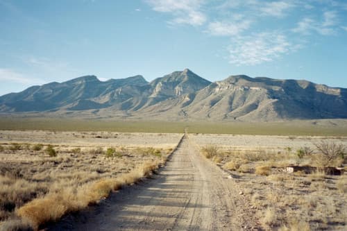
The Big Hatchet Mountains rise from Hidalgo County's bootheel as a severe, beautiful wall of limestone and faulted rock. The range is an isolated block-fault uplift with tall stratified cliffs, massive limestone faces, and a vegetation ladder from desert grasses and shrubs below to piñon, juniper, mountain mahogany, and oak above.
Hidalgo County has 4,894 residents spread across 3,445.63 square miles, about 1.4 people per square mile. Lordsburg is the county seat, and Animas, Cotton City, Rodeo, and Virden are the other main towns. Formed from Grant County in 1919, the county is expansive and sparsely populated.
Why the Big Hatchets are a county landmark
The Big Hatchet Mountains Wilderness Study Area covers 49,151 acres in the extreme southwestern corner of New Mexico. Wilderness study areas were identified under Section 603 of the Federal Land Policy and Management Act of 1976, so this is federal public land managed within a review framework rather than a formally designated wilderness.
The BLM keeps the Big Hatchets under a wilderness-study framework because the country still holds the rugged character Congress told the agency to inventory and review in 1976.
Getting there from Lordsburg and the CDT
For hikers coming from Lordsburg, the Continental Divide Trail Coalition's route to the CDT's southern terminus starts by taking Interstate 10 east to Exit 49, then NM 146 south to Hachita, east on NM 9, and south on NM 81 before turning onto graded dirt roads that continue around the base of the Big Hatchets. All roads beyond that point are dirt, so a full tank, a downloaded map, and a clear plan are part of the trip, not optional extras.
Lordsburg remains the county's easiest staging point. El Paso is about 2.5 hours away via I-10, the Grant County Airport is about an hour away, and Lordsburg has both an Amtrak station and a Greyhound stop.

If you are headed farther south toward the Crazy Cook monument, access rules now matter as much as mileage. The southernmost 1.1 miles of the CDT require a free NDA pass, the shuttle can take riders with the right pass or escort directly to the monument, and the road remains open for now even as construction brings the risk of closures and heavier traffic on Commodore Road.
What you can realistically see
Desert bighorn sheep and significant bat colonies live in the Big Hatchets, and the steep cliffs provide nesting habitat for golden eagles, kestrels, and other raptors. On the county scale, Hidalgo also sees mountain lions, bobcats, javelina, coyotes, and a wide mix of birds and reptiles, so a careful scan of ledges and ridgelines often pays off more than a long bushwhack.
The county's sky island terrain helps explain that diversity. Its southern mountain ranges rise into cooler, wetter elevations that support different plants than the valleys below, and the Big Hatchets fit that pattern with their sharp change from desert scrub to higher-elevation woodland.
A geology lesson written in cliffs
The Big Hatchets are a visible record of repeated tectonic change. Geologic work on the Little and Big Hatchet mountains describes the Hidalgo uplift as bounded by bivergent reverse faults created when a Jurassic to Early Cretaceous graben was inverted, while another study places Paleogene volcanic rocks under normal fault control between about 34 and 27 million years ago. In plain English, the range is a stack of old structural episodes that left the cliffs and ridges seen today.
New Mexico Geological Society literature describes fault blocks and elongate grabens in the broader Big Hatchet area.
How to plan a safe day in the desert
The BLM's hiking guidance is blunt: bring plenty of water, respect wildlife, stay on established paths, and expect extreme heat in summer along with lightning and flash-flooding. Stay out of washes when storms threaten and keep pets under control around rattlesnakes, bees, coyotes, mountain lions, and other wildlife.
In desert country, the National Park Service recommends about one gallon of water per person per day. That advice fits the Big Hatchets, where remoteness, heat, and rough ground can turn a short outing into a much longer one if you underpack or start late.
Because the mountains sit in a sparsely populated county where the nearest towns are small and services thin, tell someone your plan before you leave and carry a map that works without a signal. BLM georeferenced PDF maps are designed for GPS-enabled phones and remote trips with no cell coverage.
If you are combining the mountains with the CDT southern terminus, check the current permit and shuttle rules before you set out. The shuttle is still operating, the monument remains accessible through a permit process, and the road to the terminus is public but subject to change as construction moves forward.
Why locals and thru-hikers keep coming back
The Big Hatchets sit inside a wider Hidalgo County identity that mixes borderland travel, ranch country, and long-distance trail use. The Continental Divide Trail Coalition describes Hidalgo County as the home of the CDT's southernmost trailhead and says the county includes 82 of the trail's most rustic miles. Lordsburg is the town nearly every thru-hiker visits twice.
The Continental Divide Trail itself was established by Congress in 1978 and stretches 3,100 miles from Mexico to Canada across five states. In Hidalgo County, that national route intersects with a county of five small towns, 86 miles of Mexico border, and mountain country.
This article was produced by Prism’s automated news system from verified source data, official records, and press releases, then run through automated quality and moderation checks before publishing. The system is built and supervised by the people who set the standards it runs under. Read our full AI policy.
Did this article answer your question?