Hidalgo County archaeological sites reveal a connected Pueblo settlement pattern
The Animas Valley’s Pueblo sites form a linked settlement network, with room counts and ceramics showing how southern Hidalgo County was built, occupied, and connected.
The National Register’s Animas phase sites in southern Hidalgo County, New Mexico, link 25 Pueblo sites into one connected landscape. Room counts, adobe architecture, and ceramics show a community pattern stretching across centuries. Clanton Draw, Box Canyon, and Pendleton Ruin are the clearest markers of that story.
A connected settlement landscape
The National Register documentation dates the Animas phase, a Pueblo occupation in southern Hidalgo County, to about A.D. 1200 to 1350. The sites sit in the middle of a long period of Pueblo development, when communities were building, adapting, and moving within the broader borderlands of the Southwest and northwest Mexico. Later scholarship places Pendleton Ruin in an even wider A.D. 1150 to 1450 window, pushing the site into a longer arc of settlement change rather than a single short occupation.
The National Register treated these places as a regional pattern rather than isolated landmarks. The multiple-property documentation form ties them together, and southern Hidalgo County emerges as a landscape of related communities whose meaning comes from comparison with one another.
The sites that anchor the pattern
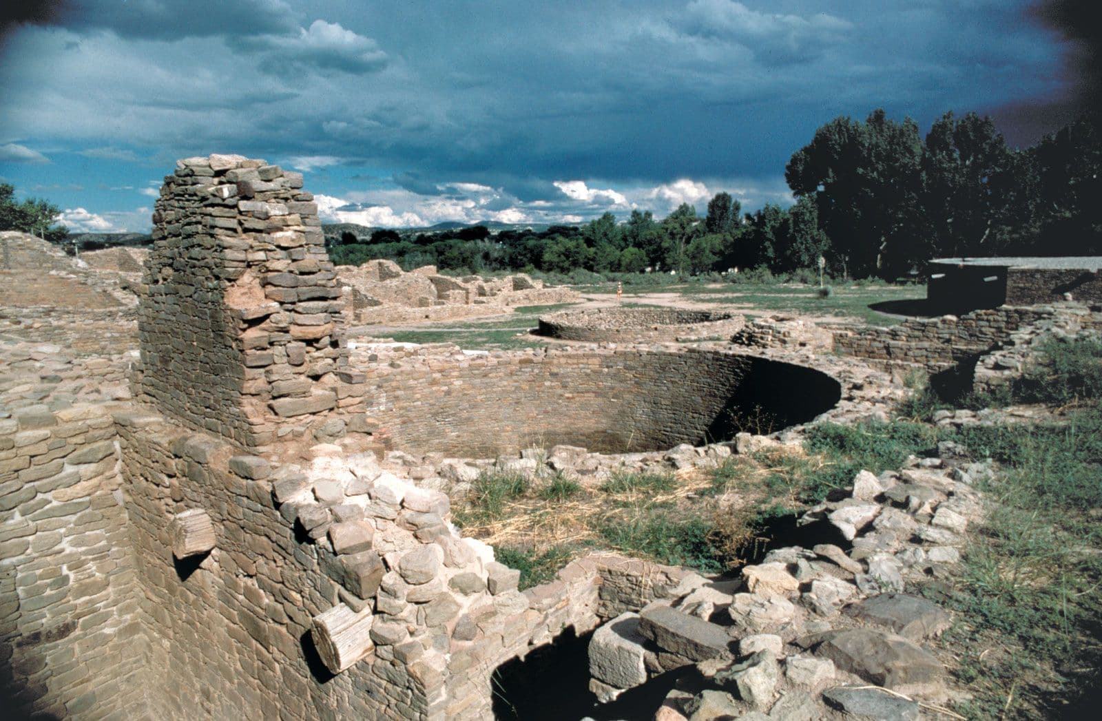
Clanton Draw, Box Canyon, and Pendleton Ruin most clearly carry the Animas phase into the public record. The National Register documentation records excavation of 11 rooms at Clanton Draw and 57 rooms at Box Canyon, numbers that give shape to communities large enough to reveal layout, household organization, and building practice. The same records show the architecture and ceramics at those sites were very similar to Pendleton, the key clue that they belonged to a shared cultural pattern.
Later scholarship identifies Pendleton Ruin as an adobe pueblo of approximately 125 rooms. Alfred V. Kidder, C. Burton Cosgrove, and Harriet S. Cosgrove excavated it in 1933, and its size makes it one of the strongest reference points for understanding settlement in the southern bootheel. Pendleton, Clanton Draw, and Box Canyon were all listed in the National Register in 1993 as part of the Animas Phase Sites in Hidalgo County multiple-property listing, formally connecting them in preservation records as well as in archaeology.
The most important details are concrete:
- Room counts help show scale and organization.
- Adobe architecture shows how communities built in the Animas Valley.
- Ceramics help archaeologists compare household ties and interaction across sites.
- Shared dates show that these communities were part of a longer regional system.
Why Pendleton remains the reference point
University of New Mexico archaeology work treats the site as a large Animas phase community and uses ceramic analysis, radiocarbon dating, architectural study, and mortuary evidence to understand community formation and interaction across the Southwest and northwest Mexico frontier.
A 2025 conference abstract presented a complete reanalysis of Pendleton’s ceramic artifacts and placed the site squarely within the International Four Corners area, where archaeologists have long identified northwest Chihuahuan influence north of the border. The pottery, room blocks, and burial evidence help track movement, exchange, and cultural overlap across a frontier that was active long before modern county lines existed.
What the bootheel adds to the Southwest story
Southern Hidalgo County also connects to a larger prehistoric landscape beyond the Animas sites themselves. The Joyce Well site in the bootheel was a roughly 200-room pueblo associated with Casas Grandes, with habitation peaking between A.D. 1200 and 1400. That comparison shows that the bootheel was part of a much broader network of substantial communities, not a remote edge of the map.
Stewardship, access, and what can be lost
These sites keep their value only if the evidence stays in place long enough to be studied. The National Park Service National Register framework gives the Animas phase sites formal recognition, and the University of New Mexico’s continuing work shows that the record is still active, not closed. But the things that make the sites readable — room counts, ceramics, wall lines, and burial evidence — are also fragile.
Erosion can blur room outlines. Looting can strip artifacts from their context. Neglect can let walls collapse and surface deposits vanish. Access limits can protect fragile places, but they can also make it harder for the public to understand why the landscape matters unless the information is carefully interpreted through museums, research, and preservation records.
Hidalgo County’s archaeological identity depends on treating the Animas phase as a living stewardship issue, not just an academic subject. The more clearly the sites are documented as a connected settlement system, the harder it becomes to reduce them to isolated ruins or leave them vulnerable to damage.
This article was produced by Prism’s automated news system from verified source data, official records, and press releases, then run through automated quality and moderation checks before publishing. The system is built and supervised by the people who set the standards it runs under. Read our full AI policy.
Did this article answer your question?