Hidalgo County marks the southern start of the Continental Divide Trail
Crazy Cook Monument in Hidalgo County is the southern start of the 3,100-mile Continental Divide Trail, with Hachita and Lordsburg built into the route.

Hidalgo County is the first mile of one of the country’s marquee hikes: the Continental Divide Trail begins at Crazy Cook Monument in the New Mexico bootheel on the Mexican border and runs about 3,100 miles to Canada. For Hachita and Lordsburg, that makes the county more than a place on the map. It is the southern gateway to a continent-spanning route.
Congress designated the Continental Divide Trail a National Scenic Trail in 1978, and the National Park Service says it was the third scenic trail in the nation, behind the Pacific Crest and Appalachian trails. The Forest Service, which manages the trail, says about 95% of the route is on public land controlled by USDA Forest Service, the National Park Service or the Bureau of Land Management. In New Mexico, the CDT stretches 820 miles and crosses Santa Fe National Forest for 43.7 miles.
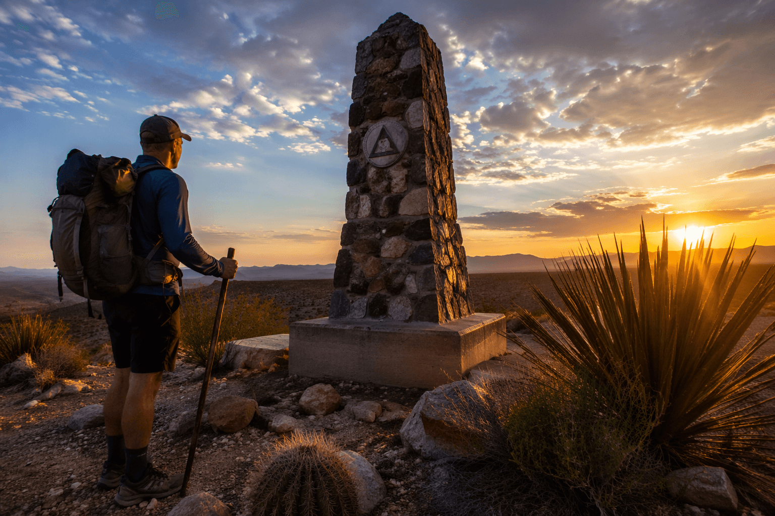
The southern end is remote by design. The closest town to the trail’s endpoint is Hachita, and the Continental Divide Trail Coalition says Hidalgo County hosts the southernmost trailhead. The coalition also says nearly every thru-hiker visits Lordsburg twice, once on the way in and again after the start of the long northbound push. Between the Mexican border and State Highway 9 near Hachita, the southernmost 50 miles of the trail cross the Chihuahuan Desert, where hikers face wide open terrain, long gaps between services and the need to plan water carefully.
That planning is part of the local reality. Thru-hikers typically cache water by car before heading to the border, then move between resupply points over the next few days. On Bureau of Land Management land in New Mexico, the route is generally not a continuous tread at all, but a line traced by signs or rock cairns. In a county where ranch roads and courthouse history often define the public image, the CDT creates a different identity, one built on navigation, self-sufficiency and the bootheel landscape itself.
The coalition classifies Hidalgo County as a CDT Gateway Community, a designation that places the county alongside towns and counties positioned to support trail users and visitors. Crazy Cook is also caught in a broader border-wall and land-control dispute, with U.S. Customs and Border Protection estimating completion in late 2027 before the terminus reopens to normal public access. For Hidalgo County, the trail’s national status is already fixed; the open question is how fully the county turns that distinction into local pride, preservation and visitor traffic.
This article was produced by Prism’s automated news system from verified source data, official records, and press releases, then run through automated quality and moderation checks before publishing. The system is built and supervised by the people who set the standards it runs under. Read our full AI policy.
Did this article answer your question?