Red Flag Warning issued for southern Hidalgo County through Saturday
Lordsburg and southern Hidalgo County faced a Red Flag Warning through Saturday night, with winds near 40 mph and dry fuels primed for fast wildfire spread.
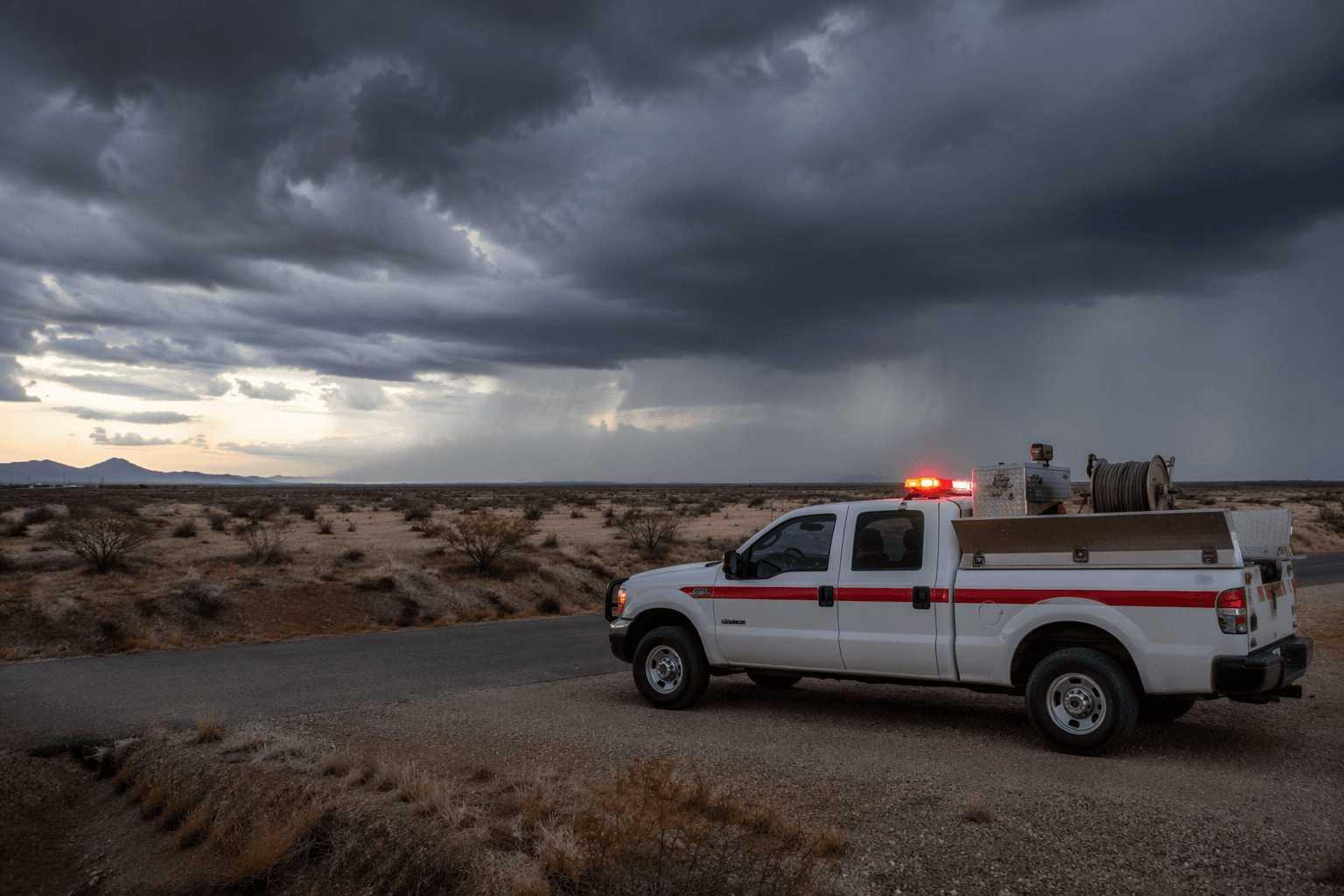
A Red Flag Warning took effect for Lordsburg and southern Hidalgo County Friday at 10 a.m. MDT and was set to run through Saturday, June 28, at 8 p.m. MDT, putting the region in a short window when one spark could become a fast-moving fire. The National Weather Service forecast page for Lordsburg Municipal Airport tied the warning to very dry air, gusty winds and enough instability for isolated storms that could send out erratic gusts.
The weather setup was especially dangerous because the pattern across southwest New Mexico stayed mainly dry while breezy conditions strengthened. Forecast discussion from the National Weather Service said gusty and erratic winds up to about 40 mph were possible as the weekend began, and broader fire-weather messaging warned that extremely critical fire-weather conditions were expected across the Great Basin and Southwest, with rapid wildfire spread possible through the weekend.
That combination turns ordinary outdoor habits into a fire risk. In and around Lordsburg, the message is to avoid open burning, burning trash, dragging chains, parking on dry grass or brush, and running equipment that can throw sparks. The Bureau of Land Management also flags campfires, off-road driving, equipment use and recreational target shooting as common targets of fire restrictions because human activity remains a leading cause of wildfire starts.
The warning mattered beyond one town because southern Hidalgo County includes travel corridors, rangeland and desert vegetation that dry out quickly under hot wind. The National Weather Service Albuquerque office said Red Flag Warnings were in effect each day from 11 a.m. to 8 p.m. MDT for highlighted areas, and its hazards information warned that rapid fire spread from any new spark was possible under the same very dry and windy conditions. For drivers, ranchers and anyone working outside, that meant changing routines for 24 to 36 hours and treating the landscape as primed to burn.
The risk was not theoretical. NM Fire Info reported new fire starts on the Mt. Taylor Ranger District on June 26, linked to scattered thunderstorms, showing how quickly the pattern was already producing ignitions elsewhere in New Mexico. The National Interagency Fire Center’s June 2026 outlook also said much of New Mexico was trending warmer and drier and that fuels were already receptive, adding to the danger facing southern Hidalgo County as the warning period continued into Saturday evening.
This article was produced by Prism’s automated news system from verified source data, official records, and press releases, then run through automated quality and moderation checks before publishing. The system is built and supervised by the people who set the standards it runs under. Read our full AI policy.
Did this article answer your question?