California has lost 60% of its coastal dunes, Humboldt included
California has lost 60% of its coastal dunes, and Humboldt Bay’s sand ridges are part of that decline. Local restorations now stretch from the North Spit to Ma-le’l Dunes.

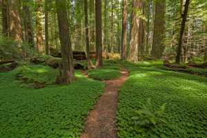
From Ma-le’l Dunes to the North Spit, the shrinkage is visible in Humboldt County. California has lost 60% of the coastal dune systems it had in 1850. The county’s beaches and dunes are part of the buffer that helps blunt storms, hold habitat and keep coastal roads and neighborhoods from taking the full force of the Pacific.
California had about 739 square kilometers of coastal dunes around statehood and now has almost 300 square kilometers left. Roughly 18 square kilometers disappeared through natural processes, but most of the decline came from human activity, including roads, infrastructure, agriculture and invasive plants. About half of what remains is now cut off from coastal processes by infrastructure and transportation networks, which makes the surviving dune systems less able to move, rebuild and absorb wave energy.

The Eureka Littoral Cell runs about 75 kilometers from Trinidad Head to False Cape. Sandy beach-dune barrier systems make up about 84.57% of that shoreline length, according to Friends of the Dunes, and those dunes around Humboldt Bay and the Eel River delta serve as a natural barrier for communities, wildlife habitat and cultural sites. West of Arcata and Eureka, more than 1,000 acres of coastal dunes at Lanphere Dunes, Ma-le’l Dunes, Humboldt Coastal Nature Center, Manila Dunes and Samoa Dunes and Wetlands form one of the longest contiguous stretches of coastal dunes on the West Coast.
NOAA set aside $1,999,600 for one Humboldt Bay project that will restore 18 acres of dunes along 1.3 miles of shoreline, aimed at reducing exposure to extreme storms and helping the barrier migrate as sea levels rise. The California State Coastal Conservancy document identifies an 80-acre dune habitat project on the Wadulh Unit. The broader push was funded in 2018 through the Coastal Conservancy with grants to UC Santa Barbara geographer Ian Walker and U.S. Fish and Wildlife Service ecologist Andrea Pickart.
Humboldt County started its Humboldt Bay Living Shoreline Planning Project in 2024, following earlier sea-level-rise adaptation planning from 2010 through 2015.
This article was produced by Prism’s automated news system from verified source data, official records, and press releases, then run through automated quality and moderation checks before publishing. The system is built and supervised by the people who set the standards it runs under. Read our full AI policy.
Did this article answer your question?