Humboldt Bay refuge protects vital habitat for migratory black brant
Black brant turn Humboldt Bay into a year-round habitat hub, with winter and spring low tides revealing thousands of birds across public access points from Arcata to Eureka.
In winter and spring, low tide can pull tens of thousands of birds onto Humboldt Bay’s mudflats, where eelgrass beds, tidal flats, salt marshes, and freshwater wetlands support a working migration system. The black brant do not just pass through Humboldt Bay; they depend on it.
Why Humboldt Bay matters
Humboldt Bay National Wildlife Refuge Complex, which includes Castle Rock National Wildlife Refuge, was established in 1971 to conserve habitat for birds, mammals, fish, amphibians, invertebrates, and plants along the Pacific Coast of northern California. The refuge protects almost 5,000 acres, a footprint that reaches far beyond one overlook or one trail.
At the south end of the state’s largest bay, Humboldt Bay’s eelgrass beds are a vital spring staging area for migrating black brant, and historical California survey data show the bay once held about 71% of the state’s brant population. Humboldt Bay historically supported the largest population of black brant on the West Coast.
The same estuary also carries a broader bird count. Humboldt Bay is second only to San Francisco Bay in the numbers and diversity of migratory waterbirds wintering along California’s coastal Pacific Flyway, and Audubon says the bay annually hosts over 850,000 shorebirds of 32 species.
Where to watch from public access
The best viewing season is winter and spring, when migratory waterbirds rely on the estuary’s tidal flats and wetlands. At low tide, the mudflats can fill with feeding birds, and binoculars or a spotting scope are the right tools for watching without pushing birds off the flats.
The clearest public access points are spread across the bay and around its edge:
- The Salmon Creek visitor center and Shorebird Loop Trail
- Hookton Slough Unit
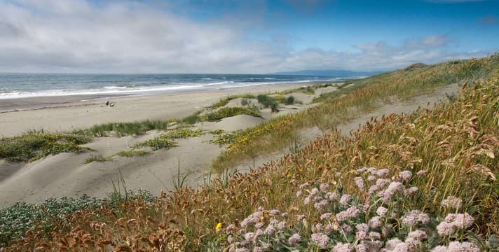
- Ma-le’l Dunes
- The permit-only Lanphere Dunes
- Arcata Marsh & Wildlife Sanctuary
- The north and south spits and jetties
- Arcata Bottoms
- The Mad River, Fay Slough, and Elk River State Wildlife Area
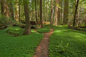
The Shorebird Loop Trail is a 1.7-mile roundtrip gravel route with an observation gazebo, wetland deck, elevated platform, benches, and interpretive panels. That combination makes it one of the best places to understand how the refuge works, because you can see birds feeding, resting, and shifting with the tide from a single short walk.

Ma-le’l Dunes is another important stop. The area includes 937 acres managed cooperatively with the refuge and is a National Natural Landmark, which gives the north bay a rare mix of protected dune habitat and birding access. On the city side of the bay, Arcata Marsh & Wildlife Sanctuary sits at the north end of Humboldt Bay and lies along the Pacific Flyway, putting urban trails directly into the migration corridor.
What to look for by season and tide
Black brant are the signature bird here, but they are not the only reason to go. Waterfowl, shorebirds, and raptors move across the estuary, with the Hookton Slough and Salmon Creek units standing out as reliable places to watch those groups move through the marshes and open water.
Tide matters as much as date on the calendar. When the water drops, the mudflats become feeding grounds, and that is when Humboldt Bay can feel most alive, with birds spreading across the bay in dense, shifting bands. Winter is the broadest viewing season, spring brings brant staging on the eelgrass, and the estuary’s mix of habitats keeps the bird list changing from one visit to the next.
For a local outing, the pattern is simple: start at one of the trailheads, arrive around low tide, and take time at the overlooks rather than chasing birds from one stop to another. Humboldt Bay rewards patience because the habitat is layered, with birds using the same stretch of bay differently as the tide rises and falls.
A landscape shaped by loss and restoration
The refuge is also a record of what Humboldt Bay has lost. Since 1900, the bay has lost about 90% of its salt marshes because of diking and draining, and tidal wetlands have dropped from about 9,000 acres to about 900 acres today. More than 75% of Humboldt Bay’s shoreline has been armored or otherwise altered.
The Mad River Slough Restoration Project and the Long Pond Tidal Wetland Enhancement Project are part of the work to rebuild habitat function. Long Pond is a 16-acre parcel on the Salmon Creek Unit, and it is intended to restore historical wetland types, improve sea-level-rise adaptation, and provide permanent refuge protection.
A University of California and California Department of Fish and Game study found historical Humboldt Bay surveys averaged 41,559 brant, with counts ranging from 5,000 to 105,000 over 11 years, while identifying Humboldt Bay, Tomales Bay, and Morro Bay as the three areas of greatest use. Another historical study found winter and spring brant use declined sharply in the mid-1950s, kept falling through the mid-1980s, then increased again, with hunting pressure likely a major driver.
This article was produced by Prism’s automated news system from verified source data, official records, and press releases, then run through automated quality and moderation checks before publishing. The system is built and supervised by the people who set the standards it runs under. Read our full AI policy.
Did this article answer your question?