NWS warns of thunderstorms, heavy downpours in interior Humboldt, Trinity counties
Thunderstorms were bearing down on Willow Creek, Trinity Village and Burnt Ranch Thursday, with lightning, heavy downpours and gusty winds threatening steep roads and river corridors.
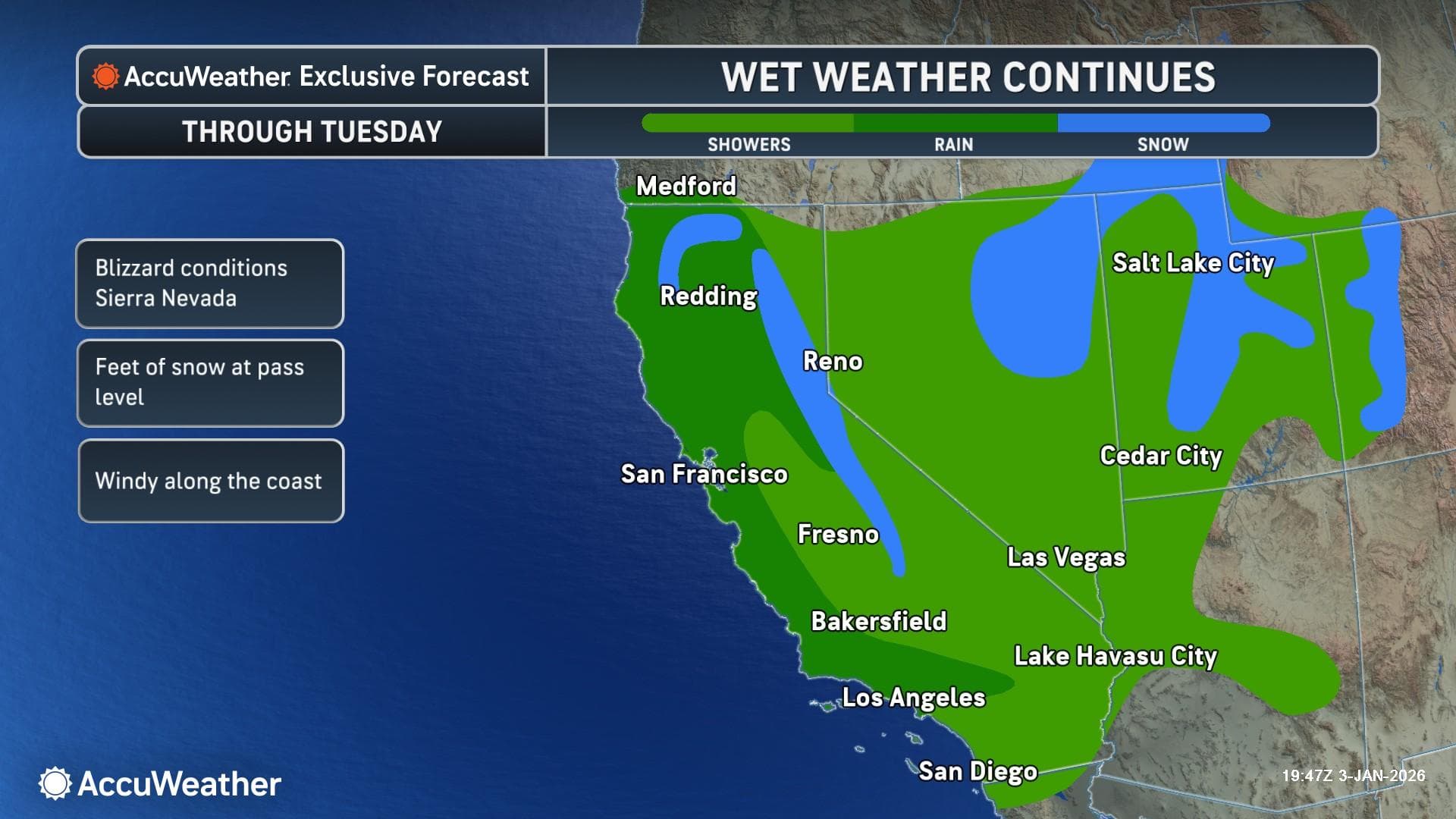
A special weather statement covered Willow Creek, Trinity Village and Burnt Ranch until 7:45 p.m. PDT Thursday as the National Weather Service in Eureka warned that thunderstorms and heavy downpours were moving into the interior of Humboldt and Trinity counties.
The weather service said shower activity and the chance for thunderstorms continued through Thursday, with isolated to scattered thunderstorms increasing across the interior. Its homepage put the chance of isolated thunderstorms across the higher terrain at 10% to 20% for the afternoon and evening, with the strongest cells capable of dangerous lightning, localized heavy downpours, small hail and erratic, gusty winds.
That combination mattered most in the rugged interior, where a sudden burst of rain can turn steep roads slick in minutes and lightning can make outdoor work, hiking and river access risky fast. In Willow Creek, Trinity Village and Burnt Ranch, residents could see brief but intense rain cores, sharper wind shifts over ridges and channeled terrain, and rapidly changing visibility along Highway 299 and other narrow mountain routes.
The forecast discussion from May 27 said breezy northwest winds were expected over interior ridges and channeled terrain before shifting toward the coast later. For communities tucked along rivers and canyons, that can mean trees swaying harder on exposed slopes, scattered power interruptions, and a higher chance that small hail or wind-blown branches interrupt service or block local roads.
The Weather Service also noted that counties can target emergency alerts only to the areas they are trying to reach, a system that matters in a region where weather can change block by block. Effective April 16, NWS Eureka reconfigured public weather zones across Northwest California, adding three new forecast zones, including one in Trinity County, to improve alerting capability.
For Humboldt County and Trinity County residents, that narrower alerting matters when thunderstorms build over the interior and river corridors, where fast-moving weather can threaten campers, commuters and anyone working outdoors. The warning covered a small slice of Northwest California, but the risks were immediate: lightning over the ridges, heavy rain on the roads, and sudden wind gusts that could make the evening commute and outdoor plans more dangerous before the sky cleared.
This article was produced by Prism’s automated news system from verified source data, official records, and press releases, then run through automated quality and moderation checks before publishing. The system is built and supervised by the people who set the standards it runs under. Read our full AI policy.
Did this article answer your question?