Michigan DNR Maps Guide Hunters and Anglers to Iron County Public Lands
With Mi-HUNT offline through 2026, hunters and anglers heading into Iron County's 138,000-acre Ottawa Forest need a backup plan before losing cell service.
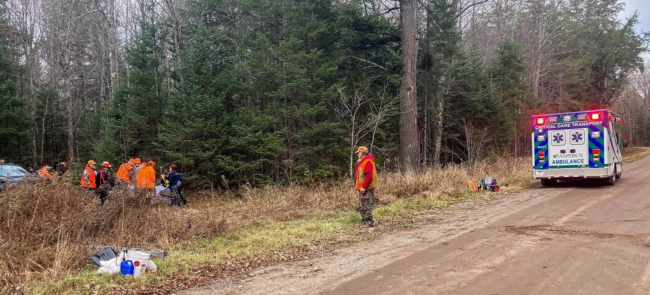
Standing at a two-track off a county road in Iron County, holding a phone with no bars, staring at a posted sign that may or may not have been there last season — that's how a productive morning turns into a misdemeanor charge. Michigan's recreational trespass law carries a fine of up to $500 and 90 days in county jail. Take a deer on the wrong side of that line and the fine jumps to $750. Getting it right starts before you ever leave your driveway, and right now, with one of hunters' most-relied-upon digital tools temporarily offline, the stakes for pre-trip preparation are higher than usual.
Understanding the Patchwork
Iron County sits in the western Upper Peninsula just seven miles from the Wisconsin border, and its outdoor footprint is staggering: hundreds of lakes and nearly 900 miles of rivers and streams, woven through a landscape where state forest, federal forest, private timber, and small private parcels share boundaries that are rarely marked at eye level. The Ottawa National Forest's Iron River Ranger District alone covers 138,000 acres, with 2,175 lakes and 902 miles of streams within its boundaries. Three of its rivers carry Wild and Scenic River designations. Add in Michigan state forest blocks managed by the DNR and scattered game areas, and the county is among the most accessible in the U.P. for public-land hunting and fishing — if you know where the lines are.
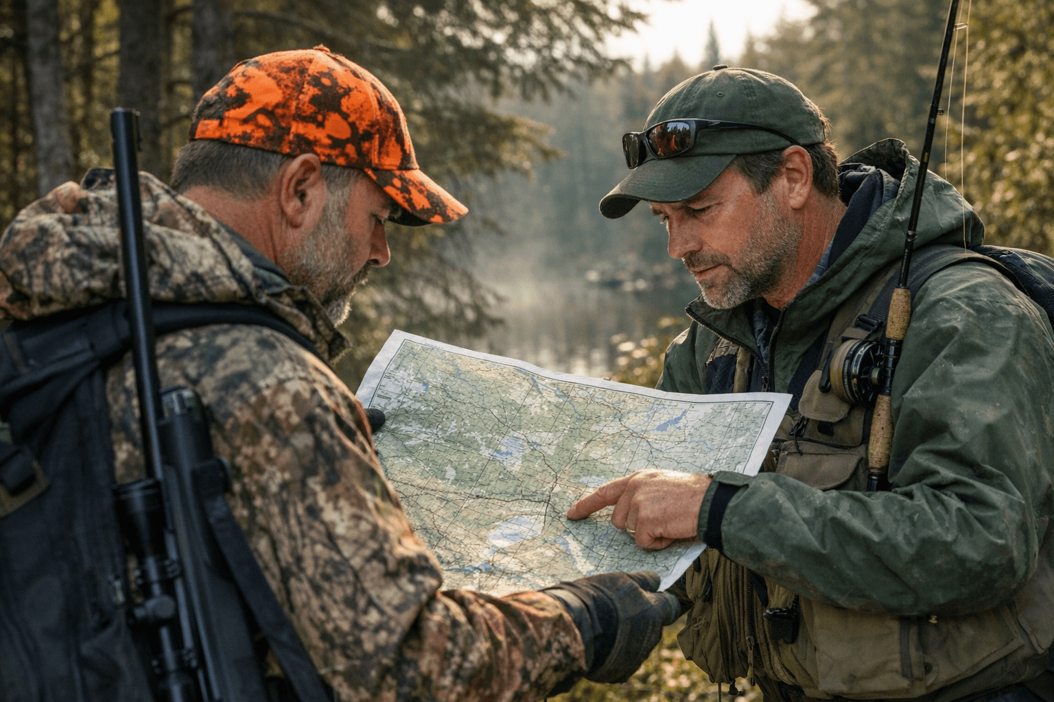
That "if" does real work. A parcel that looks like state forest on an old paper map may have reverted to private ownership. A boat launch shown on a tourism website may cross a private easement to reach the water. The Michigan DNR maintains the authoritative "Lands Open to Public Hunting" PDF map for Iron County, which shows state forest lands, game areas, and designated public access points updated periodically. Cross-referencing that PDF against current parcel data is the move every serious hunter should make before the season opens.
Your Digital Toolkit: What Works Right Now
The DNR's Mi-HUNT interactive map, which normally layers public land boundaries, ownership data, and deer management unit lines into one searchable platform, is currently down for maintenance and will not be available for several months into 2026. For anyone who relied on Mi-HUNT to plan spring turkey or trout opener trips, that's a gap that needs filling before you head north.
OnX Hunt fills much of it. The app displays satellite and topo basemaps over public and private land boundaries, includes landowner data for most Michigan counties, and — critically — allows you to download maps for offline use before you lose cell service on a forest road outside Iron River. Download your target areas at home, not at the trailhead. The Michigan DNR Hunt Fish app also provides offline mapping capability and is the official channel for accessing the Lands Open to Public Hunting layer on a mobile device. Carry both if you want redundancy.
The DNR's county-level inland lake maps remain available on michigan.gov and identify public boat access sites, ramp locations, and lake-specific information for Iron County waters. For regulatory text, the eRegulations site hosts the authoritative, up-to-date Michigan fishing and hunting regulations, including season dates, bag limits, and unit boundaries. Bookmark it and screenshot the pages relevant to your trip.
Confirming Access: Step by Step
Before any trip into Iron County public land, run through this sequence:
1. Pull the current DNR "Lands Open to Public Hunting" PDF for Iron County and identify your target area by section, township, and range.
2. Cross-reference with OnX Hunt or the DNR Hunt Fish app to verify current ownership and confirm no recent changes to access status.
3. Check the Iron County Road Commission for active spring road weight restrictions. The commission imposes county-wide restrictions each spring as frost leaves the ground, and remote two-tracks are often the first to close. A high-clearance vehicle may still face a walk-in of a mile or more to reach a preferred launch or blind site.
4. Download offline maps covering your full planned area, including a buffer zone of at least one section in every direction, before you leave cell service.
5. Confirm your license is active and any required tags or applications are in order. Spring turkey base licenses for 2026 became available March 1 through the DNR's licensing system; trout and salmon stamps must be attached to your base fishing license.
Where People Commonly Get Confused
The most frequent access errors in Iron County fall into three categories. First, easements: a legal easement for public boat access does not make the surrounding land public. Access to the water may be permitted; hunting or camping on the adjacent parcel may not be. Read the easement description, not just the launch sign.
Second, state forest boundaries near private inholdings. The Copper Country State Forest and Escanaba River State Forest both have blocks in Iron County, and private parcels are scattered throughout. The posted corners of private land can be subtle — small orange paint blazes on trees rather than full signage. OnX's parcel layer will show the line; a painted blaze 50 yards into the timber may not.
Third, the Ottawa National Forest boundary near Lake Ottawa, five miles southwest of Iron River. The recreation area itself is federal land and open to fishing, but the roads approaching it cross a mix of jurisdictions. When in doubt, the Iron River Ranger District office is the right call before you act.
Season-Specific Notes
Spring turkey season in the U.P. opens with Zone 3 and Zone 4 dates that fall in May; confirm the exact opener for your management unit on eRegulations before purchasing your license, since zone boundaries can shift. Turkey hunters should pay particular attention to game area boundaries on the DNR PDF map, since some areas that appear forested are seasonal closures or managed for specific species.
Trout opener on designated streams in the Upper Peninsula typically falls in late April for inland streams, with the Ottawa National Forest's Wild and Scenic river sections carrying special regulations on minimum size and gear type. Download the Iron River Ranger District fishing map from the U.S. Forest Service alongside DNR materials — federal land rules govern those stretches, not state rules alone.
For bear and deer prep heading into fall, the DNR's Hunt Fish app is the right tool for confirming deer management unit lines and any antler point restrictions that apply to Iron County units. Bear hunters need a valid bear license from the DNR's application process and should verify baiting rules, which vary by zone and year.
When Signage Is Unclear
If you reach a boundary and the posting is ambiguous, the rule is straightforward: treat it as private until confirmed otherwise. Michigan law does not require landowners to post every corner; it requires only conspicuous warning. A single posted sign at a trail entrance may legally cover a large parcel. Do not enter, and do not assume the sign is old or doesn't apply.
The right move is to back out, note your GPS coordinates, and make a call. The DNR's customer service line connects to regional offices that can confirm public land status for a specific parcel by legal description. The Iron County Economic Chamber Alliance at iron.org also maintains seasonal fishing and hunting guides and can direct you to local contacts who know the ground.
Pre-Trip Checklist
Screenshot this before you lose cell service:
- DNR "Lands Open to Public Hunting" PDF for Iron County — downloaded, not bookmarked
- OnX Hunt offline maps downloaded for your target sections plus one-section buffer
- Michigan DNR Hunt Fish app with offline layer active
- eRegulations page for your target species saved to camera roll
- Iron County Road Commission road status checked within 48 hours of departure
- Iron River Ranger District contact number saved: (906) 265-5139
- Valid fishing or hunting license confirmed active in the DNR Hunt Fish app
- Appropriate tags, stamps, and application confirmations printed or saved offline
- Float plan or trip plan left with someone at home for remote trips
Who to Call
The DNR's Iron River field office covers the bulk of state forest land in the county. The Iron River Ranger District handles Ottawa National Forest questions. For seasonal access road status, the Iron County Road Commission is the authoritative source — not a tourism website, not last year's memory. When a landowner's posted sign conflicts with your map, a direct call to the DNR before proceeding is not overcautious; it is the difference between a productive day afield and a court date in Crystal Falls.
Iron County's public land is genuinely vast and genuinely accessible. The 138,000 federal acres of the Iron River Ranger District alone offer more public fishing than most states can claim in total. Getting the access question right is simply the price of entry for using it responsibly, and it costs nothing but a few minutes of homework at home with reliable internet, before the two-tracks and the timber take your signal away.
This article was produced by Prism’s automated news system from verified source data, official records, and press releases, then run through automated quality and moderation checks before publishing. The system is built and supervised by the people who set the standards it runs under. Read our full AI policy.
Did this article answer your question?

