Premont’s planned origins shaped Jim Wells County’s early growth
Premont was laid out for the railroad, then split by design. That original map still shapes where people gather, from Hidalgo Park to Santa Theresa Catholic Church.
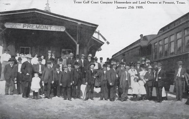
Premont still reads like a town that was drawn with a ruler and a railroad timetable. The townsite was surveyed in 1908 or 1909 by C.F.H. Von Bulcher, and banker and real-estate developer R.P. Halderman named the settlement after Charles Premont, a foreman on the Seeligson Ranch. That planned start left a visible footprint in Jim Wells County, where the street pattern, civic spaces, and neighborhood lines still reflect the choices made at the beginning.
A town drawn to the rail line
Premont did not grow in a loose, accidental way. Its earliest map was tied to the railroad alignment, the sale of lots, and a town plan that organized space before the population fully arrived. Halderman sold hundreds of lots to Charles Premont, who served as the real-estate agent for Mexican families because he spoke Spanish fluently, a detail that mattered in a community being built around land, language, and access.
That early layout gave Premont an unusual level of order for a South Texas town of its era. The railroad was the spine, the lots followed the geometry, and the town’s public spaces were set with purpose rather than left to chance. Even now, that origin story helps explain why Premont feels structured in a way that still marks how the town presents itself to residents and visitors.
The east side and Hidalgo Park
One of the clearest signs of that design was the decision to set aside a section east of the railroad for Mexican and Mexican-American families. The county history also says a plaza called Hidalgo Park was designed and built to serve those families. That means the town’s social assumptions were not just written in policy or custom, but built into the map itself.
Hidalgo Park matters because it was not an afterthought. It was part of the original plan, created as a civic anchor for a designated part of town. In a place where railroad lines and lot sales shaped development, the park became a physical expression of who the town expected to serve, where people would gather, and how public life would be organized.
For readers studying Premont today, the park is one of the best places to see the town’s planned identity in action. The original choice to create a public plaza for a specific neighborhood is still legible in the way Premont was built, with space, separation, and community life all tied together from the start.
From lots to county office
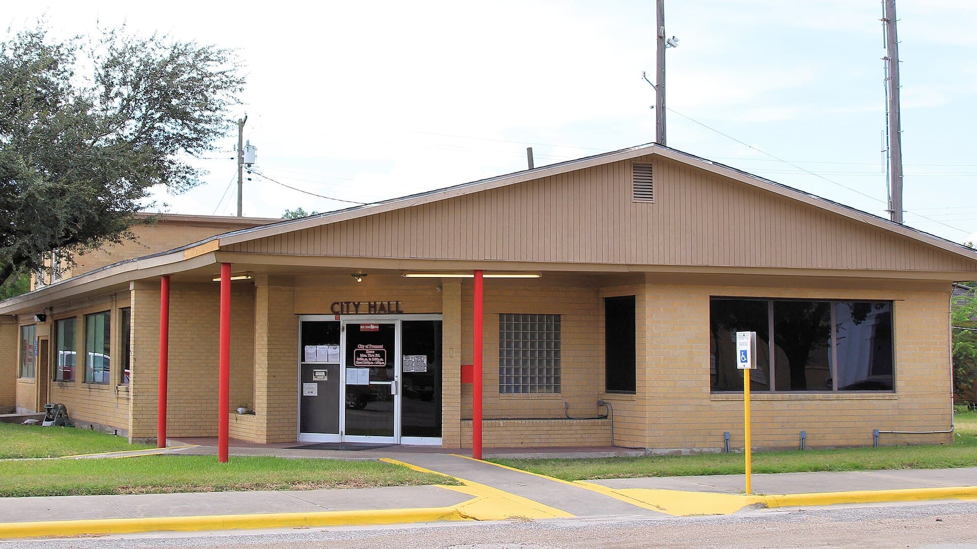
Premont’s founding was not only a land story, it was a political one. The community joined the newly organized Jim Wells County on March 11, 1911, and Charles Premont was elected the county’s first commissioner in the May 6, 1911 election. That put the town into county governance almost immediately, giving it an early voice in how the new county would take shape.

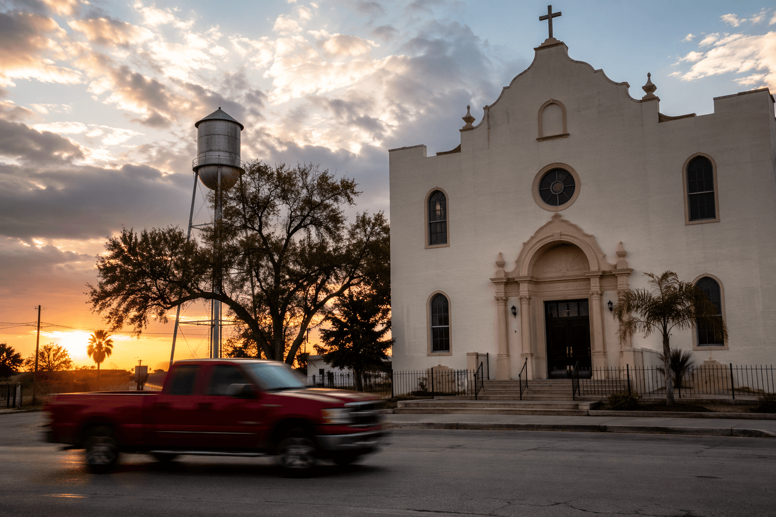
By 1912, Premont had ten businesses and about 800 residents, a sign that the planned town was already becoming a working center rather than just a subdivision on paper. Charles Premont’s role as a Spanish-speaking real-estate agent helped connect the town’s land sales to the families who would live there, and his donation of funds to build Santa Theresa Catholic Church added another enduring institution to the community.
Santa Theresa remains one of the strongest links between Premont’s founding era and its present identity. The county history says the church now ministers to three missions, which shows how one donor-backed church became a broader spiritual center over time. That church, like Hidalgo Park, is part of the civic architecture that grew out of the original plan and still helps organize daily life.
Rail stop, school district and oil
The railroad influence deepened in 1914 when the San Antonio and Aransas Pass Railway built a stop in Premont. That stop mattered because rail access did more than move freight and passengers, it reinforced Premont’s place in the county economy and made the town easier to reach, supply, and grow. In a town already built around a planned grid, the rail stop made the original design more useful and more permanent.
Premont then added another layer of institution-building when Premont ISD was created in 1921. Schools often become the most durable civic structures in small towns, and in Premont the district joined the park and church as a defining part of community life. The town’s identity was no longer only about a railroad stop and lot sales; it was becoming a place with its own public institutions.
The oil well that came in on May 12, 1933 added a different kind of economic weight. Oil brought Premont into the broader South Texas boom cycle and gave the town another reason to matter beyond its founding geography. Six years later, in 1939, the community incorporated, a formal step that confirmed what the earlier milestones had already shown: Premont was no longer just a planned settlement, but a town governing itself.
What the original plan still shows
Premont’s story is best understood as a then-versus-now map. Then, town builders placed the railroad first, assigned land east of the tracks to Mexican and Mexican-American families, and created Hidalgo Park as a designated plaza. Now, those choices still explain why certain spaces feel central, why the church and park carry such civic weight, and why the town’s layout remains one of the clearest records of its founding assumptions.
Anyone tracing Premont’s early growth can read it through the names and dates that still define the town: Von Bulcher’s survey, Halderman’s naming, Charles Premont’s land sales and county election, the 1914 rail stop, the 1921 school district, the 1933 oil well, and the 1939 incorporation. Together, they show a community that was planned, populated, institutionalized, and then built into the county’s early history.
This article was produced by Prism’s automated news system from verified source data, official records, and press releases, then run through automated quality and moderation checks before publishing. The system is built and supervised by the people who set the standards it runs under. Read our full AI policy.
Did this article answer your question?