La Paz County school district map shows boundaries across communities
In La Paz County, school lines cross desert roads and river corridors, so a move can change enrollment, bus access, and the school a child attends.
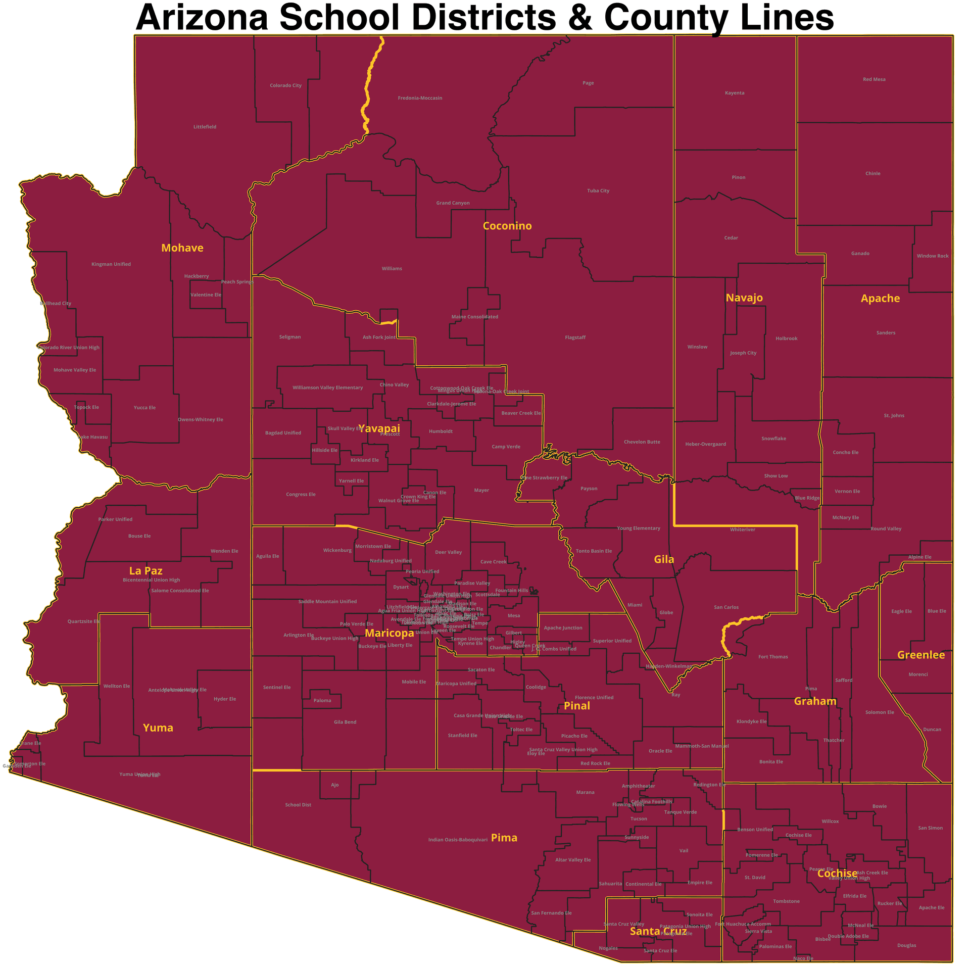
La Paz County’s boundary map shows school lines running across Parker, Quartzsite, Ehrenberg, Bouse, Wenden, Cibola, Salome, and other communities along long road corridors, not just around compact town centers. The community name on your mailbox does not always tell you which school district takes your child.
La Paz County had 16,557 people in the 2020 Census and about 16,700 people in 2025. In a place spread out like that, even a few miles can put a home on the other side of a district line, changing enrollment, transportation, and the day-to-day assumption about where a student will attend school.
Why the map is a family decision tool
La Paz County’s Districts and Map page tells users to click on a district or school name in the table to open the related website, and it lists county systems including Bicentennial Education Center, Bouse Elementary School District, Quartzsite Elementary School District, Parker Unified School District, and Wenden Elementary School District.
The page matches the reality on the ground. Parker is the county seat and one of the main anchors, Quartzsite is another incorporated town, and the surrounding communities, from Annex Parker to Alamo, do not function as one continuous school neighborhood. Families comparing houses, lots, or rental units need the district line as much as the street address.
What the boundary map actually shows
The county’s School District Boundaries PDF labels Parker, Annex Parker, Quartzsite, Cibola, Ehrenberg, Bouse, Brenda, Hope, Vicksburg, Salome, Wenden, and Alamo, along with the Colorado River corridor, and it marks roadway references such as Mohave Rd., Alamo Rd., Plomosa Rd., Avenue 42E, McVay Rd., Cibola-Ehrenberg Rd., Riverside Dr., Agnes Wilson Rd., Ehrenberg-Parker Hwy, Vicksburg Rd., Cibola Rd., and Salome Rd.
The district pattern follows long corridors and section lines across open space, so one house near a roadway can belong to one district while another house a short distance away falls into a different one. In an urban county, boundaries often track blocks and subdivisions; here, they are shaped by distance, travel routes, and sparse settlement.
Enrollment is tied to transportation and daily logistics
The boundary line sets the default school assignment, but it also shapes the school day. A district that covers a wide rural stretch has to think about bus access, road conditions, and ride time differently than one serving a dense neighborhood cluster.
A 2010 La Paz Transportation Planning Study was jointly conducted by the Arizona Department of Transportation, La Paz County, the Town of Quartzsite, the Town of Parker, and the Colorado River Indian Tribes.
Where to check district details before you move
The county superintendent’s office, La Paz County Education Service Agency / School Superintendent, exists to create the best possible opportunities for every student in the county by ensuring each district has support. For a family sorting out a boundary, records, or school placement, the county structure backs the local districts rather than replacing them.
The district websites themselves are part of the enrollment map. Parker Unified School District’s office is at 1608 S Laguna Ave. in Parker, with a mailing address at 1216 18th Street, P.O. Box 1090, and the district maintains an open-enrollment policy page. Quartzsite Elementary School District lists its office at 49241 Ehrenberg Rd. in Ehrenberg, and its site links directly to transportation, board, documents, and about-us information. Those are the places where a family should verify attendance rules, bus service, and district procedures before assuming a move will fit an address.
Why district size and oversight matter
U.S. News lists Parker Unified School District as a PK-12 district with 6 schools and 1,721 students, while Quartzsite Elementary School District has 2 schools and 159 students.
The Arizona Office of the Auditor General’s 2020 performance audit of Quartzsite Elementary School District found the district continued to operate one of its schools despite significant safety concerns and was not meeting the requirements of the state-mandated school improvement program.
Boundary lines do not change casually
Arizona law, A.R.S. 15-460, sets out a formal process for changing school-district boundaries. The lines on the county map can persist for years even as roads, housing, and travel patterns change around them.
The county’s 2024 First Things First La Paz County Resource Guide for families with children birth to age 5 shows that school-boundary questions start early, long before kindergarten. Families also have to think about child care, early learning, and the systems that support a move into the county.
This article was produced by Prism’s automated news system from verified source data, official records, and press releases, then run through automated quality and moderation checks before publishing. The system is built and supervised by the people who set the standards it runs under. Read our full AI policy.
Did this article answer your question?