Lake County highway maps show seasonal load restrictions, plow routes
Lake County's maps flag where heavy loads are restricted and where plows run first, helping haulers, buses, and responders avoid damage and delays.
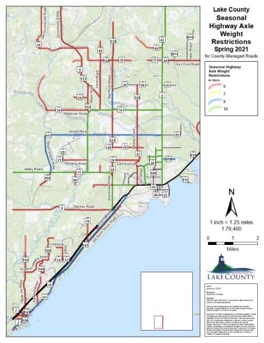
Lake County’s Maps page points users to seasonal load restriction maps and plow route maps. They show which county-managed roads carry seasonal load restrictions and where plow routes run, giving haulers, school transportation planners, farms, contractors, and emergency crews a way to avoid damaged pavement, blocked roads, and unnecessary delays.
What the maps cover
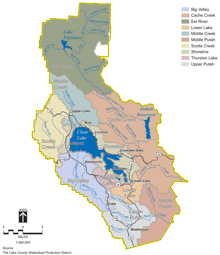
It also includes a reference map that shows the area covered by the seasonal weight restriction maps, which matters in a county that stretches from Two Harbors and the North Shore inland through a wide network of township roads. The restriction information can change without notice, so the maps are only useful if they are checked before a truck, bus, trailer, or plow-sensitive route is put into motion.
The Highway Department’s mission is to provide a continuously improving, safe, cost-effective and efficient road and bridge system that enhances quality of life for Lake County residents and visitors and promotes the area’s economic vitality.
Seasonal load restrictions and why they matter first
Lake County posts road restrictions each spring under Minnesota Statutes 169.87. When frost leaves the road base soft, heavy loads can rut, crack, and weaken county roads at the exact moment they are most vulnerable. For that reason, the restriction map is often the first thing that matters to anyone moving gravel, equipment, farm products, or building materials before the thaw has fully settled.
The road restrictions page exempts highway maintenance vehicles, school buses, and emergency public utility vehicles from the load restrictions, which means some traffic still has to move even when roads are posted. Refuse trucks may exceed the imposed restrictions by two tons per axle, but not beyond nine tons per axle in any case. Any unposted roads are limited to five tons per axle, which makes the absence of a sign an important legal limit rather than a blank slate.
A contractor hauling a loaded trailer on a county road, a farm operator moving equipment between fields, or a delivery driver carrying a heavy load all need the same basic check: whether the road is posted, what the axle limits are, and whether the route crosses a county-managed road that has changed since the last trip.
How Lake County’s spring postings change
Lake County’s own spring notices show how quickly restriction windows can shift from year to year. In 2025, one county notice set spring load restrictions to end on Monday, May 12, 2025 at 12:01 AM, except on CR 131 Drummond Grade, CSAH 7 and CSAH 8 on Cramer Road, CSAH 24 on Gun Club Road, CR 301 on Fors Road, and CSAH 3 on Highway 3. A separate county notice lifted restrictions on county highways, roads, and unorganized territory roads beginning Friday, May 14, except on the same list of roads and also Old Drummond Road, UT 10, and Westover Road.
A road that opens in one part of the system can remain restricted in another, especially on routes that serve heavy traffic or are slower to dry out. Postings above five tons take effect only when the signs are actually installed, so enforcement depends on the posted condition of the road, not just a general seasonal calendar.
Plow routes and winter access
The plow route maps show how the county organizes snow and ice control across shore communities, inland routes, and township roads, helping residents understand which roads are likely to get attention first during a storm. In a county where winter travel affects commuting, school transportation, and emergency response, the plow map is a guide to how limited equipment and time are allocated when the weather turns.
When a route is on the map, it tells people where crews can move fastest, where delays are likely, and how the county keeps roads open enough for buses, responders, and winter deliveries to continue operating.
How the maps fit into broader road work
Lake County’s highway maps also sit inside a larger road and bridge system that includes planning, design, construction, maintenance, and inspection. Its engineering staff is responsible for the Capital Improvement Program, including the design, administration, and inspection of road and bridge construction projects.
The county’s road closure history shows how that system works in practice. New Tomahawk Road, County Road 34, was closed when the bridge over the Stony River would be rehabilitated. Highway 2 also went through a reconditioning project that was scheduled from June 23, 2025 to October 4, 2025.
How county and state information split
MnDOT handles a different slice of the system. The Minnesota Department of Transportation provides seasonal load limit information for state and federal trunk highways, while county roads are handled through county weight information resources. Drivers need both sources because a restriction on one road does not apply everywhere else.
This article was produced by Prism’s automated news system from verified source data, official records, and press releases, then run through automated quality and moderation checks before publishing. The system is built and supervised by the people who set the standards it runs under. Read our full AI policy.
Did this article answer your question?