Palisade Head offers ancient geology, easy access and climbing safety tips
Palisade Head lets you drive to a billion-year-old cliff, but the views come with permits, exposed edges and serious climbing risks.
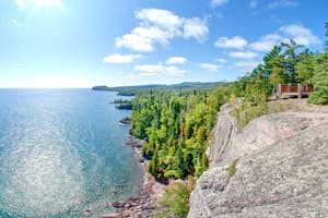
Palisade Head is one of Lake County’s easiest big views to reach, but it is also one of its most serious places to respect. You can drive to the top for a sweeping look over Lake Superior, yet the cliff edge drops hard, the rock face is exposed, and climbing there is for prepared visitors only.
A cliff shaped by fire
The geologic story starts 1.1 billion years ago, when a violent volcanic eruption created the rock that forms Palisade Head today. As the lava cooled, it shrank and cracked into columnar joints, the same structure that now gives the cliff its famous climbing character. The larger setting is the Midcontinent Rift, when North America nearly split apart about 1.1 billion years ago, and the National Park Service says the rocks from that rifting are best seen around Lake Superior.
That deep history is part of what makes Palisade Head feel so distinct. It is not just a scenic overlook on Highway 61 near Silver Bay. It is a visible slice of ancient volcanic and rift activity, with a cliff line that tells a geologic story in plain sight.
What you can see from the top
The Minnesota Department of Natural Resources says you can drive right to the top of Palisade Head, which makes it one of the easiest high viewpoints on the North Shore to reach. That matters for families, travelers with limited time, and anyone who wants a major Lake Superior vista without a long hike.
From the top, the DNR’s virtual tour shows sea caves, a sea stack, the mouth of the Baptism River, and the shoreline stretching toward Shovel Point. Those details help place Palisade Head within the broader Tettegouche landscape, where steep rock, water, and shoreline all come together in a short stretch of coast.
The DNR says Tettegouche State Park is open daily from 8 a.m. to 10 p.m., giving visitors a wide window to plan a stop. The park was protected as a state park in 1979, and today it remains one of the North Shore’s most visited scenic and recreation areas.
Why the site draws climbers
Lake County Chamber calls Palisade Head the premier climbing spot in the county, and the cliff has earned that reputation because of its exposed rock and columnar joints. The same features that make it striking from the road also make it a serious climbing venue with real consequences for mistakes.
A free permit is required for anyone who wants to climb, and the permit is available at park headquarters during business hours. That is a practical detail visitors should not miss, especially if a day trip turns into an impromptu climbing outing. For organized groups, DNR climbing map materials say a commercial climbing permit is required in Minnesota state parks, along with insurance certification and at least one week’s notice.
The permit system is not just paperwork. It is part of how the park manages a high-use cliff face where inexperienced climbing can quickly become an emergency response issue.
Safety on the edge
The cliff is open-faced and exposed, which is what gives Palisade Head its drama and its risk. Children should be kept in hand on the high cliffs, and anyone stepping near the edge needs to assume that footing can change fast in wind, wet conditions, or crowding.
That caution matters even more because Palisade Head is one of the most heavily used places on this stretch of shoreline. A fatal incident in July 2026 prompted investigation by the Lake County Sheriff’s Office, the Lake County Rescue Squad, and the Midwest Medical Examiner’s Office. For a site that attracts casual sightseers and technical climbers at the same time, that kind of response underscores how quickly a scenic stop can become a rescue scene.
The safety message is straightforward: stay back from the edge, watch your footing, and do not treat the top of the cliff like a park lawn. The same rock that creates one of Lake County’s best views also leaves little margin for error.
A short walk away: Shovel Point
Shovel Point offers a useful contrast to Palisade Head. The DNR says the Shovel Point trail is a 0.6-mile one-way walk from the visitor center, and the route ends with a view of Palisade Head to the west. It is the shoreline overlook to Palisade’s drive-up cliff-top experience, and together the two spots show the same billion-year-old rock story from very different angles.
The Shovel Point map also warns visitors to watch for peregrine falcons in summer. That warning is worth heeding, because it reflects the fact that the park is not just a sightseeing stop. It is also habitat, and the DNR manages visitor access with both recreation and wildlife in mind.
For many visitors, the combination works well. Palisade Head gives an immediate panoramic view, while Shovel Point adds a short walk and a closer shoreline experience. Both belong to the same park, but they meet different needs.
Birdwatching, trails and year-round use
The DNR describes Tettegouche as a park known not only for rock climbing, but also for quality birdwatching in spring, summer and especially fall. That wider use matters because it explains why the park draws steady traffic well beyond climbing season. Scenic overlooks, multi-use trails and shoreline access keep the area active in every season.
Palisade Head fits into that broader pattern. It is a fast, accessible stop for visitors on Highway 61, but it also sits inside a park that serves hikers, climbers, birdwatchers and people who simply want to stand above Lake Superior for a few minutes. The result is a site where geology, recreation and safety all overlap.
For Lake County, that overlap is the point. Palisade Head is valuable because it is beautiful, easy to reach and loaded with history. It is also valuable because the county and park agencies have to manage it carefully, so the view stays open, the rock stays protected, and visitors understand that the cliff edge is part of the attraction and part of the hazard.
This article was produced by Prism’s automated news system from verified source data, official records, and press releases, then run through automated quality and moderation checks before publishing. The system is built and supervised by the people who set the standards it runs under. Read our full AI policy.
Did this article answer your question?