Logan County markers link towns, roads and frontier history
Eighteen markers turn Logan County into an outdoor lesson plan, from Fort Wicked near Merino to Sterling’s railroad and courthouse sites, linking roads, land use and frontier conflict.
Logan County’s historic markers do more than name old events. They give you a working map of how a county spread across 1,845 square miles of the Great Plains and the South Platte River valley came to be divided among towns, roads, fields and civic centers that still shape daily life.
A county you read from the roadside
The Historical Marker Database lists 18 entries in Logan County, which is enough to show that the county’s public memory is spread across several communities rather than packed into one downtown district. That matters in a place as broad as northeast Colorado, where the land itself encourages long drives, long views and a history that followed transportation corridors as much as it followed town limits.
For families, teachers and newcomers, the markers function like outdoor waypoints. They connect present-day places such as Merino and Sterling to earlier layers of settlement, railroad movement, military campaigns and county government, so the landscape stops looking random and starts looking organized by history. A marker on a roadside, in that sense, becomes a clue to why the modern county still looks the way it does.
Fort Wicked and the South Platte route
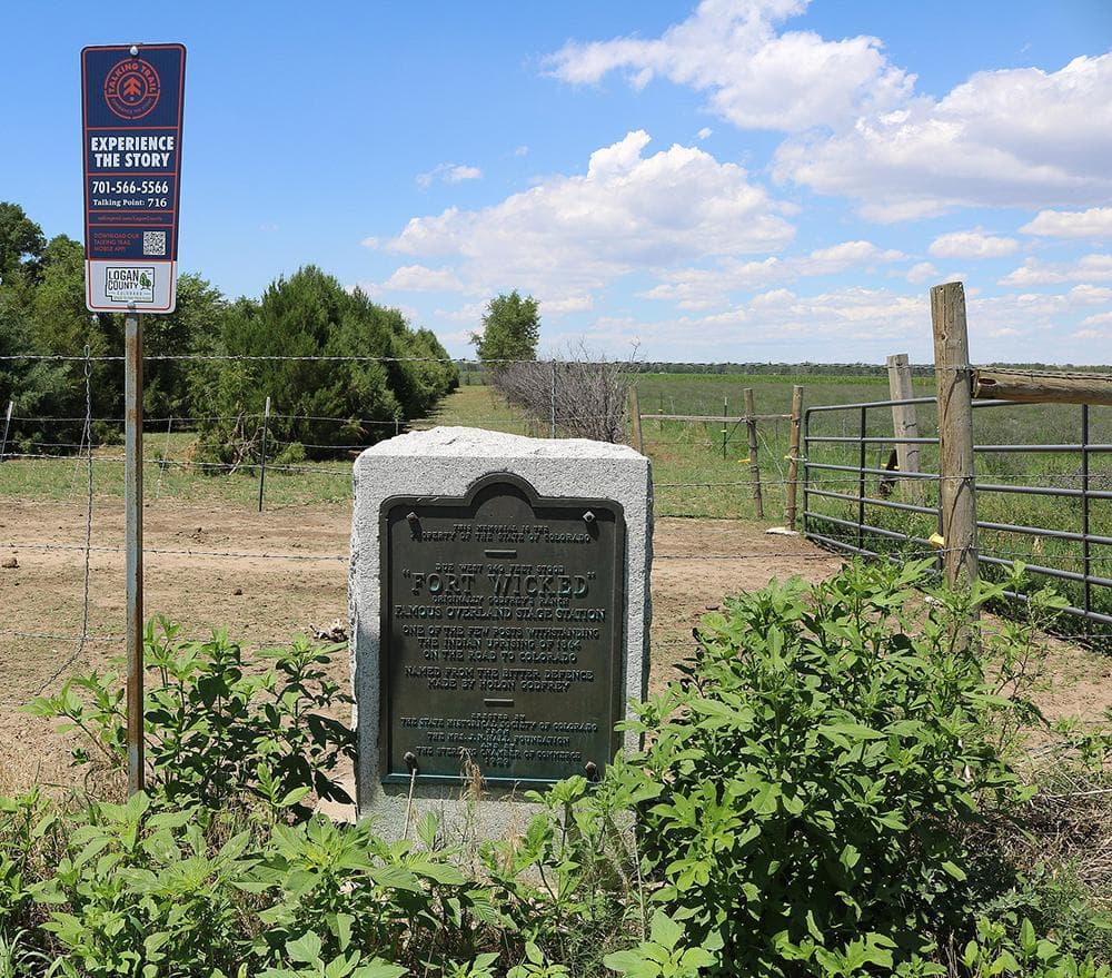
One of the most useful stops is Fort Wicked in Merino. Colorado Encyclopedia places the marker near the site of a violent clash in January 1865 between settlers Holon and Matilda Godfrey and Cheyenne and Arapaho warriors, and says the attack on the Godfreys’ stage stop was part of retaliation for the Sand Creek Massacre.
Explore Sterling puts Fort Wicked on US-6 south of Merino, about 1/2 mile north of the Washington/Logan County line. That location matters because it ties the marker to a travel corridor, not just a single isolated homestead. The same handout traces the South Platte Trail and stage route back to Long’s Expedition in the summer of 1820, notes that Fremont later followed in Long’s footsteps, and says the route became an overland stage line between Omaha and Denver in the 1860s.
That sequence explains why a marker beside a highway can still tell the story of land use today. The route that once carried expedition parties and stage traffic helped establish the logic of movement through the county, and modern roads still follow that older pattern of crossing distance by following the river valley.
Sterling’s markers show history didn’t stop at the frontier
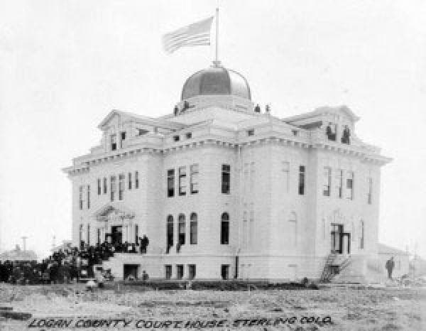
Sterling’s markers push the story beyond conflict and into infrastructure. The Historical Marker Database lists a Dinkey Engine marker in Sterling dated 1981, which signals that the county’s historical record includes railroad and local transportation history as well as frontier violence. The same database also lists a Logan County Courthouse marker in Sterling dated 1910, bringing county government into the picture.
Taken together, those Sterling markers show how public history moves from battlefield memory to the institutions that followed settlement. The courthouse marker points to the civic order that replaced the open-ended frontier, while the Dinkey Engine marker connects Sterling to the machinery and rail-linked development that shaped town growth in eastern Colorado. For a local history walk, that mix is useful because it lets you see the county as a working system, not just a set of isolated stories.
Summit Springs marks a major military turning point
The Battle of Summit Springs marker gives Logan County one of its most consequential historical touchpoints. The Encyclopedia of the Great Plains dates the battle to July 11, 1869, and describes it as one of the most decisive engagements between the U.S. military and the Southern Plains Indians. It says Brig. Gen. C. C. Augur organized the Republican River Expedition and Maj. Eugene A. Carr led the force.
That battle ended with an attack on a Cheyenne village near Summit Springs, near present-day Sterling in Logan County. The action came in retribution for raids on Kansas settlements in 1868 and 1869, which connects Logan County’s landscape to a wider regional conflict that stretched far beyond county lines. For a modern reader, that marker is a reminder that the ground around Sterling was part of a larger military and political campaign that changed the Great Plains.
Why Colorado’s marker program still works
Logan County’s markers also make sense because Colorado has treated roadside memory as a public program for decades. In History Colorado’s 1970 account, the State Historical Society of Colorado had been designating historic places and events with bronze and wooden markers for four decades. The program drew support from the Mrs. J. N. Hall Foundation, the William A. Braiden Fund and the Robert S. Ellison Fund, while the State Penitentiary made the wooden signs and the Department of Highways cooperated extensively.
That background matters for Logan County because it shows the markers were never just decorative signs. They were built as a statewide public-history system, one that relied on institutions, funding and highway cooperation to make historical interpretation visible where people actually travel. In a county as large as Logan, that approach fits the geography: history appears along roads, not only inside museums.
How to use the markers as a local field guide
A practical Logan County marker route can start with the highway south of Merino, move into Sterling and then connect the county’s military, transportation and civic layers. Fort Wicked tells the story of a violent frontier encounter tied to the Sand Creek Massacre; the Battle of Summit Springs marker places Logan County inside the 1869 military campaign on the plains; the Dinkey Engine marker and courthouse marker show how transportation and government took root after those conflicts.
- Fort Wicked helps explain why early routes clustered near the South Platte and why stage lines mattered to settlement.
- Summit Springs shows that the county’s open ground was also a battlefield in a wider regional war.
- The Dinkey Engine and courthouse markers show how Sterling grew from frontier conditions into a town shaped by rail service and county administration.
That sequence gives the county a usable story for students, drivers and newcomers alike. The markers do not just preserve names on plaques. They show how Logan County’s towns, roads and land use were built from the movement of people, the violence of frontier conflict and the institutions that followed.
This article was produced by Prism’s automated news system from verified source data, official records, and press releases, then run through automated quality and moderation checks before publishing. The system is built and supervised by the people who set the standards it runs under. Read our full AI policy.
Did this article answer your question?