Severe thunderstorm warning issued for northeastern Logan County Saturday evening
Iliff and the area northeast of Sterling faced 60 mph winds and quarter-size hail Saturday evening as storms raced north through northeastern Logan County.
A severe thunderstorm warning covered northeastern Logan County Saturday evening, placing Iliff and the area about 11 miles northeast of Sterling in the path of storms moving north at 15 mph with the potential for 60 mph wind gusts and quarter-sized hail.
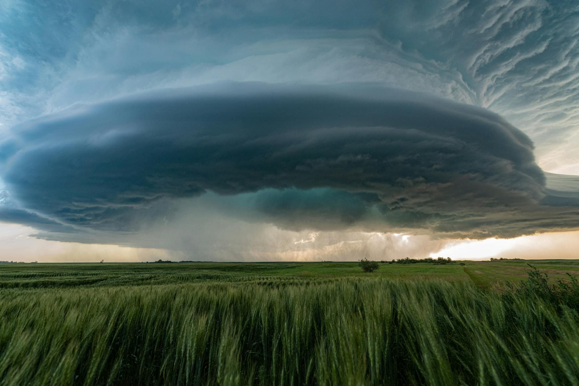
The National Weather Service in Denver and Boulder said scattered showers and thunderstorms were expected through early Saturday evening, with a few storms strong to severe across the eastern plains. Its forecast discussion pointed to increasing moisture, instability and 45 to 55 knots of deep-layer shear across eastern Colorado, a setup that favored large hail and damaging wind gusts. Forecasters also said the far northeastern part of the forecast area had the greatest severe-weather potential, and a brief tornado or two was possible where low-level flow and convergence lined up.
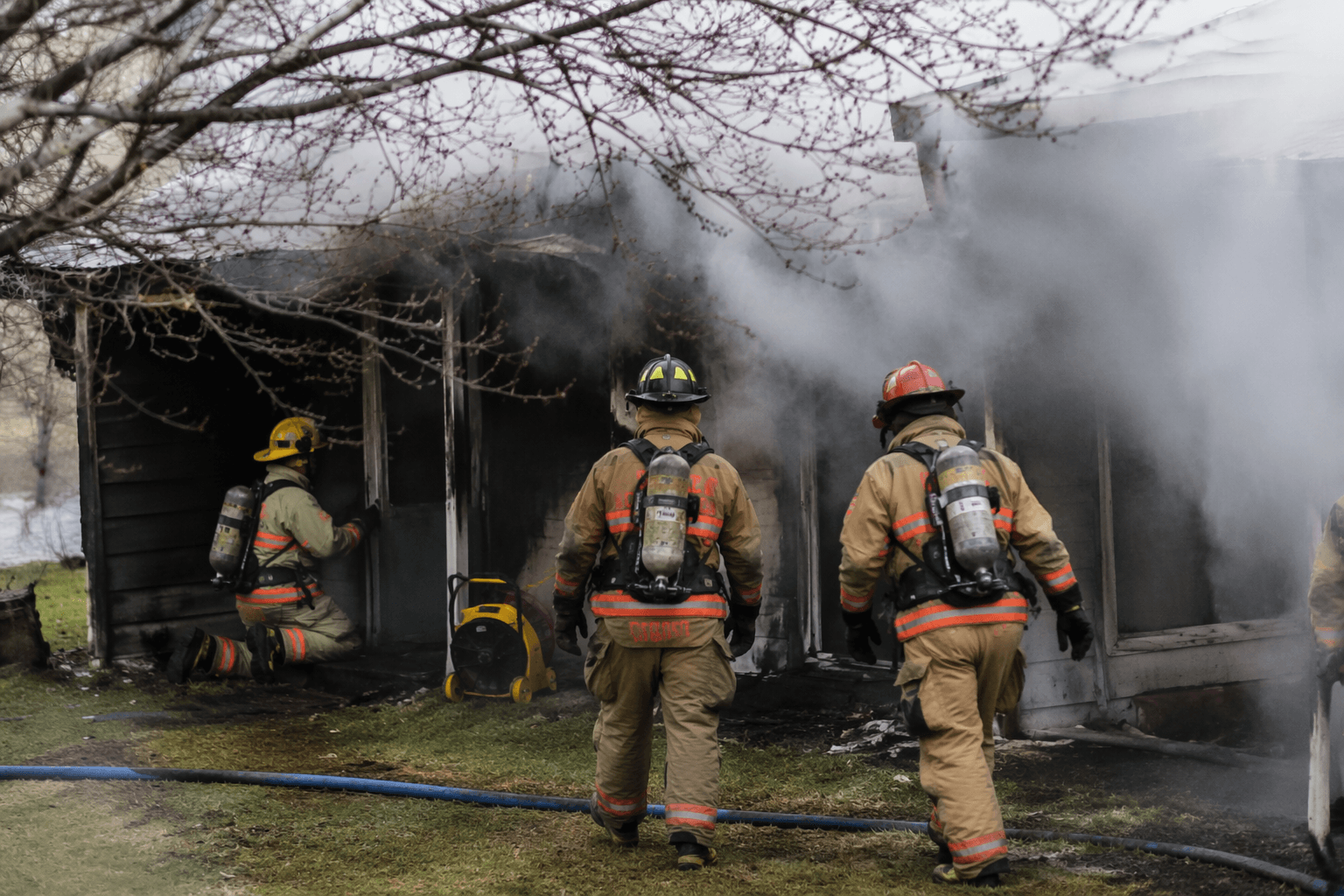
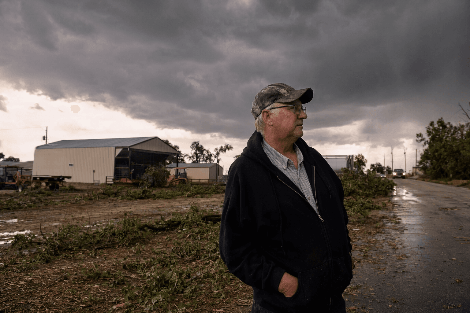
For residents, farmers and drivers near Iliff, the threat was not just hail. The storm could hit evening travel on rural roads, outdoor events and exposed farm yards, while strong winds raised the risk of downed limbs, scattered debris and power interruptions. Equipment left in the open, including vehicles, irrigation gear and other supplies, was especially vulnerable if the hail core tracked directly over the warned area.
The warning also came during an active stretch for northeastern Colorado. Forecasters expected another stormy day Sunday, followed by much colder weather and accumulating snow in the mountains and foothills Sunday night into Monday. That pattern kept Logan County in a volatile spring setup, with one round of storms quickly giving way to the next.
The region has seen what that kind of weather can do. On May 23, 2025, a long-lived supercell produced three tornadoes across Logan and Washington counties, including one EF-2 and one EF-1, along with a swath of golf ball to baseball sized hail and one report of hail larger than 3 inches in northern Washington County. No injuries were reported, but the event underscored how fast severe storms can intensify across the plains. National Weather Service Denver/Boulder also maintains a Logan County hazard page and a Colorado tornado history map covering 1950 through 2024 for local reference as storms move through the area.
This article was produced by Prism’s automated news system from verified source data, official records, and press releases, then run through automated quality and moderation checks before publishing. The system is built and supervised by the people who set the standards it runs under. Read our full AI policy.
Did this article answer your question?