McKinley County highlights 100 miles of trails in the Zuni Mountains
McKinley County's trail map stretches from red rock to ponderosa forest, with about 100 maintained miles and a bigger Zuni network just minutes from Gallup.
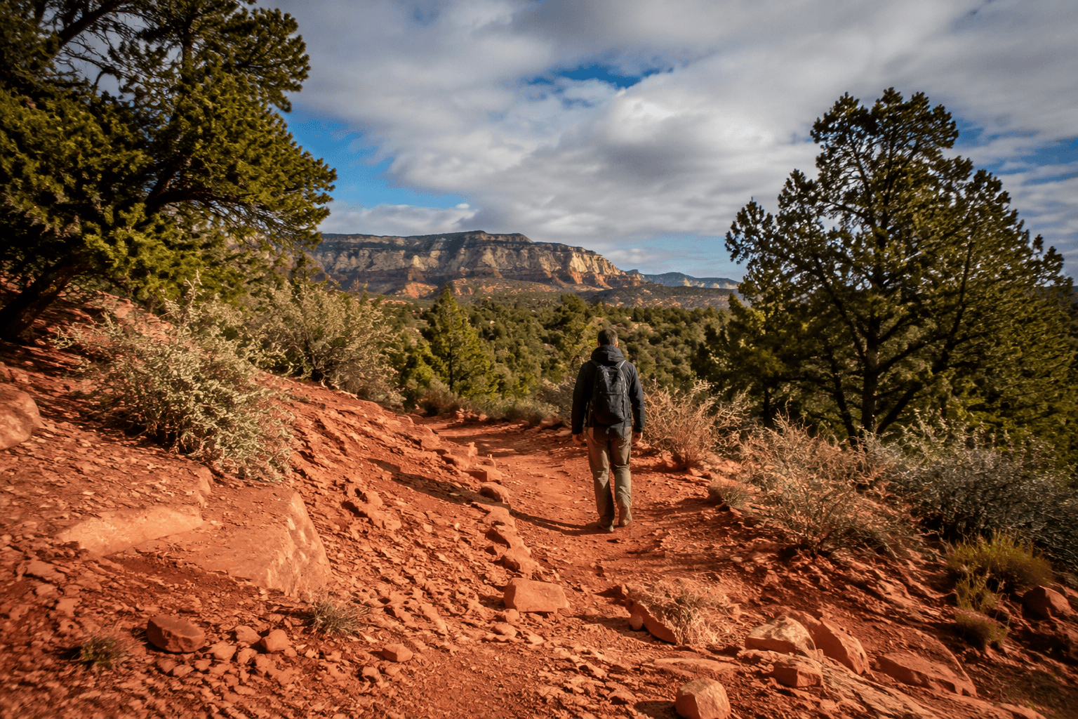
McKinley County's trail system runs from red-rock vistas into pine-covered mountains, and the county puts the maintained, non-motorized total at about 100 miles. In the Zuni Mountains, that mileage becomes a real weekend option, with trailheads, singletrack and forested canyons close enough to Gallup for a short drive.
What the Zuni Mountains look like on the ground
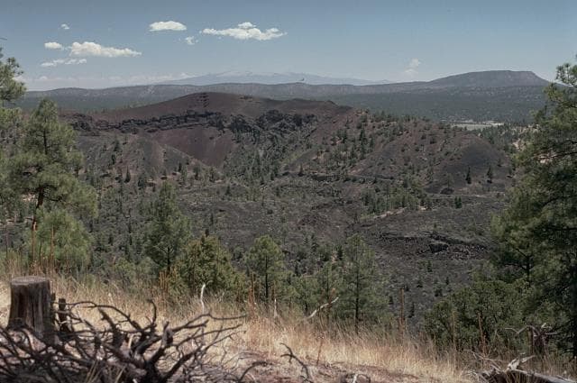
The appeal starts with the land itself. The county describes a landscape that shifts from high-desert color to mountain country, and Visit Gallup’s Zuni Mountains guide adds the details residents recognize on the drive toward Fort Wingate and McGaffey: ponderosa pine forests, aspen-lined canyons and an old, highly eroded range. That mix matters because it tells you the trails are not one uniform experience. They move from exposed desert edges into cooler, shaded terrain.
The Forest Service places the Hilso Mountain Bike Trail in the Cibola National Forest near Fort Wingate, and a trail guide says the Zuni Mountain system sits off State Highway 400 south of Fort Wingate. That makes the area easy to picture and easy to reach from Gallup, with trail access anchored in a place most local drivers already know.
How much trail there really is
The county's 100-mile figure is the cleanest headline number, but it is only one way to measure the system. Visit Gallup says the Zuni Mountains have more than 25 miles of singletrack for mountain biking, running and hiking. A separate trail guide for the Hilso Mountain trails says that part of the system alone includes 57 miles of non-motorized single-track trails.
Broader trail planning stretches even farther. The Cibola Trail Alliance says the Zuni Mountain Trails consist of 186 miles of non-motorized trails, 28 miles of connector trails and six new trailheads, with routes managed for pack and saddle, biking and hiker-pedestrian use. Trailforks also maps the region near Gallup with 46 trails and 14 routes, which shows how many ways the same terrain can be linked together.
- Non-motorized trails for hiking and walking
- Singletrack for mountain biking and trail running
- Pack and saddle routes for horse use
- Connector trails that link communities and trailheads
- Trail maps and kiosks for first-time visitors
What that looks like in practice is a system large enough to support repeat outings, not just one signature hike. A 100-mile network gives you options for short out-and-backs, longer rides and different terrain without leaving McKinley County.
Where to start near Fort Wingate and McGaffey
The Hilso Mountain Trailhead is one of the key access points. The trail guide says an interpretive kiosk there offers information on the history of the area and a trail map, which makes it a practical starting point if you want to understand where you are before heading out. The same guide also asks visitors to stay on the trail, be courteous to other users and pay attention to private land boundaries, reminders that matter in a system threaded through public and private land.
That shared-use reality is part of the trail network’s character. The Zuni Mountain system was made possible by the Zuni Mountain Trail Partnership, and the final Decision Notice for the Zuni Mountain Trails Project was signed on May 17, 2017, by Alvin Whitehair, then district ranger from the Mt. Taylor Ranger District of the Cibola National Forest. A master plan draft completed in August 2024 for the Zuni Mountains Trails Partnership included Cibola County, McKinley County, the U.S. Forest Service and the Mt. Taylor Ranger District.
The partnership model reaches beyond those core agencies. A separate case study identifies Arizona State Parks, Backcountry Horsemen, Cibola and McKinley counties, the Cibola National Forest and the U.S. Forest Service Mt. Taylor Ranger District among the project partners. That kind of collaboration helps explain why the trails feel more like a regional system than a single park.
Who the trails fit best
The Zuni Mountains work for different kinds of users because the system was built for more than one purpose. Mountain bikers get singletrack. Runners have the same kind of narrow trail surface to train on. Hikers can use the network for shorter outings or longer linkups. Horse users also have a place in the system through the pack and saddle design.
The best fit depends on how you want to spend your time outside, but the common thread is access. If you want a dirt trail experience within a short drive of Gallup, this is the county’s biggest concentration of it. If you want forest shade after a stretch of open desert, the route toward Fort Wingate and McGaffey gives you that transition in one outing.
Why the trails matter close to home
McKinley County has also treated trails as part of community life, not just scenery. The county marked National Trails Day on May 10, 2024, with a Joy Ride & Run, which shows local recreation taking place on the same land that draws visitors. Greater Gallup Economic Development Corporation says Gallup and McKinley County have more than 25 miles of urban hiking and biking trail, plus over 186 additional miles in the Zuni Mountain Trail System within a 20-minute drive of Gallup.
That same organization has framed outdoor recreation as a possible backbone for research, development, testing and use of recreational products and initiatives. In plain terms, the trails are not only for leisure. They support an outdoor economy, give residents a nearby recreation option and connect Gallup to the larger Zuni Mountain landscape without requiring a long trip out of county.
For McKinley County, the value is in how close and how varied the system is: red rock at one end, ponderosa forest at the other, and enough trail mileage in between to make the Zuni Mountains a real local asset for the next ride, run or hike.
This article was produced by Prism’s automated news system from verified source data, official records, and press releases, then run through automated quality and moderation checks before publishing. The system is built and supervised by the people who set the standards it runs under. Read our full AI policy.
Did this article answer your question?