Utqiaġvik sea ice melts early, raising barge and food delivery concerns
Warm temperatures sped Utqiaġvik’s sea ice breakup, threatening to strand barges and push food and fuel onto costly air cargo.

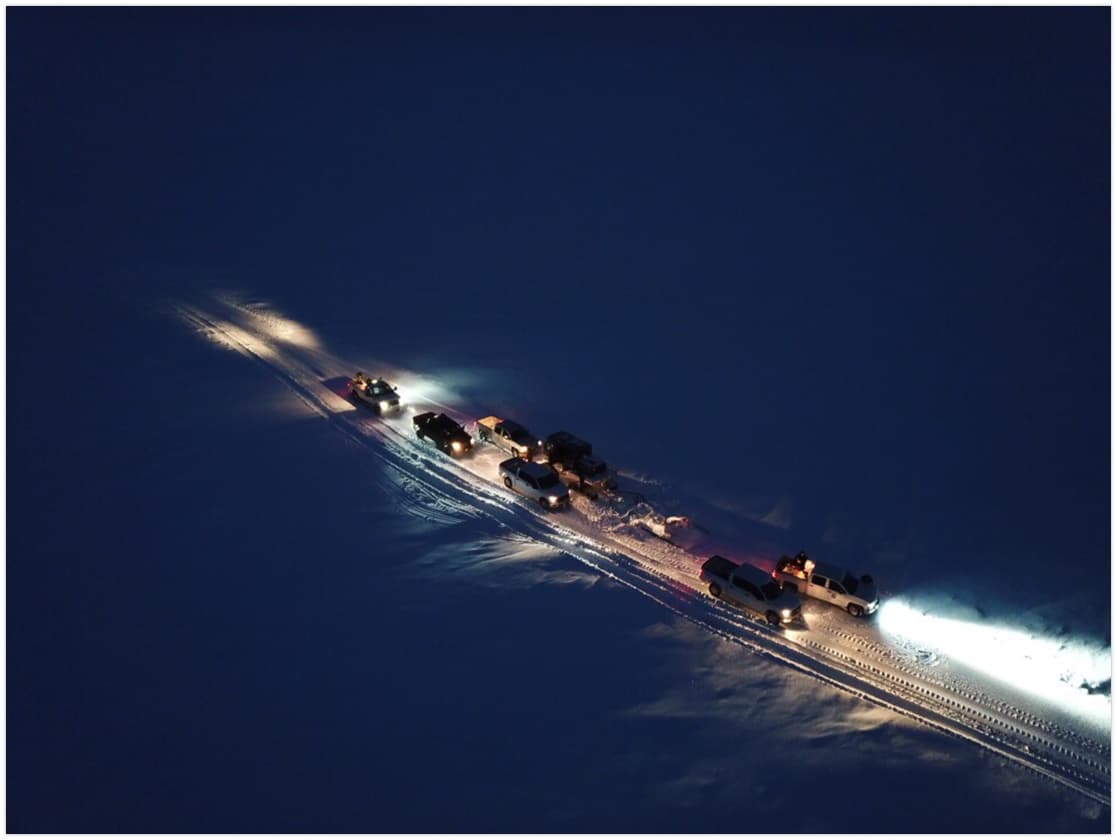
Warm temperatures sped the melt of shorefast sea ice around Utqiaġvik, raising the risk that a barge could be stranded and that food deliveries would have to move by costly air cargo instead of summer sea lift. Borough officials were lining up airlifts as backup, a reminder that a single early breakup can ripple through grocery shelves, fuel supplies and construction freight in the North Slope’s main hub.
Utqiaġvik is the economic, transportation and administrative center of the North Slope Borough and the northernmost community in the United States. Freight for North Slope villages arrives by barge in the summer and by air cargo year-round, so timing matters. When ice gives way early, the fallback is smaller loads, higher costs and less room for delay.
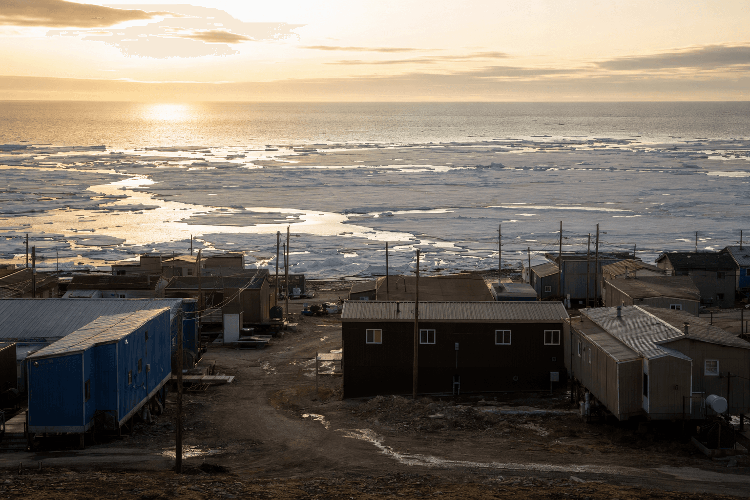
The coastline is watched closely for that reason. The University of Alaska Fairbanks Geophysical Institute runs a coastal ice observatory in Utqiaġvik that uses webcam, radar and archived imagery to track the start of spring melt and breakup. That monitoring matters because shorefast sea ice is not just a backdrop; it is a travel platform for Iñupiat hunters and fishers, and conditions near the shore can change suddenly.
The same ice supports Utqiaġvik’s spring bowhead whale hunt. North Slope Borough wildlife-management materials say a systematic ice-trail mapping and surveying project began in spring 2008 to improve safety, and borough materials say the 2025 bowhead census was successful, with an ice-based count and an aerial survey from an observation perch near the ice edge. That local knowledge remains central to decisions about who can travel and when.
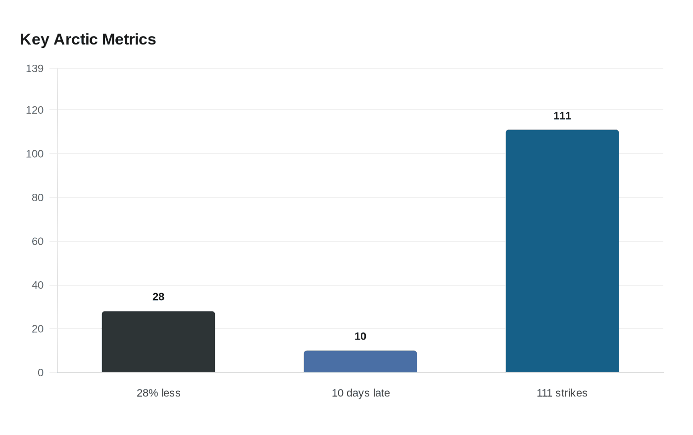
The warning signs are broader than one season. A 2024 Alaska Public Media report said whalers and scientists saw fewer grounded ridges than usual near Utqiaġvik and that multi-year ice had become rare. NOAA’s Arctic Report Card said the Arctic sea-ice cover at the end of summer 2025 was younger, thinner and 28% less extensive than in 2005. Climate.gov said the winter 2025 maximum was the lowest in the 47-year satellite record and arrived 10 days later than the 1981-2010 average.
The National Weather Service Alaska-Pacific River Forecast Center’s April 10, 2026 breakup outlook flagged elevated breakup-flood risk across portions of the North Slope, adding urgency as residents watched the nearshore ice weaken. North Slope Borough records also point back to the 1977 bowhead moratorium, when NOAA counted fewer than 1,000 whales in the Bering-Chukchi-Beaufort stock and 111 strikes were reported that year, helping drive formation of the Alaska Eskimo Whaling Commission.
In Utqiaġvik, the stakes run from the whaling trail to the grocery store. The borough’s ice-trail mapping, the observatory’s live monitoring and the community knowledge carried by people such as Harry Brower, Sr., Gordon Brower, Vera Metcalf, Taqulik Hepa, Craig George, Matt Druckenmiller, Josh Jones and Nicole Wojciechowski all feed into the same question: whether the season’s last safe ice will hold long enough for people, supplies and subsistence travel to make it across.
This article was produced by Prism’s automated news system from verified source data, official records, and press releases, then run through automated quality and moderation checks before publishing. The system is built and supervised by the people who set the standards it runs under. Read our full AI policy.
Did this article answer your question?