Amargosa River lands on endangered list amid mining, solar threats
Groundwater that feeds Ash Meadows is now caught between claystone mining, solar plans and a federal withdrawal fight that could decide Nye County's future.
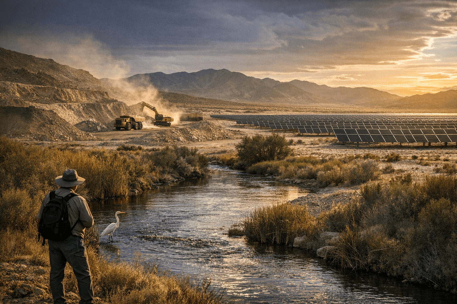
The Amargosa River is not just another name on a national endangered list. In Nye County, it is the groundwater-fed lifeline that keeps Ash Meadows alive, shapes habitat near Beatty, and could determine how much more mining and solar development the desert can absorb without losing the water beneath it.
American Rivers ranked the Amargosa No. 9 on its 2026 America’s Most Endangered Rivers list, warning that proposed claystone mining could pollute the river and damage the groundwater that sustains its flow. The group said the Department of the Interior must approve a mineral withdrawal to block new mining and protect the basin, a warning that lands with unusual force in western Nye County, where the river, springs and surrounding lands are already under pressure from development.
That pressure is not abstract. The Bureau of Land Management proposed withdrawing 308,890 acres of federal land in Nye County for 20 years, subject to valid existing rights, to protect cultural, recreational and biological resources. The proposal also covers about 40,000 acres of non-federal land if those parcels are later acquired by the United States. The public comment period closed April 15, 2025, after BLM held a public meeting in Amargosa Valley on February 27, 2025.
That meeting drew more than a hundred people, including locals, environmental activists and rural county officials, and every public comment supported the 20-year mineral withdrawal. The coalition pressing for protection includes Amargosa Conservancy, the Timbisha Shoshone Tribe, the Amargosa Valley Town Advisory Board and Indigenous Voices of Nevada. Their concern centers on the same fragile hydrology that has made Ash Meadows National Wildlife Refuge the largest remaining oasis in the Mojave Desert and an internationally recognized wetland and Ramsar site.
Federal wildlife officials say Ash Meadows holds 12 threatened and endangered species and 26 species found nowhere else on Earth. The refuge itself was established in 1984 after The Nature Conservancy bought 12,613 acres that had been slated for development and transferred the land to the U.S. Fish and Wildlife Service. A 2010 withdrawal already protected about 9,460.66 acres of public lands and 5,570.02 acres of reserved federal minerals there for 20 years, underscoring how often the area has had to be defended from outside pressure.
Solar expansion has added another layer to the fight. Nevada Current reported that the proposed Rock Valley Solar Project would cover about 10,000 acres, sit about 16 miles north of Ash Meadows and could power about 360,000 homes. Together with mining, the project has intensified a broader struggle over the Amargosa Basin, where BLM says the river is the only free-flowing river in the Death Valley region of the Mojave, flows year-round south from Nevada into Death Valley National Park, and has supported people for about 8,000 years.
A temporary pause on new mining claims near Ash Meadows is moving toward its January 2027 expiration, making the Interior Department’s next decision on the mineral withdrawal pivotal for groundwater, habitat and the long-term future of rural Nye County.
This article was produced by Prism’s automated news system from verified source data, official records, and press releases, then run through automated quality and moderation checks before publishing. The system is built and supervised by the people who set the standards it runs under. Read our full AI policy.
Did this article answer your question?