Otter Tail County Pushes Forward on Trails, Water Access Projects
Otter Tail County's Glacial Edge Trail would wind past four lakes and through prairie wetlands along the 186-mile Otter Tail River corridor.
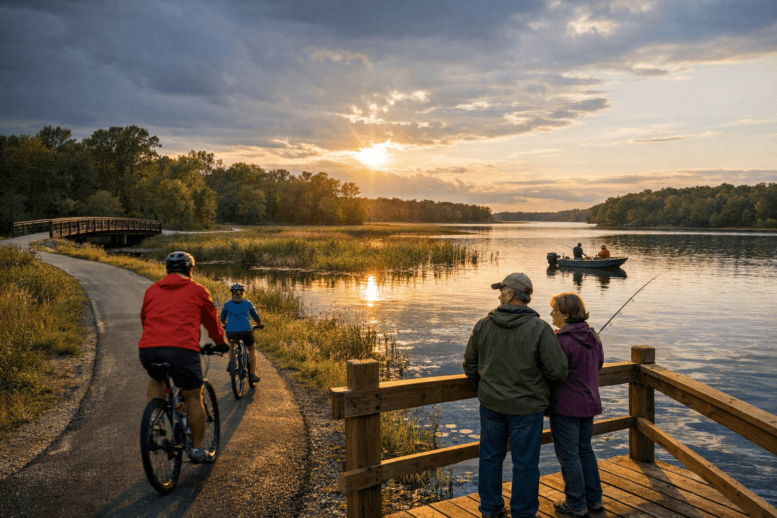
Otter Tail County has been advancing an ambitious trail and water-access agenda centered on the Glacial Edge Trail, a proposed route that would carry riders and hikers through some of the county's most ecologically significant terrain, from the glacial moraines above the Otter Tail River to prairie wetland stretches past four of the county's more than a thousand nationally recognized lakes.
The Glacial Edge Trail is routed through the hilly moraine left by the glacial action that formed ancient Lake Agassiz, tracing the 186-mile Otter Tail River corridor before passing through prairie wetlands. The county's master trail plan describes Fergus Falls and the surrounding county as sitting "in the heart of one of the largest grassland areas in the world," hosting critical and threatened waterfowl habitat. That ecological backdrop forms the foundation of the trail's first classification criterion: providing a high-quality outdoor recreation experience.
The trail's planning has been cross-referenced with the Minnesota Statewide Bicycle System Plan, suggesting county officials intend for the Glacial Edge Trail to connect into a broader regional network, not simply serve local users.
The county's trail master plan took shape through an 18-month, three-part process. A Project Management Team composed of county and state employees who manage recreation and transportation systems, and a Project Steering Committee that included local business owners, government officials, and Otter Tail County citizens, were both established in 2017 to guide the effort. Concepts were developed and refined in June 2016, and the planning record notes both dates without fully reconciling the sequence. The county and project consultant HKGi, which facilitated meetings throughout the planning process, would be the appropriate sources to confirm the master timeline.
A Project Advisory Group drawn from seven trail, recreation, and natural resource organizations met three times during the planning process, in November, December, and March, and participated in two of the project's public open houses. The groups represented included the Minnesota Department of Natural Resources, West Central Initiative, Lake Region Health Care, the North Country Trail Association, Pedal Fergus Falls, and PartnerSHIP4Health, alongside Otter Tail County itself. The inclusion of Lake Region Health Care and PartnerSHIP4Health reflects the county's framing of trail access as a public health issue, not purely a recreation or tourism one.
Community feedback on the trail concepts was collected at public open houses held in Perham, Pelican Rapids, Parkers Prairie, and Fergus Falls. Residents at each location were asked feedback questions, though the full set of those questions was not disclosed in the planning documents reviewed.
The county's broader planning emphasis extends beyond the Glacial Edge Trail to water-trail connections on the Otter Tail River itself, with county documents pointing to continued investment in non-motorized access across rolling glacial hills, lake corridors, and river stretches. The specific put-in and take-out points for the river water trail, along with construction timelines and funding status for the Glacial Edge Trail's individual segments, remain outstanding questions the county and HKGi are expected to address as the master plan moves toward implementation.
This article was produced by Prism’s automated news system from verified source data, official records, and press releases, then run through automated quality and moderation checks before publishing. The system is built and supervised by the people who set the standards it runs under. Read our full AI policy.
Did this article answer your question?