Winter Storm Warning Extended for West Otter Tail County Through Sunday
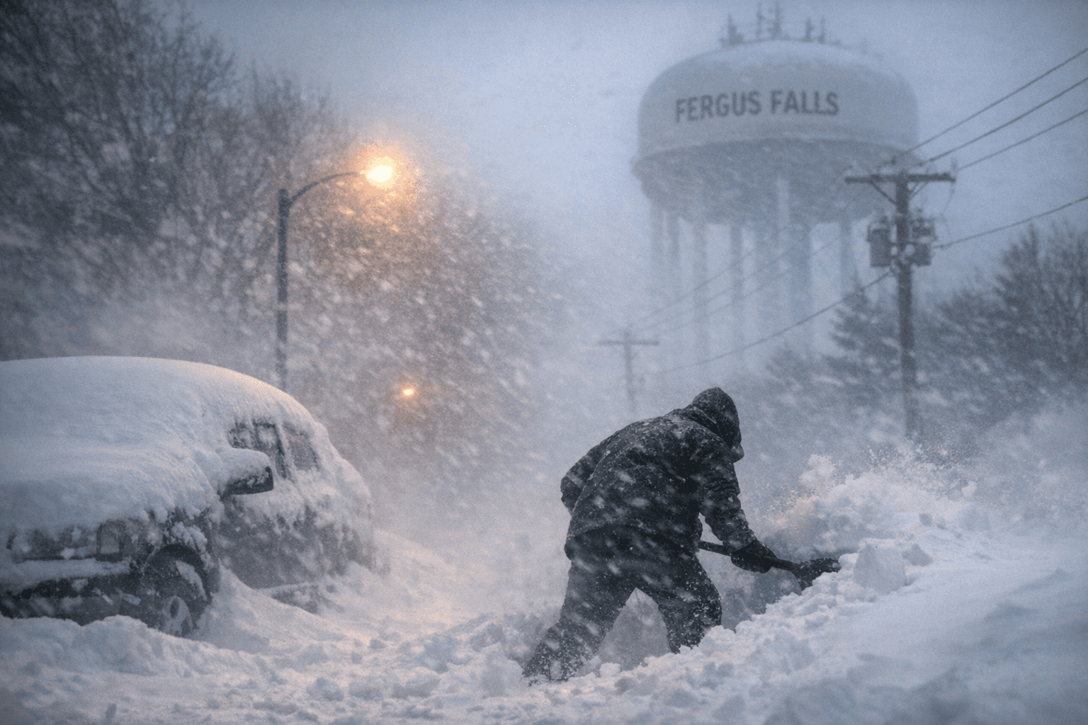
A storm already responsible for 16.5 inches of snowfall statewide extended a Winter Storm Warning over West Otter Tail County, with Fergus Falls facing up to a foot of accumulation.

A volunteer weather observer near Ottertail recorded just 1 inch of snow early Thursday, but West Otter Tail County was braced for far more: the National Weather Service extended a Winter Storm Warning through 1:00 AM Saturday, with Fergus Falls facing up to a foot of snow before the system cleared.
The warning, which took effect at 4:00 PM Thursday and carried impacts into Sunday, April 6, was part of a multi-day storm system the Minnesota Department of Natural Resources tracked since April 1, when a large area of low pressure departed eastern Colorado. The system reached eastern Minnesota by April 2 and pushed north of Lake Superior into Ontario by April 3, depositing heavy, wet snow across a wide swath of the state as it traveled.
By the time the low cleared Minnesota's northern edge, roughly 40% of the state had recorded at least 6 inches of accumulation, with the highest single-site total reaching 16.5 inches. Neighboring Becker County was also under the same Winter Storm Warning, reflecting the regional scope of what meteorologists informally called the "April Fools' Day storm."
The NWS forecast for the Fergus Falls area called for total accumulations of 4 to 6 inches, with localized totals possibly reaching a foot in some locations. Wind gusts up to 35 mph were expected alongside steady temperatures near 30 degrees. At the storm's peak intensity, snowfall rates could reach 1 inch per hour, with winds as high as 40 mph.
The Minnesota State Patrol had not reported any major crashes as of early Thursday, though road conditions across western and northern Minnesota were described as slick. The Ottertail observer is part of the NWS Cooperative Observer Program, a national network of more than 8,700 trained volunteers whose daily ground-level readings support the warnings and climate records that agencies rely on during events exactly like this one.
Late-season snowstorms have left marks on this region before. A comparable event struck west-central and central Minnesota from March 30 through April 1, 2023, and April 2018 still holds the record as the snowiest April in Twin Cities history, with 15.8 inches. The current storm placed itself squarely in that lineage before the week was out.
This article was produced by Prism’s automated news system from verified source data, official records, and press releases, then run through automated quality and moderation checks before publishing. The system is built and supervised by the people who set the standards it runs under. Read our full AI policy.
Did this article answer your question?