Tell City ranger district serves as Perry County's forest front door
The Tell City Ranger District is Perry County’s on-the-ground contact for Hoosier National Forest access, maps, closures, and recreation. Its office in Tell City also serves as a visitor hub with restrooms, a nature store, and a pollinator garden.
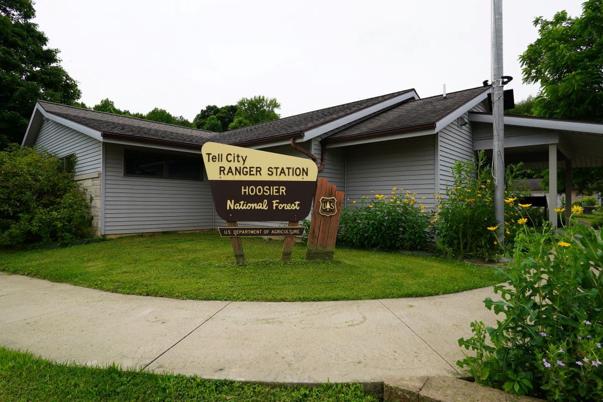
The first place many Perry County residents should look when a forest road closes, a trail needs checking, or a hunting trip needs a last-minute map is not a distant federal office. It is the Tell City Ranger District at 248 15th Street, the Hoosier National Forest’s local front door for the southern part of the state. Open Tuesday through Thursday, the office gives the county a live point of contact for access, safety, and day-to-day use of the forest.
What the Tell City office does for Perry County
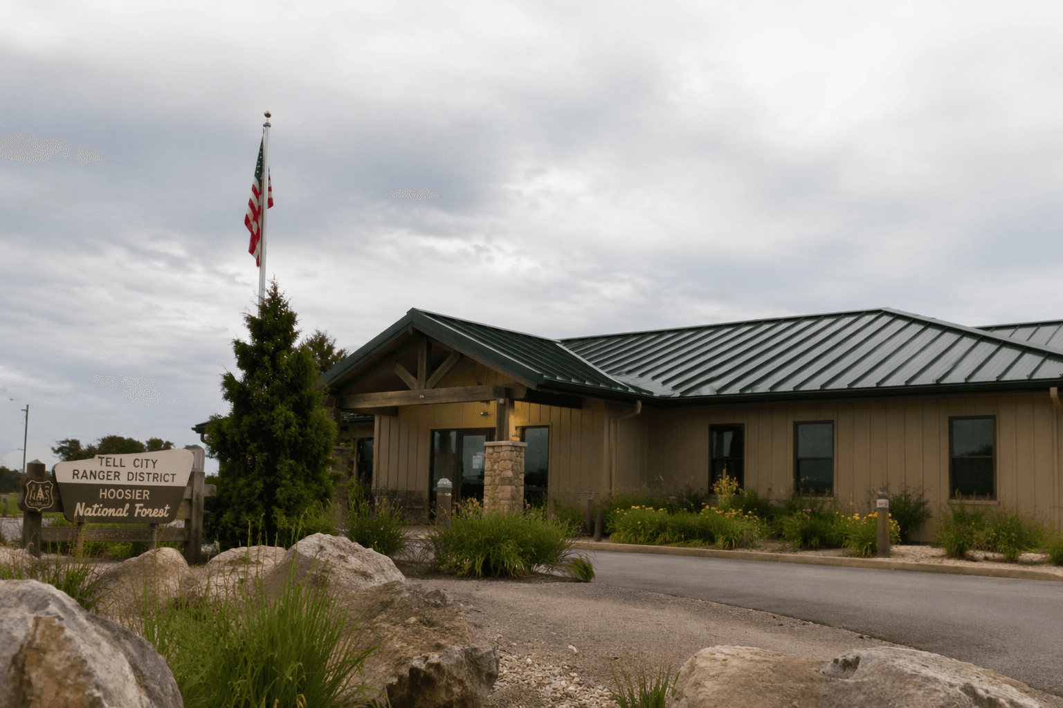
The Tell City Ranger District is more than a desk for paperwork. The Forest Service says the office provides visitor center services, public restrooms, a nature store, and a pollinator garden where people can see native wildflowers, butterflies, and other pollinators. That makes it one of the few places in the county where forest information, rest stop facilities, and a small interpretive experience all sit in one building.
Chris Thornton is listed as the district ranger, the local official tied to the office’s operations. For residents trying to figure out where to go, what is open, or what is changing on the ground, that office is the practical starting point. The Forest Service also plans public-facing events there, including an August 29, 2026 open house at the Tell City Ranger Station, which underscores how central the site is to local contact with the forest.
The office keeps a strict schedule: Tuesday through Thursday from 8:00 a.m. to noon and 1:00 to 4:30 p.m., closed Mondays, Fridays, and federal holidays. That matters for anyone who wants to check conditions before heading out, because the service window is limited and the timing is specific.
Why the district matters for daily forest use
The Hoosier National Forest is not just a patchwork on a map. The forest says it offers more than 260 miles of trails for hiking, mountain biking, or horseback riding, and that range of uses makes up a large part of the public value in Perry County and the surrounding region. If you are planning a ride, a hike, a family outing, or a hunt, the Tell City District is the place that connects those plans to current conditions.
The forest’s geography also explains why Tell City matters so much. The Hoosier National Forest says it has two public offices: Bedford for the northern part of the forest and Tell City for the southern areas of the state. That split is not cosmetic. It means southern Indiana users do not need to depend on a distant administrative center when they need a local answer about access, closures, or site conditions.
The forest is also within a two-hour drive of Cincinnati, Evansville, Indianapolis, and Louisville, which helps explain the pressure on local access points in and around Perry County. People coming from those cities may treat the forest as a day trip destination, but for local residents it is part of the landscape, and the Tell City office is the place where that traffic gets managed.
Maps, road access, and what to check before you go
The most important practical tool for anyone entering the forest is the map. The Forest Service says the Forest Visitor Map and the interactive map show roads, trails, recreation sites, wilderness areas, and wild and scenic rivers, while motor vehicle use maps are reissued every year. That annual update matters for people who drive forest roads, because the routes can change from one season to the next.
There is another important shift underway: printed trail maps will no longer be available at trailhead kiosks once current supplies run out. That makes downloadable and digital maps especially useful for anyone heading out from Perry County or using trailheads near Tell City. If you rely on a paper map at the kiosk, the forest is signaling that you should not assume that option will always be there.
That practical reality is why the Tell City office functions as more than an information stop. It is where local users can anchor a trip before they reach the woods, especially when conditions are changing or a road, trail, or recreation site may not match an older printout.
The protected places that make Perry County’s forest distinctive
Some of the most notable places tied to the Tell City District are not generic recreation stops. Boone Creek Special Area contains rare barrens communities and roadside wildflowers, making it a place where the roadside itself becomes part of the conservation story. Clover Lick Special Area is highlighted for limestone barrens and adjacent dry forest communities near the Ohio River, a reminder that the forest’s value is as much ecological as it is recreational.
Haskins Tract shows how the district blends habitat work with public land management. The site is a 125-plus-acre early successional habitat and native pollinator resource area seeded with 18 forbs and 6 grasses, then expanded with two ponds and native hardwood plantings. That kind of restoration affects more than scenery. It supports pollinators, diversifies habitat, and creates a landscape that can recover and function over time.
For Perry County residents, these sites are proof that the Tell City office is not just keeping track of land. It is managing living places with specific ecological jobs: barrens conservation, pollinator support, and habitat restoration.
A longer scientific and cultural legacy
The district’s role is not only about recreation and current management. The Paoli Experimental Forest, established in 1963 in the then Wayne-Hoosier National Forest, covers about 256 hectares and was created to study mixed hardwoods and improve the quality of high-value timber species. That research history gives the forest a second identity: it is also a long-running outdoor laboratory.
The broader Hoosier National Forest plan reflects that layered role. The latest Land and Resource Management Plan was released in March 2006, revised from the 1991 plan to reflect resource and social changes and new scientific information. For a county that depends on forest access, that kind of planning shapes what can happen on the ground, from timber and habitat decisions to recreation management.
The forest’s only Congressionally designated federal wilderness, the Charles C. Deam Wilderness, adds another benchmark. Designated in 1982 and covering 12,953 acres, it is the only such wilderness in the Hoosier National Forest and in Indiana. That designation places a clear limit on development while preserving a large stretch of backcountry land for hiking and quiet use.
For those interested in the human history of the forest, the Rickenbaugh House adds another layer. Built in 1874 and restored to its original condition, it ties the forest to a built heritage that predates modern recreation planning. Together, the wilderness, the restoration sites, the experimental forest, and the special habitat areas show why the Tell City District matters so much: it manages access, protects land, and connects Perry County to one of Indiana’s most important public landscapes.
This article was produced by Prism’s automated news system from verified source data, official records, and press releases, then run through automated quality and moderation checks before publishing. The system is built and supervised by the people who set the standards it runs under. Read our full AI policy.
Did this article answer your question?